Sovietskyi Raion
Sovietskyi Raion
Ichki Raion | |
|---|---|
 Village (selo) Prudy, Sovetsky District | |
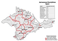
 Raion location within Crimea | |
| Country | Disputed: |
| Republic | Crimea |
| Capital | Sovietskyi |
| Subdivisions | List
|
| Area | |
| • Total | 1,080 km2 (420 sq mi) |
| Population (2014) | |
| • Total | 31,898 |
| • Density | 30/km2 (76/sq mi) |
| Time zone | UTC+3 (MSK) |
| Dialing code | +380-6551 |
| Website | sovmo.rk.gov.ru |
Sovietskyi Raion (Russian: Советский район, Ukrainian: Совєтський район) or Ichki Raion (Ukrainian: Ічкінський район, Crimean Tatar: İçki rayonı) was one of the 25 regions of the Autonomous Republic of Crimea until its abolition in 2020. It continues to be used as an administration of Russia's Republic of Crimea, as it occupies the peninsula. The administrative center of the raion is the urban-type settlement of Sovietskyi, which is also known as Ichki. Population: 31,898 (2014 Census).[1]
History
[edit]2020 Ukrainian administrative reform
[edit]
In July 2020, Ukraine conducted an administrative reform throughout its de jure territory. This included Crimea; among other changes, Ichki Raion was abolished, and its territories to become a part of Feodosia Raion. However, this has not yet been implemented due to the ongoing Russian occupation of Crimea.[2]
References
[edit]- ^ Russian Federal State Statistics Service (2014). "Таблица 1.3. Численность населения Крымского федерального округа, городских округов, муниципальных районов, городских и сельских поселений" [Table 1.3. Population of Crimean Federal District, Its Urban Okrugs, Municipal Districts, Urban and Rural Settlements]. Федеральное статистическое наблюдение «Перепись населения в Крымском федеральном округе». ("Population Census in Crimean Federal District" Federal Statistical Examination) (in Russian). Federal State Statistics Service. Retrieved January 4, 2016.
- ^ "Про утворення та ліквідацію районів". Офіційний вебпортал парламенту України (in Ukrainian). Retrieved 2023-10-16.


