Niamembe Island
Appearance
| Geography | |
|---|---|
| Location | Zanzibar Channel |
| Coordinates | 06°21′25″S 39°21′11″E / 6.35694°S 39.35306°E |
| Archipelago | Zanzibar Archipelago |
| Adjacent to | Indian Ocean |
| Length | 1.55 km (0.963 mi) |
| Width | 0.62 km (0.385 mi) |
| Administration | |
| Region | Mjini Magharibi Region |
| District | Mjini |
| Ward | Fumba |
| Demographics | |
| Languages | Swahili |
| Ethnic groups | Hadimu |
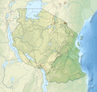
Niamembe Island (Kisiwa cha Niamembe, in Swahili) is a protected island located in Fumba ward of Mjini District in Mjini Magharibi Region, Tanzania. One of the Menai Bay islands, the island is a part of the Menai Bay Marine Conservation Area and is composed of limestone.[1] [2][3]
References
[edit]- ^ Kotarba-Morley, Anna M., et al. "Coastal landscape changes at Unguja Ukuu, Zanzibar: Contextualizing the archaeology of an early Islamic port of trade." The Journal of Island and Coastal Archaeology 19.1 (2024): 57-91.
- ^ "Niamembe Island overview".
- ^ Fitton, Tom. Pushing the boat out: A study of spatial organisation and harbour spaces in the early Swahili ports of the Zanzibar archipelago, 550-1100 CE. Diss. University of York, 2017.

