Moycarkey
Moycarkey
Maigh Chairce | |
|---|---|
Village | |
| Coordinates: 52°37′34″N 7°47′24″W / 52.6259958°N 7.7899714°W | |
| Country | Ireland |
| Province | Munster |
| County | County Tipperary |
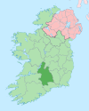
Moycarkey (Irish: Maigh Chairce),[1] sometimes written Moycarky, is a village at the northern end of Moycarky townland in the civil parish of Moycarky in County Tipperary, Ireland.
It contains the extensive ruins of Moycarkey Castle. To the west of the castle, there is a Catholic church, St. Peter's, which was built some time before the first Ordnance Survey in the early 19th century and heavily modernised in the mid-20th century. Beside the church is the parochial house for the Catholic parish of Moycarkey, Littleton, Two-Mile-Borris. To the north of the current church, just across the road, there is an old graveyard and the ruins of an old church; to the north of these ruins, the first Ordnance Survey map showed the remains of what it termed an 'R.C. Chapel (in ruins)'.[2] The modern graveyard, in which the first burial was made around 1958, is located a hundred metres or so to the south of the current church.
See also
[edit]References
[edit]- ^ "Maigh Chairce/Moycarky". Placenames Database of Ireland (logainm.ie). Retrieved 31 December 2021.
- ^ "Ordnance Survey map". Archived from the original on 29 August 2012. Retrieved 26 September 2012.


