Mothel
Mothel
Maothail | |
|---|---|
Village | |
 | |
| Coordinates: 52°17′57″N 7°25′10″W / 52.299232°N 7.419468°W | |
| Country | Ireland |
| Province | Munster |
| County | County Waterford |
| Time zone | UTC+0 (WET) |
| • Summer (DST) | UTC-1 (IST (WEST)) |
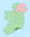
Mothel (Irish: Maothail, meaning 'spongy land')[1][2] is a small village, civil parish and townland, near the Comeragh Mountains in the northern part of County Waterford, Ireland.[3] The nearest town is Carrick-on-Suir, 5 km to the north. Waterford city is 20 km to the east.
Heritage
[edit]Mothel Abbey was founded in the 6th century by a St. Breoghan.[4] It was refounded for the Augustinians by the Power family in the 13th century. It was closely associated with Molana Abbey and St. Catherine's Abbey in Waterford.
A Cross Pillar stone, also known as a termon-stone, stands by the roadside in Mothel. The squared sandstone pillar stands four feet high and is inscribed with ornamental crosses.[5]
Traditionally, local people walk through the stream at Mothel holy well seven times on the local Pattern day, known as Lá Chuain Airbhre.
Sport
[edit]Cyclist Sean Kelly grew up in the townland of Curraghduff, approximately 1 km from Mothel.
See also
[edit]References
[edit]- ^ "Maothail/Mothel". Placenames Database of Ireland (logainm.ie). Retrieved 7 January 2022.
- ^ Reeves, William (1873). "On the Célí Dé, commonly called Culdees". The Transactions of the Royal Irish Academy. 24. Royal Irish Academy: 175. Retrieved 7 January 2022.
- ^ "Ordnance Survey Ireland Map Viewer". Archived from the original on 29 August 2012. Retrieved 11 January 2015.
- ^ "Archaeological Survey Database SMR No WA007-010001". National Monuments Service. Archived from the original on 23 January 2015. Retrieved 11 January 2015.
- ^ "Archaeological Survey Database SMR No WA007-011". National Monuments Service. Archived from the original on 23 January 2015. Retrieved 11 January 2015.


