Mohora
Appearance
Mohora | |
|---|---|
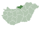
 Location of Nógrád county in Hungary | |
| Coordinates: 47°59′36″N 19°20′34″E / 47.99328°N 19.34279°E | |
| Country | |
| County | Nógrád |
| Area | |
• Total | 15.96 km2 (6.16 sq mi) |
| Population (2004) | |
• Total | 1,000 |
| • Density | 62.65/km2 (162.3/sq mi) |
| Time zone | UTC+1 (CET) |
| • Summer (DST) | UTC+2 (CEST) |
| Postal code | 2698 |
| Area code | 35 |
47°59′36″N 19°20′52″E / 47.99328°N 19.3479°E Mohora is a village in Nógrád county, Hungary.

External links
[edit]- Street map (in Hungarian)


