Kutasó
Appearance
Kutasó | |
|---|---|
Municipality | |
| Kutasó | |
 | |
 | |
| Country | |
| Region | [[Error in {{Hungarian county region}}: Bad or missing parameter "Northern Hungary"]] |
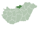
| County | Nógrád |
| District | Pásztó District |
| Area | |
• total | 13.72 km2 (5.30 sq mi) |
| Population (2024) | |
• total | 85 |
| Website | www.kutaso.hu |
Kutasó is a village in Pásztó District, Nógrád County, Hungary with 87 inhabitants (2014).

47°56′N 19°32′E / 47.933°N 19.533°E


