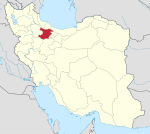
Mohammadiyeh District
Appearance
Mohammadiyeh District
Persian: بخش محمدیه | |
|---|---|
| Coordinates: 36°15′18″N 50°15′43″E / 36.25500°N 50.26194°E[1] | |
| Country | Iran |
| Province | Qazvin |
| County | Alborz |
| Capital | Mohammadiyeh |
| Population (2016)[2] | |
• Total | 138,903 |
| Time zone | UTC+3:30 (IRST) |
Mohammadiyeh District (Persian: بخش محمدیه) is in Alborz County, Qazvin province, Iran. Its capital is the city of Mohammadiyeh.[3]
History
[edit]After the 2006 National Census, the village of Sharifabad was elevated to the status of the city of Sharifiyeh.[4][a] After the 2016 census, Mehregan rose to city status.[6]
Demographics
[edit]Population
[edit]At the time of the 2006 census, the district's population was 87,193 in 22,728 households.[7] The following census in 2011 counted 98,658 people in 29,052 households.[8] The 2016 census measured the population of the district as 43,898 households.[2]
Administrative divisions
[edit]| Administrative Divisions | 2006[7] | 2011[8] | 2016[2] |
|---|---|---|---|
| Hesar Kharvan RD | 8,329 | 8,488 | 9,662 |
| Sharifabad RD | 16,988 | 303 | 321 |
| Bidestan (city) | 20,110 | 19,996 | 18,060 |
| Mehregan (city)[b] | |||
| Mohammadiyeh (city) | 41,766 | 48,862 | 90,513 |
| Sharifabad (city)[c] | 21,009 | 20,347 | |
| Total | 87,193 | 98,658 | 138,903 |
| RD = Rural District | |||
See also
[edit]Notes
[edit]- ^ In 2023, the name of the city was changed back to Sharifabad[5]
- ^ Became a city after the 2016 census[6]
- ^ Formerly Sharifiyeh[5]
References
[edit]- ^ OpenStreetMap contributors (14 September 2024). "Mohammadiyeh District (Alborz County)" (Map). OpenStreetMap (in Persian). Retrieved 14 September 2024.
- ^ a b c Census of the Islamic Republic of Iran, 1395 (2016): Qazvin Province. amar.org.ir (Report) (in Persian). The Statistical Center of Iran. Archived from the original (Excel) on 30 November 2021. Retrieved 19 December 2022.
- ^ Aref, Mohammad Reza (c. 2024) [Approved 22 December 1380]. Divisional reforms and changes in Qazvin province. lamtakam.com (Report) (in Persian). Ministry of the Interior, Political-Defense Commission of the Government Board. Notification 58538/T26118H. Archived from the original on 10 January 2024. Retrieved 10 January 2024 – via Lam ta Kam.
- ^ Davodi, Parviz (29 July 2016) [Approved 29 July 1386]. The transformation of Sharifabad village, the center of Sharifabad Rural District, from the functions of Mohammadiyeh District of Alborz County in Qazvin province to Sharifiyeh city. qavanin.ir (Report) (in Persian). Ministry of the Interior, Political-Defense Commission of the Government Board. 58538/T26118AH. Archived from the original on 14 May 2023. Retrieved 14 May 2023 – via Laws and Regulations Portal of the Islamic Republic of Iran.
- ^ a b "Change the name of Sharifiyeh to Sharifabad". yjc.ir (in Persian). Ministry of the Interior, Council of Ministers. 25 October 2023. Archived from the original on 26 October 2023. Retrieved 13 September 2024 – via Young Journalists Club.
- ^ a b Alaei, Mohammad Mahdi (7 March 2022). "Mehregan became the 29th city of Qazvin province". tasnimnews.com (in Persian). Supreme Council of Architecture and Urban Planning of Iran. Archived from the original on 8 March 2022. Retrieved 13 May 2023 – via Tasnim News Agency.
- ^ a b Census of the Islamic Republic of Iran, 1385 (2006): Qazvin Province. amar.org.ir (Report) (in Persian). The Statistical Center of Iran. Archived from the original (Excel) on 20 September 2011. Retrieved 25 September 2022.
- ^ a b Census of the Islamic Republic of Iran, 1390 (2011): Qazvin Province. irandataportal.syr.edu (Report) (in Persian). The Statistical Center of Iran. Archived from the original (Excel) on 19 January 2023. Retrieved 19 December 2022 – via Iran Data Portal, Syracuse University.


