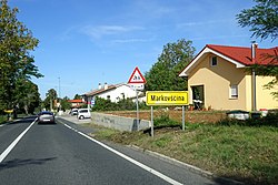
Markovščina
Markovščina | |
|---|---|
 | |
| Coordinates: 45°33′33.66″N 14°2′6.61″E / 45.5593500°N 14.0351694°E | |
| Country | |
| Traditional region | Littoral |
| Statistical region | Coastal–Karst |
| Municipality | Hrpelje-Kozina |
| Area | |
• Total | 3.83 km2 (1.48 sq mi) |
| Elevation | 561.9 m (1,843.5 ft) |
| Population (2002) | |
• Total | 115 |
| [1] | |
Markovščina (pronounced [ˈmaːɾkɔu̯ʃtʃina]; Italian: Marcossina) is a clustered village in the Municipality of Hrpelje-Kozina in the Littoral region of Slovenia.[2]
Geography
[edit]Markovščina lies in the heart of the karst Materija Lowland (Slovene: Matarsko podolje),[3] also known as the Podgrad Lowland (Slovene: Podgrajsko podolje), a dry valley extending from Kozina to Starod. It is connected by road to Materija to the northwest and Podgrad to the southeast.
Name
[edit]Markovščina was first attested in written records in 1295 and 1371 as sancti Marci (and as S. Marco in 1 475, de Marcossa in 1512, and Marcouschena in 1694). The name is derived from the adjective markovski 'Mark's' from the saint's name Mark (cf. the similarly suffixed name Ajdovščina < ajd- 'pagan'). The name therefore means 'settlement near St. Mark's Church', to which the current Saint Anthony's Church was formerly dedicated. An alternative name for Markovščina, attested in a 1295 manuscript, was Novak(i).[4]
Church
[edit]The local church is dedicated to Saint Anthony of Padua and belongs to the Parish of Slivje.[5]
References
[edit]- ^ Statistical Office of the Republic of Slovenia
- ^ Hrpelje-Kozina municipal site Archived 2008-12-18 at the Wayback Machine
- ^ Savnik, Roman (1968). Krajevni leksikon Slovenije, vol. 1. Ljubljana: Državna založba Slovenije. p. 322.
- ^ Snoj, Marko. 2009. Etimološki slovar slovenskih zemljepisnih imen. Ljubljana: Modrijan and Založba ZRC, p. 253.
- ^ Roman Catholic Diocese of Koper List of Churches May 2008 Archived 2009-03-06 at the Wayback Machine
External links
[edit] Media related to Markovščina at Wikimedia Commons
- Markovščina on Geopedia


