Marie Louise Island Airport
Appearance
Marie Louise Island Airport | |||||||||||
|---|---|---|---|---|---|---|---|---|---|---|---|
| Summary | |||||||||||
| Airport type | Private | ||||||||||
| Operator | Islands Development Corporation (IDC)[1] | ||||||||||
| Location | Marie Louise Island, Seychelles | ||||||||||
| Elevation AMSL | 10 ft / 3 m | ||||||||||
| Coordinates | 06°10′40″S 53°08′45″E / 6.17778°S 53.14583°E | ||||||||||
| Map | |||||||||||
 | |||||||||||
| Runways | |||||||||||
| |||||||||||
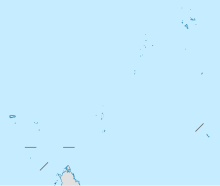
Marie Louise Island Airport (ICAO: FSMA) is an airstrip serving Marie Louise Island in the Seychelles. The runway is along the eastern shore of the island.
Marie Louise Island is 308 kilometres (191 mi) southwest of Victoria, the capital of the Seychelles.
See also
[edit]References
[edit]- ^ Islands Development Corporation
- ^ Airport information for Marie Louise Island Airport at Great Circle Mapper.
- ^ Google Maps - Marie Louise
External links
[edit]- OurAirports - Marie Louise
- FallingRain - Marie Louise Airport
- Accident history for Marie Louise Island Airport at Aviation Safety Network

