Assumption Island Airport
Appearance
Assumption Island Airport | |||||||||||
|---|---|---|---|---|---|---|---|---|---|---|---|
| Summary | |||||||||||
| Airport type | Private | ||||||||||
| Operator | Islands Development Corporation (IDC)[1] | ||||||||||
| Location | Assumption Island, Seychelles | ||||||||||
| Elevation AMSL | 10 ft / 3 m | ||||||||||
| Coordinates | 09°44′32″S 46°30′24″E / 9.74222°S 46.50667°E | ||||||||||
| Map | |||||||||||
 | |||||||||||
| Runways | |||||||||||
| |||||||||||
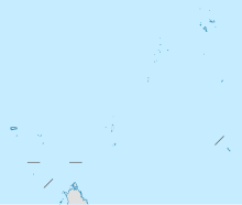
Assumption Island Airport (ICAO: FSAS) is an airport serving Assumption Island in the Seychelles. The island is 30 kilometres (19 mi) southeast of the Aldabra Atoll and is part of the Aldabra Group.
See also
[edit]References
[edit]External links
[edit]- OurAirports - Assumption
- SkyVector - Assumption
- FallingRain - Assumption Airport
- Accident history for Assumption Airport at Aviation Safety Network

