Mandé, Mali
Appearance
Mandé | |
|---|---|
| Coordinates: 12°32′44″N 8°5′8″W / 12.54556°N 8.08556°W | |
| Country | |
| Region | Koulikoro Region |
| Cercle | Koulikoro Cercle |
| Area | |
• Total | 730 km2 (280 sq mi) |
| Population (2009 census)[1] | |
• Total | 59,352 |
| • Density | 81/km2 (210/sq mi) |
| Time zone | UTC+0 (GMT) |

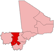
Mandé is a commune in the Cercle of Kati in the Koulikoro Region of south-western Mali The commune lies to the southwest of Bamako, the Malian capital, along the left bank of the Niger River. It covers for an area of 730 km2 and includes the small town of Ouezzindougou, the administrative centre, and 24 villages.[2] In the 2009 census the commune had a population of 59,352.[1]
References
[edit]- ^ a b Resultats Provisoires RGPH 2009 (Région de Koulikoro) (PDF) (in French), République de Mali: Institut National de la Statistique, archived from the original (PDF) on 2011-07-22.
- ^ Communes de la Région de Koulikoro (PDF) (in French), Ministère de l’administration territoriale et des collectivités locales, République du Mali, archived from the original (PDF) on 2012-03-09.
External links
[edit]- Plan de Sécurité Alimentaire Commune Rurale de Mandé 2008-2012 (PDF) (in French), Commissariat à la Sécurité Alimentaire, République du Mali, USAID-Mali, 2008.


