Lower Hack Lift
Lower Hack Lift Bridge | |
|---|---|
 Lower Hack Lift, looking southwest, in a 1979 photo | |
| Coordinates | 40°44′36″N 74°04′37″W / 40.7432°N 74.0770°W |
| Carries | New Jersey Transit |
| Crosses | Hackensack River |
| Locale | Jersey City, New Jersey and Kearny |
| Other name(s) | Erie-Lackawanna Railroad Bridge |
| Maintained by | New Jersey Transit |
| Characteristics | |
| Design | Lift bridge |
| Material | Steel |
| History | |
| Designer | John Alexander Low Waddell |
| Construction start | 1927 |
| Opened | October 2, 1928 |
| Location | |
 | |
The Lower Hack Lift is a lift bridge carrying the New Jersey Transit Morristown Line across the Hackensack River at mile 3.4, Jersey City, New Jersey.
The three-track lift span was built in 1927–28 by the Delaware, Lackawanna and Western Railroad under the direction and design of John Alexander Low Waddell. The span was completed and opened October 2, 1928.[citation needed]
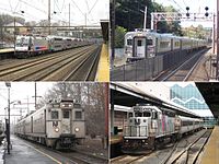
In addition to the Morristown and Gladstone lines, Montclair-Boonton Line service and North Jersey Coast Line service (via the Waterfront Connection) also use Lower Hack to access Hoboken Terminal.[citation needed]
According to US Coast Guard regulations, Lower Hack shall open upon signal with at least one hour notice to the bridge tender at Upper Hack Lift on the Main Line.[1]
See also
[edit]- Upper Hack Lift (NJ Transit bridge at mile 6.9)
- List of bridges documented by the Historic American Engineering Record in New Jersey
- List of crossings of the Hackensack River
- NJT movable bridges
References
[edit]- ^ U.S. Coast Guard. "Title 33--Navigation and Navigable Waters, Chapter I, Part 117, Section 723 - Hackensack River". Code of Federal Regulations. July 1, 2007. 33 CFR 117.723.
External links
[edit]- Movable Railroad Bridges of New Jersey-photo catalog
- Movable Railroad Bridges of New Jersey
- Views from Lower Hack
- Lower Hack photos and notes
- Historic American Engineering Record (HAER) No. NJ-42, "Erie & Lackawanna Railroad Bridge, Spanning Hackensack River, Kearny, Hudson County, NJ", 10 photos, 2 data pages, 1 photo caption page
- Bridges completed in 1928
- Delaware, Lackawanna and Western Railroad bridges
- Bridges over the Hackensack River
- NJ Transit bridges
- Railroad bridges in New Jersey
- Vertical lift bridges in New Jersey
- Buildings and structures in Jersey City, New Jersey
- Bridges in Hudson County, New Jersey
- Historic American Engineering Record in New Jersey
- Kearny, New Jersey
- 1928 establishments in New Jersey
- Steel bridges in the United States
- Northeastern United States bridge (structure) stubs
- New Jersey building and structure stubs
- New Jersey transportation stubs


