Lombard locks
Chiuse longobarde | |
| Location | Chiusa di San Michele, Piedmont, Itay |
|---|---|
| Coordinates | 45°06′N 7°19′E / 45.100°N 7.317°E |
| Type | Linear fortification |
| History | |
| Periods | VII Century |
| Events | Charlemain's conquest of the Lombard kingdom |
| Site notes | |
| Condition | Exact location uncertain |
The Lombard locks were fortification systems that were built at the mouth of valleys on the Italian side of the Alps in ancient times to prevent the invasion of the Po Valley by forces from the rest of Europe.
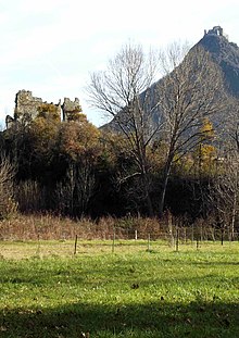
Inherited and consolidated by the Lombards, the Lombard locks were located at the mouth of the Susa valley in the region of the present-day municipality of Chiusa di San Michele.
The alpine locks (Latin: clusae langobardorum) were seldom stone walls; more usually they were sets of minor defensive structures which were arranged to reinforce existing natural obstacles.[1]
They are famed for the victory of the Franks led by Charlemagne at the beginning of his Italian campaign against the Lombard king Desiderius in 773, which was recounted by Alessandro Manzoni in Adelchi (Act II, scene III). Charlemagne's army met the fortifications of Desiderius, but his scouting forces found an alternate route and attacked the defenders from the east. The route Charlemagne used is now a hiking trail known locally as the Path of the Franks.[2] A plaque commemorating the event has been placed in the centre of Conte Verde castle in the village of Condove (Turin).[3]
Archeology
[edit]
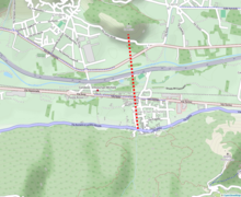
The town of Chiusa di San Michele has always been identified as the site of the fortifications. The reason for this is the topography of the Susa Valley, which is at its narrowest point of its lower section, specifically along a south-north line running from the hamlet of Borgo Pracchio di Chiusa di San Michele on the south side of the valley, to the area of the Conte Verde Castle in the municipality of Condove on the north side.[1]


While some structures built along the Praocchio brook in Chiusa di San Michele have traditionally been regarded as Lombard, their origin is unclear. There is a some evidence of fortification along this imaginary line, but near the central Piazza della Repubblica, has raised the doubts of archaeologists. In a room below a deconsecrated chapel, known as St. Joseph's, ancient walls have been found, of uncertain date, but which may hint at an early medieval fortification, possibly a tower with four corner turrets. It is a square room, with chamfered corners on the four corners suggesting small turrets two metres in diameter.[4]
References
[edit]Citations
[edit]- ^ a b "Chiuse dei Longobardi" [The Lombard Links]. Museo Torino (in Italian). Retrieved 8 February 2023.
- ^ "A cavallo per la val di Susa sulle orme dei Franchi. Così, forse, Carlo Magno ha aggirato i Longobardi" [Riding through the Susa Valley in the footsteps of the Franks. Thus, perhaps, Charlemagne bypassed the Lombards]. StampaSera "Torino cronaca" (in Italian). p. 3.
- ^ "Information panel of the Piedmont Archaeological Heritage Department at the entrance to the archaeological area". Valle Susa Tesori (in Italian). Archived from the original on 13 April 2013.
- ^ "Le chiuse e la cappella di San Giuseppe a Chiusa San Michele" [The locks and the chapel of St Joseph at Chiusa San Michele] (PDF). Valle Susa Tesori. Soprintendenza per i beni archeologici del Piemonte. Retrieved 10 April 2013.
Bibliography
[edit]- Barello, F.; Ferrero, L.; Uggé, S. (2013). "Evidenze archeologiche in Valle di Susa: acquisizioni, bilanci, prospettive di ricerca" [Archaeological evidence in the Susa Valley: acquisitions, analysis, research perspectives]. Segusium (in Italian) (52).
- Itinerari di cultura e natura alpina Valle di Susa (in Italian). Borgone Susa, Turin, Italy: Progetto Tesori d'Arte e Cultura Alpina. 2010.
