List of conflicts in Mexico
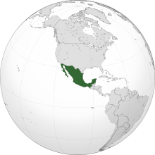
This is a list of conflicts in Mexico arranged chronologically starting from the Pre-Columbian era (Lithic, Archaic, Formative, Classic, and Post-Classic periods/stages of North America; c. 18000 BCE – c. 1521 CE) up to the colonial and postcolonial periods (c. 1521 CE – Present[update]). This list includes any raid, strike, skirmish, siege, sacking, and/or battle (land, naval, and air) that occurred on the territories of what may today be referred to as Mexico (Mesoamerica, Aridoamerica, and Oasisamerica); however, in which the conflict itself may have only been part of an operation of a campaign in a theater of a greater war (e.g. any and/or all border, undeclared, colonial, proxy, liberation, global, Indian wars, etc.). There may also be periods of violent, civil unrest listed; such as, shootouts, spree killings, massacres, terrorist attacks, coups, assassinations, regicides, riots, rebellions, revolutions, and civil wars (as well as wars of succession and/or independence). The list might also contain episodes of human sacrifice, mass suicide, and ethnic cleansing/genocide.
Pre-Columbian era (c. 18000 BCE – c. 1521 CE)
[edit]
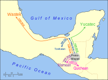


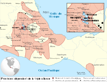
Preclassic stage (c. 1000 BCE – c. 500 CE)
[edit]Late Preclassic period (c. 400 BCE – c. 500 CE)
[edit]Terminal Preclassic division (c. 159 – c. 500 CE)
[edit]Teotihuacan civilization (c. 300 BCE – c. 547 CE)
[edit]- Campaigns of Spearthrower Owl (r. c. 374 – c. 439 CE)
- Conquest of Tikal (378 CE)
- Conquest of Copán (426 CE)
- Conquest of Quiriguá (426 CE)
- Fall of Teotihuacan (c. 410 – c. 547 CE)
Maya civilization (c. 1000 BCE – c. 1697 CE)
[edit]- Wars of the Mayans (c. 1000 BCE – c. 1697 CE)
- Campaigns of K'inich Tatb'u Skull I (reign: c. 402 – c. 454 CE)
- Campaigns of Yuknoom Chʼeen I (r. c. 484 – c. 520 CE)
Classic stage (c. 500 – c. 1200 CE)
[edit]Early Classic period (c. 500 – c. 600 CE)
[edit]Maya civilization (c. 1000 BCE – c. 1697 CE)
[edit]- Wars of the Mayans (c. 1000 BCE – c. 1697 CE)
- Campaigns of Tuun Kʼabʼ Hix (r. c. 520 – c. 546 CE)
- Campaigns of Itzamnaaj Bahlam II (r. 570–610, 599–611 CE)
- Campaigns of Yohl Ikʼnal (r. 583–604 CE)
- Palenque–Calakmul war (599–611 CE)
- Sack of Palenque (599 CE)
- Palenque–Calakmul war (599–611 CE)
Late Classic period (c. 600 – c. 800 CE)
[edit]Maya civilization (c. 1000 BCE – c. 1697 CE)
[edit]- Wars of the Mayans (c. 1000 BCE – c. 1697 CE)
- Campaigns of Sky Witness (r. c. 561 – c. 572 CE)
- Tikal–Calakmul wars (537–838 CE)
- First Tikal–Calakmul War (537–572 CE)
- Star wars (562–781 CE)
- Tikal–Calakmul star war (562 CE)
- Tikal–Calakmul wars (537–838 CE)
- Campaigns of Scroll Serpent (r. 579–611 CE)
- Calakmul–Palenque war (599 CE)
- Campaigns of Yuknoom Head (r. 630–636 CE)
- Star wars (562–781 CE)
- Calakmul–Naranjo star war (631 CE)
- Star wars (562–781 CE)
- Campaigns of K'ahk' Xiiw Chan Chaahk (r. 644–680 CE)
- Star wars (562–781 CE)
- Naranjo–Caracol war (636 CE)
- Star wars (562–781 CE)
- Campaigns of Bahlam Ajaw (r. 644–679 CE)
- Star wars (562–781 CE)
- Tortuguero star war (644 CE)
- Conquest of Comalcalco (649 CE)
- Star wars (562–781 CE)
- Campaigns of Yuknoom Chʼeen II (r. c. 600 – c. 686 CE)
- Tikal–Calakmul wars (537–838 CE)
- Second Tikal–Calakmul War (650–695 CE)
- Defeat of Calakmul (695 CE)
- Second Tikal–Calakmul War (650–695 CE)
- Star wars (562–781 CE)
- Tikal–Calakmul star war (657 CE)
- Tikal–Calakmul wars (537–838 CE)
- Campaigns of Yaxun Bʼalam III (r. 631–681 CE)
- Conquest of Hix Witz (c. 646 – c. 647 CE)
- Campaigns of Itzamnaaj Bahlam III (r. 681–742 CE)
- War against Ah Ahaual (c. 680 CE)
- Campaigns of Kʼakʼ Tiliw Chan Chaak (r. 693 – c. 720 CE)
- Defeat of Ucanal (695 CE)
- Sack of Yaxha (710 CE)
- Campaigns of K'inich B'aaknal Chaak (r. 688–715 CE)
- Star wars (562–781 CE)
- Tonina–Palenque war (711 CE)
- Star wars (562–781 CE)
- Campaigns of Wak Chanil Ajaw (r. 693–706, 721–741 CE)
- Sack of K'inichil Kab (699 CE)
- Sacking of nine unknown polities (c. 699 – c. 726 CE)
- Victory against Komkom (726 CE)
- Campaigns of Yax Mayuy Chan Chaak (r. 741–744, 721–741 CE)
- Conquest of Komkom (726 CE)
- Defeat by Tikal (744 CE)
- War of succession (c. 742 – c. 752 CE)
- Campaigns of Yaxun Bʼalam IV (r. 752–768 CE)
- Defeat of Yuknoom Tookʼ Kʼawiil (r. c. 702 – c. 731, c. 702 – c. 736 CE)
- Tikal–Calakmul wars (537–838 CE)
- Third Tikal–Calakmul War (720–744 CE)
- Conquest of Calakmul (736 CE)
- Third Tikal–Calakmul War (720–744 CE)
- Tikal–Calakmul wars (537–838 CE)
- Campaigns of Sky Witness (r. c. 561 – c. 572 CE)
Terminal Classic period (c. 800 – c. 1000 CE)
[edit]Maya civilization (c. 1000 BCE – c. 1697 CE)
[edit]- Wars of the Mayans (c. 1000 BCE – c. 1697 CE)
- Classic Maya collapse (c. 763 – c. 1179 CE)
Toltec civilization (c. 400 BCE – c. 1222 CE)
[edit]Toltec empire (c. 674 – c. 1179 CE)
[edit]- Campaigns of Xochitl (r. c. 877 – c. 916 CE)
- Toltec civil war (c. 877 – c. 1110 CE)
- Campaigns of Ce Acatl Topiltzin (r. c. 923 – c. 931, c. 923 – c. 947 CE)
- Toltec civil war (c. 877 – c. 1110 CE)
Postclassic stage (c. 900 – c. 1519 CE)
[edit]Early Postclassic period (c. 900 – c. 1200 CE)
[edit]Mixtec civilization (c. 1250 BCE – c. 1550 CE)
[edit]- Campaigns of Eight Deer Jaguar Claw (r. 1063–1115 CE)
- Conquest of Red and White Bundle (c. 1099 CE)
- Execution of Eight Deer Jaguar Claw (1115 CE)
- Campaigns of Atonal II (r. c. 1453 – c. 1458, c. 1453 – c. 1461, c. 1468, c. 1490 CE)
- Defeated by the Aztecs (c. 1453, c. 1458, c. 1461, c. 1468, or c. 1490 CE)
- Conquest of Coixtlahuaca (c. 1453, c. 1458, c. 1461, c. 1468, or c. 1490 CE)
- Defeated by the Aztecs (c. 1453, c. 1458, c. 1461, c. 1468, or c. 1490 CE)
Maya civilization (c. 1000 BCE – c. 1697 CE)
[edit]- Wars of the Mayans (c. 1000 BCE – c. 1697 CE)
- Classic Maya collapse (c. 763 – c. 1179 CE)
- Campaigns of Chac-Xib-Chac (r. c. 1175 – c. 1194 CE)
- Fall of Mayapan (c. 1440 – c. 1461 CE)
Late Postclassic period (c. 1200 – c. 1519 CE)
[edit]Purépecha civilization (c. 1000 – 1530 CE)
[edit]Purépecha empire (c. 1300 – 1530 CE)
[edit]- Campaigns of Tariácuri (r. c. 1350 CE)
- Campaigns of Tangaxuan II (r. 1520–1530 CE)
- Saltpeter war (1480–1510 CE)
Zapotec civilization (c. 700 BCE – c. 1715 CE)
[edit]- Wars of the Zapotecs
- Campaigns of Cosijoeza (r. 1487–1504 CE)
- Zapotec conquest of Tehuantepec (1487 CE)
- Zapotec warfare and resistance against the Aztecs (1496–1497 CE)
- Aztec siege of Tehuantepec (1496 CE)
- Aztec destruction of Huaxyacac (1497 CE)
- Aztec destruction of Mitla (1497 CE)
- Aztec siege of Guiengola (1497 CE)
- Campaigns of Cosijoeza (r. 1487–1504 CE)
Aztec civilization (c. 1248 – 1521 CE)
[edit]Tepanec empire (c. 995–1428 CE)
[edit]- Wars of the Tepanecs (c. 1222 – c. 1431 CE)
- Conquest of Ayotoxco (c. 1222 – c. 1283 CE)
- Conquest of Ocoyoacac (c. 1222 – c. 1283 CE)
- Conquest of Coyoacán (c. 1222 – c. 1283 CE)
- Conquest of Coatepec (c. 1222 – c. 1283 CE)
- Conquest of Cuitláhuac (c. 1250 – c. 1414 CE)
- Conquest of Cuauhtitlan (c. 1283 – c. 1343 CE)
- Conquest of Azcapotzalco (c. 1283 – c. 1414 CE)
- Conquest of Atotonilco (c. 1300 – c. 1414 CE)
- Campaigns of Coxcoxtli (reign: c. 1281 – c. 1307, c. 1281 – c. 1350 CE)
- Culhuacán-Mexica war (c. 1299 – c. 1325 CE)
- Conquest of Coatlinchan (c. 1337 – c. 1418 CE)
- Conquest of Tetzcoco (c. 1337 – c. 1418 CE)
- Conquest of Cuajimalpa (1342 CE)
- Conquest of Xochimilco (c. 1352 – c. 1376 CE)
- Conquest of Chalco (c. 1354 – c. 1376 CE)
- Conquest of Cuauhnahuac (c. 1365 – c. 1396 CE)
- Campaigns of Tezozomoc (r. c. 1353 – 1426, c. 1370 – 1426 CE)
- Azcapotzalco-Texcoco war (c. 1367 – c. 1428 CE)
- Conquest of Tepotzotlán (1372 CE)
- Conquest of Culhuacán (c. 1377 – c. 1428 CE)
- Conquest of Xaltocan (c. 1395 CE)
- Campaigns of Maxtla (r. c. 1426 – c. 1428 CE)
- Rebellion in Azcapotzalco (c. 1426 CE)
- Tepanec War (1426–1440 CE)
- Wars of the Aztecs (c. 1248 – c. 1521 CE)
- Campaigns of Acamapichtli (r. c. 1350 – c. 1403, c. 1376 – c. 1395 CE)
- Conquest of Chalco (c. 1376 – c. 1410 CE)
- Conquest of Cuauhnahuac
- Conquest of Xochimilco (c. 1376 – c. 1430 CE)
- Campaigns of Huitzilihuitl (r. c. 1390 – c. 1415, c. 1403 – c. 1417 CE)
- Conquest of Tollantzingo (c. 1390 – c. 1417 CE)
- Conquest of Otompa (c. 1395 – c. 1417 CE)
- Conquest of Acolman (1396 CE)
- Conquest of Tultitlan (c. 1396 – c. 1417 CE)
- Conquest of Xaltocan (c. 1428 – c. 1495 CE)
- Campaigns of Acamapichtli (r. c. 1350 – c. 1403, c. 1376 – c. 1395 CE)
Aztec Empire (1428–1521 CE)
[edit]- Wars of the Aztecs (c. 1248 – c. 1521 CE)
- Tepanec War (1426–1440 CE)
- Conquest of Teotihuacan (1427 CE)
- Campaigns of Itzcoatl (r. c. 1427 – c. 1440, c. 1428 – c. 1440 CE)
- Conquest of Coyoacán (c. 1428 CE)
- Conquest of Culhuacán (c. 1428 CE)
- Conquest of Mixquic (1432 CE)
- Conquest of Cuitláhuac (c. 1433 – c. 1434 CE)
- Conquest of Tezompa (c. 1433 – c. 1434 CE)
- Conquest of Cuauhnahuac (c. 1439 CE)
- Conquest of Tenayuca (c. 1434 CE)
- Campaigns of Moctezuma I (r. 1440–1466, 1440–1469 CE)
- Subjugation of the Huastec people (c. 1445 – c. 1450 CE)
- Subjugation of the Totonac people (c. 1445 – c. 1450 CE)
- Flower wars (1454–1519 CE)
- Subjugation of the Mixtec people (c. 1458 CE)
- Conquest of Coixtlahuaca (c. 1458 CE)
- Conquest of Cosamaloapan (c. 1458 – c. 1466 CE)
- Conquest of Āhuilizāpan (c. 1458 – c. 1466 CE)
- Conquest of Cuauhtitlan (c. 1458 – c. 1466 CE)
- Campaigns of Axayacatl (r. c. 1469 – c. 1481, c. 1472 – c. 1481 CE)
- Battle of Tlatelolco (1473 CE)
- Conquest of Tlatelolco (1473 CE)
- Conquest of Cuetlachtlan (1474 CE)
- Subjugation of the Matlatzinca people (c. 1474 – c. 1478 CE)
- Conquest of Calixtlahuaca (c. 1476 CE)
- Conquest of Tollocan (1478 CE)
- Battle of Tlatelolco (1473 CE)
- Campaigns of Moctezuma II (r. c. 1502 – 1520, c. 1503 – 1520 CE)
- Conquest of Soconusco (c. 1486 – c. 1502 CE)
- Conquest of Tehuantepec (c. 1496 – c. 1502 CE)
- Subjugation of the Zapotec people (c. 1497 – c. 1502 CE)
- Subjugation of the Yopi people (c. 1502 CE)
Colonial period (1521–1821)
[edit]

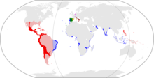



Spanish Golden Age (1492–1681)
[edit]Trastámaran dynasty (1479–1555)
[edit]Spanish conquest era (1521–1550)
[edit]- European colonization of the Americas (c. 1003 – c. 1945)
- Spanish colonization of the Americas (c. 1492 – c. 1898)
- Spanish conquest of Mexico (c. 1521 – c. 1550)
- Spanish conquest of the Maya (c. 1521 – c. 1704)
- Spanish conquest of Yucatán (c. 1521 – 1546)
- Spanish conquest of Chiapas (c. 1523 – c. 1695)
- Spanish conquest of the Aztec Empire (1519–1521)
- Cholula massacre (1519)
- Massacre in the Great Temple of Tenochtitlan (1520)
- Battle of Cempoala (1520)
- La Noche Triste (1520)
- Battle of Otumba (1520)
- Fall of Tenochtitlan (1521)
- Battle of Colhuacatonco (1521)
- Spanish conquest of the Tarascan empire (1522–1530)
- Expedition of Francisco Vázquez de Coronado (1535–1554)
- Conquest of Cíbola (1540)
- Tiguex War (1540–1541)
- Yaqui Wars (1533–1929)
- Mixtón war (1540–1542)
- Apache Wars (c. 1541 – 1924)
- Apache–Mexico Wars (c. 1541 – 1915)
- Chichimeca war (1550–1590)
- Spanish conquest of the Maya (c. 1521 – c. 1704)
- Spanish conquest of Mexico (c. 1521 – c. 1550)
- Spanish colonization of the Americas (c. 1492 – c. 1898)
Habsburg dynasty (1555–1700)
[edit]Pax Hispanica (1598–1621)
[edit]- European colonization of the Americas (c. 1003 – c. 1945)
- Spanish colonization of the Americas (c. 1492 – c. 1898)
- Spanish conquest of Mexico (c. 1502 – c. 1550)
- Spanish conquest of the Maya (c. 1502 – c. 1704)
- Spanish conquest of Chiapas (c. 1523 – c. 1695)
- Spanish conquest of Petén (c. 1618 – c. 1697)
- Yaqui Wars (1533–1929)
- Apache Wars (c. 1541 – 1924)
- Apache–Mexico Wars (c. 1541 – 1924)
- Chichimeca war (1550–1590)
- Acoma massacre (1599)
- Acaxee Rebellion (1601–1607)
- Tepehuán Revolt (1616–1620)
- Navajo Wars (c. 1641 – 1864)
- Spanish conquest of the Maya (c. 1502 – c. 1704)
- Spanish conquest of Mexico (c. 1502 – c. 1550)
- Spanish colonization of the Americas (c. 1492 – c. 1898)
- European wars of religion (c. 1522 – c. 1714)
- Eighty Years' War (1568–1648)
- Anglo-Spanish war (1585–1604)
- Raid on Tabasco (1599)
- Anglo-Spanish war (1585–1604)
- Eighty Years' War (1568–1648)
Bourbon dynasty (1700–1808)
[edit]- European colonization of the Americas (c. 1003 – c. 1945)
- Spanish colonization of the Americas (c. 1492 – c. 1898)
- Spanish conquest of Mexico (c. 1502 – c. 1550)
- Spanish conquest of the Maya (c. 1502 – c. 1704)
- Apache wars (c. 1541 – 1924)
- Apache–Mexico wars (c. 1541 – 1924)
- First Magdalena Massacre (1757)
- Second Magdalena massacre (1776)
- Apache–Mexico wars (c. 1541 – 1924)
- Navajo wars (c. 1641 – 1864)
- Tzeltal rebellion (1712)
- Spanish conquest of Mexico (c. 1502 – c. 1550)
- Spanish colonization of the Americas (c. 1492 – c. 1898)
Postcolonial period (1821 – Present)
[edit]Mexican independence era (1808–1829)
[edit]House of Bonaparte (1808–1813)
[edit]

- Spanish American wars of independence (1808–1833)
- Mexican War of Independence (1810–1821)
- First stage (1810–1811)
- Battle of Monte de las Cruces (1810)
- Battle of Calderón Bridge (1811)
- Organizational phase (1810–1815)
- Battle of El Veladero (1810–1811)
- Battle of Puerto de Piñones (1811)
- Battle of Zacatecas (1811)
- Battle of El Maguey (1811)
- Battle of Llanos de Santa Juana (1811)
- Battle of Zitácuaro (1812)
- Battle of Tecualoya (1812)
- Battle of Tenancingo (1812)
- Siege of Cuautla (1812)
- Battle of Izúcar (1812)
- Siege of Huajuapan de León (1812)
- Battle of Tenango del Valle (1812)
- Battle of Escamela (1812)
- Battle of Zitlala (1812)
- Capture of Orizaba (1812)
- Capture of Oaxaca (1812)
- First stage (1810–1811)
- Mexican War of Independence (1810–1821)
House of Bourbon (1813–1820)
[edit]- Spanish American wars of independence (1808–1833)
- Mexican War of Independence (1810–1821)
- Organizational phase (1811–1815)
- Battle of Rosillo Creek (1813)
- Siege of Acapulco (1813)
- Battle of La Chincúa (1813)
- Battle of Alazan Creek (1813)
- Battle of Medina (1813)
- Battle of Lomas de Santa María (1813)
- Battle of Puruarán (1814)
- Battle of Temalaca (1815)
- Resistance and consummation phases (1815–1821)
- Battle of Agua Zarca (1819)
- Organizational phase (1811–1815)
- Mexican War of Independence (1810–1821)
House of Iturbide (1821–1823)
[edit]First Mexican Empire (1821–1823)
[edit]
- Spanish American wars of independence (1808–1833)
- Mexican War of Independence (1810–1821)
- Resistance and consummation phases (1815–1821)
- Battle of Azcapotzalco (1821)
- Resistance and consummation phases (1815–1821)
- Mexican War of Independence (1810–1821)
Revolt against the emperor (1822–1823)
[edit]- Casa Mata Plan Revolution (1822–1823)
- Battle of Almolonga (1823)
First Mexican Republic (1824–1835)
[edit]Provisional Government of Mexico (1823–1824)
[edit]
Spaniards in Mexico (1821–1829)
[edit]- Spanish attempts to reconquer Mexico (1821–1829)
- Battle of Mariel (1828)
Revolts against the government (1823)
[edit]- Rebellion of Oaxaca (1823)
- Rebellion of Guadalajara (1823)
- Rebellion of Puebla (1823)
- Revolt of Querétaro (1823)
Age of Santa Anna (1829–1846)
[edit]
- Spanish attempts to reconquer Mexico (1821–1829)
- Battle of Tampico (1829–1829)
Centralist Republic of Mexico (1835–1846)
[edit]Comanche conflict (1821–1846)
[edit]
- Comanche-Mexico Wars (1821–1870)
Armed opposition (1835–1840)
[edit]
- Mexican Federalist War (1835–1840)
- Zacatecas rebellion (1835)
- Battle of Zacatecas (1835)
- Zacatecas rebellion (1835)
Texas war for independence (1835–1836)
[edit]- Mexican Federalist War (1835–1840)
- Mexican conflicts with Texas (1835–1836)
- Texas Revolution (1835–1836)
- Battle of Gonzales (1835)
- Battle of Goliad (1835)
- Battle of Concepción (1835)
- Grass Fight (1835)
- Siege of Béxar (1835)
- Battle of San Patricio (1836)
- Battle of the Alamo (1836)
- Battle of Agua Dulce (1836)
- Battle of Refugio (1836)
- Battle of Coleto (1836)
- Battle of San Jacinto (1836)
- Battle of Matamoros (1836)
- Battle of Salado Creek (1842)
- Texan Santa Fe Expedition (1841–1842)
- Texas Revolution (1835–1836)
- Battle of Acajete (1839)
- Siege of Tampico (1839)
- Battle of Alcantra (1839)
- Mexican conflicts with Texas (1835–1836)
- First Franco-Mexican War (1838–1839)
- Battle of Veracruz (1838)
- Mier expedition (1842–1843)
- Naval Battle of Campeche (1843–1843)
Mexican–American War (1846)
[edit]- Mexican–American War (1846–1848)
- Northern Mexican Theater (1846–1848)
- Battle of Monterrey (1846)
- Mexico City Campaign (1846–1848)
- Blockade of Veracruz (1846–1848)
- Northern Mexican Theater (1846–1848)
Second Federal Republic of Mexico (1846–1863)
[edit]Mexican–American War (1846–1848)
[edit]
- Mexican–American War (1846–1848)
- Northern Mexican Theater (1846–1848)
- Battle of Buena Vista (1847)
- Battle of the Sacramento River (1847)
- Battle of Santa Cruz de Rosales (1848)
- Mexico City Campaign (1846–1848)
- Blockade of Veracruz (1846–1848)
- Revolt of the Polkos (1847)
- Siege of Veracruz (1847)
- Battle of Cerro Gordo (1847)
- Battle of Contreras (1847)
- Battle of Churubusco (1847)
- Battle for Mexico City (1847)
- Battle of Molino del Rey (1847)
- Battle of Chapultepec (1847)
- Siege of Puebla (1847)
- Battle of Huamantla (1847)
- Action of Atlixco (1847)
- Skirmish at Matamoros (1847)
- Affair at Galaxara Pass (1847)
- Action of Sequalteplan (1848)
- Pacific Coast Campaign (1847–1848)
- Battle of Mulegé (1847)
- Bombardment of Guaymas (1847)
- Bombardment of Punta Sombrero (1847)
- Battle of La Paz (1847)
- Battle of San José del Cabo (1847)
- Siege of La Paz (1847)
- Siege of San José del Cabo (1848)
- Skirmish of Todos Santos (1848)
- Northern Mexican Theater (1846–1848)
La Reforma (c. 1833 – c. 1867)
[edit]- Zacatecas rebellion (1835)
- Caste War of Yucatán (1847 – c. 1933)
Santa Anna dictatorship (1853–1855)
[edit]Alvarez Presidency (1855)
[edit]- Revolution of Ayutla (1854–1855)
Juarez Presidency (1857–1872)
[edit]- Cortina Troubles (1859–1861)
- Battle of La Ebonal (1859)
- Battle of Rio Grande City (1859)
Reform War (1857–1860)
[edit]
- Mexican Civil Wars (c. 1857 – Present)
- Reform War (1857—1860)
- Crabb massacre (1857)
- Battle of Celaya (1858)
- Battle of Salamanca (1858)
- Battle of Atenquique (1858)
- Battle of La Albarrada (1858)
- Battle of Ixtlahuaca (1858)
- Battle of Ahualulco (1858)
- Battle of Guadalajara (1858)
- Battle of San Joaquín (1858)
- Reform War (1857—1860)
Foreign intervention (1861–1863)
[edit]- Second Franco-Mexican War (1861–1867)
- Battle of Fortín (1862)
- Battle of Las Cumbres (1862)
- Battle of Atlixco (1862)
- Battle of Puebla (1862)
- Battle of Acapulco (1863)
Second Mexican Empire (1864–1867)
[edit]- Second Franco-Mexican War (1861–1867)
- Battle of San Juan Bautista (1864)
- Capture of Mazatlán (1864)
- Capture of Monterrey (1864)
- Battle of San Pedro (1864)
- Battle of la Loma (1865)
- Capture of Chihuahua (1865)
- Battle of Miahuatlán (1866)
- Battle of La Carbonera (1866)
- Battle of Guayabo (1866)
- Third Battle of Puebla (1867)
- Siege of Querétaro (1867)
- Siege of Mexico City (1867)
Restored Republic (1867–1876)
[edit]- Las Cuevas War (1875)
- Battle of Tecoac (1876)
Contemporary Mexico (1876 – Present)
[edit]Porfiriato (1876–1911)
[edit]

- Spanish colonization of the Americas (c. 1492 – c. 1898 CE)
- Mexican-Indian Wars (c. 1533 CE – Present[update])
- Yaqui Wars (1533–1929)
- Yaqui Uprising (1896)
- Battle of Mazocoba (1900)
- Apache Wars (c. 1541 – 1924 CE)
- Apache–Mexico Wars (c. 1541 – 1924)
- Post-1887 Apache Wars period (1887–1924)
- Apache campaign (1896)
- Post-1887 Apache Wars period (1887–1924)
- Apache–Mexico Wars (c. 1541 – 1924)
- Victorio's War (1879–1880)
- Geronimo's War (1886–1887)
- Crawford affair (1886)
- Yaqui Wars (1533–1929)
- Mexican-Indian Wars (c. 1533 CE – Present[update])
- Garza Revolution (1891–1893)
Revolutionary Mexico (1911–1928)
[edit]Madero presidency (1911–1913)
[edit]

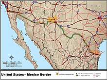

- Mexican Revolution (1910–1921)
- Magonista campaign in Baja California (1911)
- Capture of Mexicali (1911)
- First Battle of Tijuana (1911)
- Second Battle of Tijuana (1911)
- Battle of Casas Grandes (1911)
- First Battle of Agua Prieta (1911)
- Battle of Cuautla (1911)
- First Battle of Rellano (1912)
- Second Battle of Rellano (1912)
- Magonista campaign in Baja California (1911)
Counter-revolution and civil war (1913–1915)
[edit]- Mexican Revolution (1910–1921)
- Naval operations of the Mexican Revolution (1914)
- First Battle of Topolobampo (1914)
- Second Battle of Topolobampo (1914)
- Third Battle of Topolobampo (1914)
- Action of 9 April 1914
- Fourth Battle of Topolobampo (1914)
- Ten Tragic Days (1913)
- First Battle of Nogales (1913)
- Battle of Naco (1913)
- First Battle of Torreón (1913)
- Second Battle of Ciudad Juárez (1913)
- Battle of Tierra Blanca (1913)
- Battle of Ojinaga (1914)
- Second Battle of Torreón (1914)
- Battle of Zacatecas (1914)
- Naval operations of the Mexican Revolution (1914)
Constitutionalists in power (1915–1920)
[edit]- Mexican Revolution (1910–1921)
- Battle of Celaya (1915)
- Second Battle of Agua Prieta (1915)
- Third Battle of Torreón (1916)
- Third Battle of Ciudad Juarez (1919)
- First World War (1914–1918)
- Banana Wars (1898–1934)
- Mexican–American wars (c. 1845 – c. 1977)
- Rio Grande border disputes (c. 1845 – c. 1977)
- Río Rico (c. 1845 – c. 1977)
- Chamizal dispute (c. 1848 – c. 1967)
- Country Club Dispute (c. 1850 – c. 1927)
- Ojinaga Cut (c. 1970)
- United States involvement in the Mexican Revolution (1910–1919)
- Tampico Affair (1914)
- Ypiranga incident (1914)
- Mexican Border War (1910–1919)
- First Battle of Agua Prieta (1911)
- First Battle of Ciudad Juárez (1911)
- Second Battle of Nogales (1915)
- United States occupation of Veracruz (1914)
- Pancho Villa Expedition (1916–1917)
- Battle of Parral (1916)
- Battle of Carrizal (1916)
- Zimmermann Telegram (1917)
- Battle of Ambos Nogales (1918)
- Rio Grande border disputes (c. 1845 – c. 1977)
- Mexican–American wars (c. 1845 – c. 1977)
- Banana Wars (1898–1934)
Calles presidency (1924–1928)
[edit]- Cristero War (1926–1929)
- Battle of San Julián (1927)
Maximato (1928–1934)
[edit]Mexico under the PNR (1929–1988)
[edit]Mexico under the PNR (1929–1938)
[edit]- Cristero War (1926–1929)
- Battle of Tepatitlán (1929)
- Escobar Rebellion (1929)
- Siege of Naco (1929)
- Bombing of Naco (1929)
- Johnson's Ranch Raid (1929)
Mexico under the PRM (1938–1946)
[edit]- Saturnino Cedillo rebellion (1938–1939)
Camacho presidency (1940–1946)
[edit]- Second World War (1939–1945)
- Sinking of SS Faja de Oro (1942)
Mexico under the PRI (1946–1988)
[edit]
- Mexico–Guatemala conflict (1958–1959)
- Cold War (1947–1991)
- Mexican Dirty War (1959–2000)
- Protests of 1968 (1968–1969)
- Mexican Movement (1968–1968)
- Tlatelolco massacre (1968)
- Mexican Movement (1968–1968)
- El Halconazo (1971)
- Protests of 1968 (1968–1969)
- Mexican Dirty War (1959–2000)
Chiapas conflict (1994–2014)
[edit]- Chiapas conflict (1994–2014)
- Zapatista Uprising (1994–2006)
- Zapatista uprising (1994)
- Zapatista crisis (1995)
- The Other Campaign (2005–2006)
- Acteal massacre (1997)
- Zapatista Uprising (1994–2006)
Mexican drug war (2006 – Present)
[edit]- War on drugs (1969 – Present[update])
- Mexican drug war (2006 – Present[update])
- Operation Michoacán (2006 – Present[update])
- Operation Baja California (2007 – Present[update])
- Joint Operation Nuevo León-Tamaulipas (2007 – Present[update])
- Nuevo León mass graves (2010)
- San Fernando massacre (2010)
- Shootout at Matamoros (2010)
- San Fernando massacre (2011)
- Monterrey casino attack (2011)
- Operation Sinaloa (2008 – Present[update])
- Operation Chihuahua (2008 – Present[update])
- Operation Quintana Roo (2009 – Present[update])
- Coahuila mass graves (2011)
- Operación Lince Norte (2011)
- Operación Escorpión (2011)
- Mexican drug war (2006 – Present[update])
- Mexican Indignados Movement (2011 – Present[update])
- Mexican protests (2017)
