[ 1] Landmark name
Image
Date designated[ 2]
Location
County
Description
1
Alexandria Historic District Alexandria Historic District November 13, 1966 (#66000928 ) Alexandria 38°48′12″N 77°02′47″W / 38.8033°N 77.0464°W / 38.8033; -77.0464 (Alexandria Historic District ) Alexandria (independent city)
Comprises the central portion of Alexandria, Virginia
2
Aquia Church Aquia Church July 5, 1991 (#69000282 ) Garrisonville 38°27′53″N 77°24′11″W / 38.4646°N 77.4030°W / 38.4646; -77.4030 (Aquia Church ) Stafford
Mid-18th-century church
3
Bacon's Castle Bacon's Castle October 9, 1960 (#66000849 ) Bacon's Castle 37°06′32″N 76°43′20″W / 37.1088°N 76.7222°W / 37.1088; -76.7222 (Bacon's Castle ) Surry
One of the oldest brick buildings in Virginia
4
Ball's Bluff Battlefield and National Cemetery Ball's Bluff Battlefield and National Cemetery April 27, 1984 (#84003880 ) Leesburg 39°07′53″N 77°31′45″W / 39.1314°N 77.5292°W / 39.1314; -77.5292 (Ball's Bluff Battlefield and National Cemetery ) Loudoun
Site of an embarrassing Union defeat early in the American Civil War , caused by inept generalship, after which drowned troops' bodies floated down the Potomac River to Washington, D.C.
5
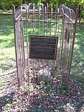
Banneker (Benjamin) SW-9 Intermediate Boundary Stone Banneker (Benjamin) SW-9 Intermediate Boundary Stone May 11, 1976 (#76002094 ) Arlington 38°52′58″N 77°09′33″W / 38.8829°N 77.15905°W / 38.8829; -77.15905 (Banneker (Benjamin) SW-9 Intermediate Boundary Stone ) Arlington
A boundary stone associated with Benjamin Banneker , (1731–1806), an African American surveyor, mathematician and astronomer who assisted Andrew Ellicott during the first two months of Ellicott's 1791–1792 survey of the boundaries of the original District of Columbia.[ 3]
6
Barracks, Virginia Military Institute Barracks, Virginia Military Institute December 21, 1965 (#66000956 ) Lexington 37°47′25″N 79°26′19″W / 37.7903°N 79.4386°W / 37.7903; -79.4386 (Barracks, Virginia Military Institute ) Lexington (independent city)
Gothic style cadet barracks building on the grounds of Virginia Military Institute
7
Berkeley Berkeley November 11, 1971 (#71001040 ) Charles City 37°19′18″N 77°10′54″W / 37.3217°N 77.1817°W / 37.3217; -77.1817 (Berkeley ) Charles City
One of the great plantations of Virginia, associated with Presidents William Henry Harrison and Benjamin Harrison .
8
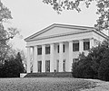
Berry Hill Berry Hill November 11, 1971 (#69000246 ) South Boston 36°41′48″N 78°56′39″W / 36.6967°N 78.9442°W / 36.6967; -78.9442 (Berry Hill ) Halifax
A Greek Revival plantation mansion, imitating the Parthenon
9
Brandon Brandon April 15, 1970 (#69000271 ) Burrowsville 37°15′27″N 76°59′36″W / 37.2575°N 76.9934°W / 37.2575; -76.9934 (Brandon ) Prince George
Plantation tended from 1614 on, with unusual brick mansion in style of Palladio 's "Roman Country House" completed in 1760s
10
Bremo Historic District Bremo Historic District November 11, 1971 (#69000241 ) Bremo Bluff 37°43′31″N 78°19′47″W / 37.7254°N 78.3297°W / 37.7254; -78.3297 (Bremo Historic District ) Fluvanna
James River plantation with mansion probably designed by Thomas Jefferson
11
Bruton Parish Church Bruton Parish Church April 15, 1970 (#70000861 ) Williamsburg 37°16′09″N 76°42′10″W / 37.2693°N 76.7028°W / 37.2693; -76.7028 (Bruton Parish Church ) Williamsburg (independent city)
Earliest church in the British American colonies to reflect the infusion of English Renaissance style.
12
Camden Camden November 11, 1971 (#69000228 ) Port Royal 38°09′48″N 77°09′41″W / 38.1632°N 77.1614°W / 38.1632; -77.1614 (Camden ) Caroline
Two-story Italian villa featuring such 19th-century innovations as a central heating system, gas lights, inside toilets, and shower baths.
13
Camp Hoover Camp Hoover June 7, 1988 (#88001825 ) Graves Mill 38°29′31″N 78°25′16″W / 38.4919°N 78.4210°W / 38.4919; -78.4210 (Camp Hoover ) Madison
President Herbert Hoover 's rustic presidential retreat, also known as Rapidan Camp.
14
Cape Henry Lighthouse Cape Henry Lighthouse January 29, 1964 (#66000910 ) Virginia Beach 36°55′26″N 76°00′30″W / 36.9239°N 76.0082°W / 36.9239; -76.0082 (Cape Henry Lighthouse ) Virginia Beach (independent city)
First lighthouse to be erected by the Federal Government.
15
Carter's Grove Carter's Grove April 15, 1970 (#69000249 ) Williamsburg 37°12′25″N 76°37′29″W / 37.2070°N 76.6248°W / 37.2070; -76.6248 (Carter's Grove ) James City
Georgian country house and plantation near Williamsburg.
16
Cedar Creek Battlefield and Belle Grove Plantation Cedar Creek Battlefield and Belle Grove Plantation August 11, 1969 (#69000243 ) Middletown and Strasburg 39°01′11″N 78°18′02″W / 39.0196°N 78.3006°W / 39.0196; -78.3006 (Cedar Creek Battlefield and Belle Grove Plantation ) Frederick and Warren
Site of the American Civil War battle of Cedar Creek and the Belle Grove Plantation . Divided into two pieces by Interstate 81
17
Christ Church, Alexandria Christ Church, Alexandria April 15, 1970 (#70000899 ) Alexandria 38°48′23″N 77°02′51″W / 38.8063°N 77.0475°W / 38.8063; -77.0475 (Christ Church, Alexandria ) Alexandria (independent city)
1773 Georgian brick church
18
Christ Church (Lancaster County) Christ Church (Lancaster County) May 30, 1961 (#66000841 ) Irvington 37°40′36″N 76°25′07″W / 37.6768°N 76.4186°W / 37.6768; -76.4186 (Christ Church (Lancaster County) ) Lancaster
Example of British Colonial ecclesiastical architecture.
19
City Hall (Richmond) City Hall (Richmond) November 11, 1971 (#69000327 ) Richmond 37°32′16″N 77°25′59″W / 37.5379°N 77.4331°W / 37.5379; -77.4331 (City Hall (Richmond) ) Richmond (independent city)
Example of the High Victorian Gothic style.
20
Patsy Cline House Patsy Cline House January 13, 2021 (#100006248 ) Winchester 39°10′41″N 78°09′53″W / 39.1781°N 78.1647°W / 39.1781; -78.1647 (Patsy Cline House ) Winchester (independent city)
Childhood home of country music singer Patsy Cline .
21
Confederate Capitol Confederate Capitol December 19, 1960 (#66000911 ) Richmond 37°32′20″N 77°26′01″W / 37.5388°N 77.4336°W / 37.5388; -77.4336 (Confederate Capitol ) Richmond (independent city)
From July 1861 to April 1865, the Confederate Congress met here; state capitol before and after the war
22
Charles Richard Drew House Charles Richard Drew House May 11, 1976 (#76002095 ) Arlington 38°52′21″N 77°05′14″W / 38.8726°N 77.0872°W / 38.8726; -77.0872 (Charles Richard Drew House ) Arlington
Home of Dr. Charles R. Drew , an African American physician and researcher whose leadership on stockpiling blood plasma saved lives in World War II
23
Drydock Number One, Norfolk Naval Shipyard Drydock Number One, Norfolk Naval Shipyard November 11, 1971 (#70000862 ) Portsmouth 36°49′07″N 76°17′35″W / 36.8187°N 76.2931°W / 36.8187; -76.2931 (Drydock Number One, Norfolk Naval Shipyard ) Portsmouth (independent city)
Union frigate USS Merrimack was rebuilt by the Confederates in this drydock, becoming the ironclad CSS Virginia . Now part of Norfolk Naval Shipyard .
24
Egyptian Building Egyptian Building November 11, 1971 (#69000321 ) Richmond 37°32′18″N 77°25′45″W / 37.5384°N 77.4292°W / 37.5384; -77.4292 (Egyptian Building ) Richmond (independent city)
First permanent home of the Medical Department of Hampden-Sydney College
25
Elsing Green Elsing Green November 11, 1971 (#69000252 ) Tunstall 37°36′09″N 77°03′04″W / 37.602444°N 77.051103°W / 37.602444; -77.051103 (Elsing Green ) King William
Georgian plantation house built by Carter Braxton
26
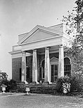
Exchange Exchange November 11, 1971 (#69000322 ) Petersburg 37°13′55″N 77°24′19″W / 37.231950°N 77.405403°W / 37.231950; -77.405403 (Exchange ) Petersburg (independent city)
Two-story Greek Revival structure with a Doric portico.
27
Eyre Hall Eyre Hall March 2, 2012 (#69000265 ) Cheriton 37°13′48″N 77°24′16″W / 37.230105°N 77.40445°W / 37.230105; -77.40445 (Eyre Hall ) Northampton
A private plantation in the hands of the Eyre family since 1668.
28
Five Forks Battlefield Five Forks Battlefield December 19, 1960 (#66000830 ) Petersburg 37°08′21″N 77°37′23″W / 37.13927°N 77.62292°W / 37.13927; -77.62292 (Five Forks Battlefield ) Dinwiddie
Site of Battle of Five Forks , where Lee's flank was turned, leading to virtual end of the American Civil War in 1865.
29
Gerald R. Ford Jr. House Gerald R. Ford Jr. House December 17, 1985 (#85003048 ) Alexandria 38°48′40″N 77°04′49″W / 38.811189°N 77.080263°W / 38.811189; -77.080263 (Gerald R. Ford Jr. House ) Alexandria (independent city)
House of President Gerald R. Ford .
30
Fort Monroe Fort Monroe December 19, 1960 (#66000912 ) Hampton 37°00′13″N 76°18′27″W / 37.00361°N 76.3075°W / 37.00361; -76.3075 (Fort Monroe ) Hampton (independent city)
Fort Monroe was completed in 1834, and is named in honor of U.S. President James Monroe. Completely surrounded by a moat, the six-sided stone fort was an active Army post until 2011. The fort was redesignated as Fort Monroe National Monument in 2011.
31
Fort Myer Historic District Fort Myer Historic District November 28, 1972 (#72001380 ) Arlington 38°52′49″N 77°04′47″W / 38.880343°N 77.079735°W / 38.880343; -77.079735 (Fort Myer Historic District ) Arlington
U.S. Army post adjacent to Arlington National Cemetery .
32
Franklin & Armfield Office Franklin & Armfield Office June 2, 1978 (#78003146 ) Alexandria 38°48′07″N 77°03′17″W / 38.801911°N 77.054661°W / 38.801911; -77.054661 (Franklin & Armfield Office ) Alexandria (independent city)
Largest slave trading firm in the antebellum South
33
Gadsby's Tavern Gadsby's Tavern November 4, 1963 (#66000913 ) Alexandria 38°48′13″N 77°02′38″W / 38.803630°N 77.044001°W / 38.803630; -77.044001 (Gadsby's Tavern ) Alexandria (independent city)
Original tavern was a central part of the social, economic, political, and educational life of the city of Alexandria, and the United States. (Try Gadsby's Tavern Museum )
34
Ellen Glasgow House Ellen Glasgow House November 11, 1971 (#71001041 ) Richmond 37°32′27″N 77°26′42″W / 37.540934°N 77.445003°W / 37.540934; -77.445003 (Ellen Glasgow House ) Richmond (independent city)
Residence of author Ellen Glasgow
35
Carter Glass House Carter Glass House December 8, 1976 (#76002183 ) Lynchburg 37°24′48″N 79°08′51″W / 37.413451°N 79.147488°W / 37.413451; -79.147488 (Carter Glass House ) Lynchburg (independent city)
A home of influential congressman and senator Carter Glass
36
Green Springs Historic District Green Springs Historic District May 30, 1974 (#73002036 ) Zion Crossroads 38°00′55″N 78°09′51″W / 38.015278°N 78.164167°W / 38.015278; -78.164167 (Green Springs Historic District ) Louisa
Rural manor houses and related buildings.
37
Greenway Court Greenway Court October 9, 1960 (#66000829 ) White Post 39°02′40″N 78°07′09″W / 39.044366°N 78.119195°W / 39.044366; -78.119195 (Greenway Court ) Clarke
Remnants of 5,000,000-acre (20,000 km2 ) estate of Thomas Fairfax, 6th Lord Fairfax of Cameron , only British peer in America, where George Washington worked as a surveyor
38
Gunston Hall Gunston Hall December 19, 1960 (#66000832 ) Lorton 38°38′49″N 77°08′47″W / 38.64697°N 77.14642°W / 38.64697; -77.14642 (Gunston Hall ) Fairfax
Home of the United States Founding Father George Mason .
39
Hampton Institute Hampton Institute May 30, 1974 (#69000323 ) Hampton 37°01′17″N 76°20′14″W / 37.02128°N 76.33713°W / 37.02128; -76.33713 (Hampton Institute ) Hampton (independent city)
Hampton University began in 1868 as a teacher training school to train young Black men and women.
40
Hanover County Courthouse Hanover County Courthouse November 7, 1973 (#69000247 ) Hanover Court House 37°45′40″N 77°22′03″W / 37.761204°N 77.367507°W / 37.761204; -77.367507 (Hanover County Courthouse ) Hanover
This Georgian courthouse has been used continuously since its completion around 1735. It was here that, in 1763, Patrick Henry argued and won THE PARSON'S CAUSE, a case involving religious liberty in the Colony.
41
Holly-Knoll-Robert R. Moton House Holly-Knoll-Robert R. Moton House December 21, 1981 (#81000640 ) Capahosic 37°23′16″N 76°38′38″W / 37.387808°N 76.643858°W / 37.387808; -76.643858 (Holly-Knoll-Robert R. Moton House ) Gloucester
Retirement home of Black educator Robert Russa Moton
42
The Homestead The Homestead July 17, 1991 (#84003494 ) Hot Springs 37°59′44″N 79°49′47″W / 37.995472°N 79.829644°W / 37.995472; -79.829644 (The Homestead ) Bath
Example of Georgian and Colonial Revival architecture.
43
Humpback Bridge Humpback Bridge October 16, 2012 (#69000219 ) Covington 37°48′02″N 80°02′49″W / 37.800597°N 80.047011°W / 37.800597; -80.047011 (Humpback Bridge ) Alleghany
Oldest surviving covered bridge in Virginia; a rare example of a covered humpback bridge .
44
Jackson Ward Historic District Jackson Ward Historic District June 2, 1978 (#76002187 ) Richmond 37°32′54″N 77°26′27″W / 37.548333°N 77.440833°W / 37.548333; -77.440833 (Jackson Ward Historic District ) Richmond (independent city)
A historically African-American neighborhood.
45
Stonewall Jackson Headquarters Stonewall Jackson Headquarters May 28, 1967 (#67000027 ) Winchester 39°11′17″N 78°09′58″W / 39.187947°N 78.166125°W / 39.187947; -78.166125 (Stonewall Jackson Headquarters ) Winchester (independent city)
Confederate Major General Jackson lived here during the 1861-1862 winter
46
Kenmore Kenmore April 15, 1970 (#69000325 ) Fredericksburg 38°17′35″N 77°27′59″W / 38.293155°N 77.466468°W / 38.293155; -77.466468 (Kenmore ) Fredericksburg (independent city)
Home of Fielding Lewis
47
Lee Chapel, Washington and Lee University Lee Chapel, Washington and Lee University December 19, 1960 (#66000914 ) Lexington 37°47′08″N 79°26′32″W / 37.785508°N 79.442113°W / 37.785508; -79.442113 (Lee Chapel, Washington and Lee University ) Lexington (independent city)
Victorian Gothic brick chapel commemorates the years Robert E. Lee (1807–1870) served as president (1865–1870) of the college, then known as Washington College. Lee is buried in a chapel vault.
48
LIGHTSHIP NO. 101 "PORTSMOUTH " LIGHTSHIP NO. 101 "PORTSMOUTH " May 5, 1989 (#89001080 ) Portsmouth 36°50′12″N 76°17′55″W / 36.836799°N 76.298616°W / 36.836799; -76.298616 (LIGHTSHIP NO. 101 "PORTSMOUTH " ) Portsmouth (independent city)
Lightship Portsmouth, commissioned as Lightship 101, was first stationed at Cape Charles, Virginia .
49
Lunar Landing Research Facility Lunar Landing Research Facility October 3, 1985 (#85002808 ) Hampton 37°06′01″N 76°23′23″W / 37.100276°N 76.389803°W / 37.100276; -76.389803 (Lunar Landing Research Facility ) Hampton (independent city)
Crane at Langley Research Center used to practice Apollo lunar landings
50
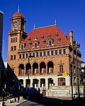
Main Street Station and Trainshed Main Street Station and Trainshed December 8, 1976 (#70000867 ) Richmond 37°31′58″N 77°25′45″W / 37.532861°N 77.429203°W / 37.532861; -77.429203 (Main Street Station and Trainshed ) Richmond (independent city)
Station is an example of Beaux-Arts influence, and the trainshed is one of the last gable-roofed trainsheds in America.
51
Marlbourne Marlbourne July 19, 1964 (#66000837 ) Richmond 37°39′15″N 77°13′21″W / 37.654203°N 77.222478°W / 37.654203; -77.222478 (Marlbourne ) Hanover
Property of Confederate secessionist Edmund Ruffin
52
General George C. Marshall House General George C. Marshall House June 19, 1996 (#96000972 ) Leesburg 39°06′51″N 77°33′36″W / 39.114178°N 77.559959°W / 39.114178; -77.559959 (General George C. Marshall House ) Loudoun
Last home of General George C. Marshall , who called it "Dodona Manor".
53
John Marshall House John Marshall House December 19, 1960 (#66000916 ) Richmond 37°32′27″N 77°25′59″W / 37.540892°N 77.433085°W / 37.540892; -77.433085 (John Marshall House ) Richmond (independent city)
Home of 4th Chief Justice John Marshall .
54
Cyrus McCormick Farm and Workshop Cyrus McCormick Farm and Workshop July 19, 1964 (#66000846 ) Steele's Tavern 37°56′02″N 79°13′04″W / 37.933889°N 79.217778°W / 37.933889; -79.217778 (Cyrus McCormick Farm and Workshop ) Rockbridge
Home of the inventor of mechanical reaper .
55
Gari Melchers Home Gari Melchers Home December 21, 1965 (#66000848 ) Falmouth 38°19′30″N 77°28′23″W / 38.325028°N 77.472917°W / 38.325028; -77.472917 (Gari Melchers Home ) Stafford
Residence and studio of painter Gari Melchers
56
Menokin Menokin November 11, 1971 (#69000276 ) Warsaw 38°00′25″N 76°48′04″W / 38.006944°N 76.801111°W / 38.006944; -76.801111 (Menokin ) Richmond
Home of Declaration of Independence signer Francis Lightfoot Lee .
57
Gen. William "Billy" Mitchell House Gen. William "Billy" Mitchell House December 8, 1976 (#76002112 ) Middleburg 38°57′40″N 77°44′44″W / 38.961111°N 77.745556°W / 38.961111; -77.745556 (Gen. William "Billy" Mitchell House ) Loudoun
Residence of General William "Billy" Mitchell , advocate of military air power.
58
James Monroe Law Office James Monroe Law Office November 13, 1966 (#66000917 ) Fredericksburg 38°18′09″N 77°27′42″W / 38.302539°N 77.461592°W / 38.302539; -77.461592 (James Monroe Law Office ) Fredericksburg (independent city)
James Monroe used this structure as a law office from 1786 to 1789. It is now a museum.
59
James Monroe Tomb James Monroe Tomb November 11, 1971 (#71001044 ) Richmond 37°31′59″N 77°27′20″W / 37.533154°N 77.455567°W / 37.533154; -77.455567 (James Monroe Tomb ) Richmond (independent city)
Tomb with "flamboyant and delicate tracery in cast iron" of President James Monroe
60
Monticello (Thomas Jefferson House) Monticello (Thomas Jefferson House) December 19, 1960 (#66000826 ) Charlottesville 38°00′30″N 78°27′12″W / 38.00833°N 78.4533°W / 38.00833; -78.4533 (Monticello (Thomas Jefferson House) ) Albemarle
Mansion of President Thomas Jefferson .
61
Montpelier (James Madison House) Montpelier (James Madison House) December 19, 1960 (#66000843 ) Orange 38°13′11″N 78°10′10″W / 38.219722°N 78.169444°W / 38.219722; -78.169444 (Montpelier (James Madison House) ) Orange
Residence of President James Madison .
62
Monument Avenue Historic District Monument Avenue Historic District December 9, 1997 (#70000883 ) Richmond 37°33′37″N 77°28′15″W / 37.560194°N 77.470847°W / 37.560194; -77.470847 (Monument Avenue Historic District ) Richmond (independent city)
Broad tree-lined avenue with several impressive memorials.
63
Monumental Church Monumental Church November 11, 1971 (#69000326 ) Richmond 37°32′13″N 77°25′48″W / 37.53699°N 77.430016°W / 37.53699; -77.430016 (Monumental Church ) Richmond (independent city)
Early Greek Revival church.
64
Robert Russa Moton High School Robert Russa Moton High School August 5, 1998 (#95001177 ) Farmville 37°17′28″N 78°23′52″W / 37.291111°N 78.397778°W / 37.291111; -78.397778 (Robert Russa Moton High School ) Prince Edward
Site of a 1951 student strike that led to court case striking down the practice of "separate but equal" schools; now a museum
65
Mount Airy Mount Airy October 9, 1960 (#66000845 ) Warsaw 37°58′20″N 76°47′29″W / 37.9722°N 76.79139°W / 37.9722; -76.79139 (Mount Airy ) Richmond
Stone plantation house. Burial place of Francis Lightfoot Lee .
66
Mount Vernon Mount Vernon December 19, 1960 (#66000833 ) 38°42′28″N 77°05′10″W / 38.7079°N 77.0861°W / 38.7079; -77.0861 (Mount Vernon ) Fairfax
Plantation home of President George Washington .
67
Natural Bridge Natural Bridge August 5, 1998 (#97001401 ) Natural Bridge 37°37′32″N 79°32′43″W / 37.625681°N 79.545173°W / 37.625681; -79.545173 (Natural Bridge ) Rockbridge
Natural rock arch, once owned by Thomas Jefferson .
68
New Kent School and George W. Watkins School New Kent School and George W. Watkins School August 7, 2001 (#01001046 ) New Kent and Quinton 37°31′56″N 77°08′29″W / 37.532222°N 77.141389°W / 37.532222; -77.141389 (New Kent School and George W. Watkins School ) New Kent
Pair of schools that represent the first wave of desegregation of southern schools in the decade after the 1954 Brown v. Board of Education Supreme Court decision. Focus of 1968 Green v. County School Board
69
Oak Hill (James Monroe house) Oak Hill (James Monroe house) December 19, 1960 (#66000842 ) Leesburg 38°59′51″N 77°37′13″W / 38.997458°N 77.620403°W / 38.997458; -77.620403 (Oak Hill (James Monroe house) ) Loudoun
Residence of President James Monroe
70
Oatlands Oatlands November 11, 1971 (#69000255 ) Leesburg 39°02′27″N 77°37′02″W / 39.040833°N 77.617222°W / 39.040833; -77.617222 (Oatlands ) Loudoun
Notable Federal-style mansion designed and built by George Carter.
71
Pear Valley Pear Valley March 11, 2013 (#69000266 ) Eastville 37°23′48″N 75°55′29″W / 37.396667°N 75.924722°W / 37.396667; -75.924722 (Pear Valley ) Northampton
An early 18th century Chesapeake cottage.
72
Pentagon Pentagon October 5, 1992 (#89000932 ) Arlington 38°52′16″N 77°03′21″W / 38.87099°N 77.05596°W / 38.87099; -77.05596 (Pentagon ) Arlington
Building is symbolic of national military power; a boundary increase was approved September 11, 2023 .
73
Petersburg Breakthrough Battlefield Petersburg Breakthrough Battlefield February 17, 2006 (#06000239 ) Petersburg 37°11′22″N 77°28′33″W / 37.189444°N 77.475833°W / 37.189444; -77.475833 (Petersburg Breakthrough Battlefield ) Dinwiddie
Site of Union breakthrough that collapsed Confederate General Lee's fortifications from Petersburg to Richmond, on April 2, 1865.
74
Pittsylvania County Courthouse Pittsylvania County Courthouse May 4, 1987 (#81000643 ) Chatham 36°49′35″N 79°23′54″W / 36.826398°N 79.39839°W / 36.826398; -79.39839 (Pittsylvania County Courthouse ) Pittsylvania
In 1878, Judge J.D. Coles was arrested for excluding African Americans citizens from serving as jurors, resulting in the Supreme Court case Ex Parte Virginia Equal Protection Clause of the United States Constitution to jury selection processes.
75
Pocahontas Exhibition Coal Mine Pocahontas Exhibition Coal Mine October 12, 1994 (#94001651 ) Pocahontas 37°18′29″N 81°20′59″W / 37.308056°N 81.349722°W / 37.308056; -81.349722 (Pocahontas Exhibition Coal Mine ) Tazewell
1882 mine in the Pocahontas coalfield .
76
Poplar Forest Poplar Forest November 11, 1971 (#69000223 ) Lynchburg 37°20′54″N 79°15′54″W / 37.34826°N 79.26495°W / 37.34826; -79.26495 (Poplar Forest ) Bedford
Thomas Jefferson built this structure as a country retreat.
77
Potomac (Potowmack)(Patowmack) Canal Historic District Potomac (Potowmack)(Patowmack) Canal Historic District December 17, 1982 (#79003038 ) Great Falls 38°59′47″N 77°15′11″W / 38.996389°N 77.253056°W / 38.996389; -77.253056 (Potomac (Potowmack)(Patowmack) Canal Historic District ) Fairfax
Remains of an impressively engineered canal built beside the falls of the Potomac.
78
Prestwould Prestwould July 31, 2003 (#03001033 ) Clarksville 36°39′19″N 78°34′14″W / 36.655278°N 78.570556°W / 36.655278; -78.570556 (Prestwould ) Mecklenburg
Most intact and best documented plantation surviving in Southside Virginia.
79
Quarters 1 (Fort Myer) Quarters 1 (Fort Myer) November 28, 1972 (#72001382 ) Arlington 38°52′58″N 77°04′53″W / 38.882778°N 77.081389°W / 38.882778; -77.081389 (Quarters 1 (Fort Myer) ) Arlington
Residence of all U.S. Army Chiefs of Staff since 1910
80
Peyton Randolph House Peyton Randolph House April 15, 1970 (#70000863 ) Williamsburg 37°16′13″N 76°42′00″W / 37.270184°N 76.700131°W / 37.270184; -76.700131 (Peyton Randolph House ) Williamsburg (independent city)
Home of Peyton Randolph , first President of the Continental Congress .
81
Virginia Randolph Cottage Virginia Randolph Cottage December 2, 1974 (#74002126 ) Glen Allen 37°39′40″N 77°28′56″W / 37.661124°N 77.482340°W / 37.661124; -77.482340 (Virginia Randolph Cottage ) Henrico
Commemorates notable Black teacher Virginia E. Randolph (1874-1958).
82
Rendezvous Docking Simulator Rendezvous Docking Simulator October 3, 1985 (#85002809 ) Hampton 37°05′02″N 76°22′41″W / 37.083828°N 76.378028°W / 37.083828; -76.378028 (Rendezvous Docking Simulator ) Hampton (independent city)
Trainer used by Gemini and Apollo program astronauts to practice rendezvous and docking techniques at Langley Research Center
83
Reynolds Homestead Reynolds Homestead December 22, 1977 (#71000987 ) Critz 36°38′32″N 80°08′55″W / 36.642298°N 80.148582°W / 36.642298; -80.148582 (Reynolds Homestead ) Patrick
Home of R. J. Reynolds , founder of the R. J. Reynolds Tobacco Company
84
Ripshin Farm Ripshin Farm November 11, 1971 (#71000979 ) Trout Dale 36°41′53″N 81°24′26″W / 36.698056°N 81.407222°W / 36.698056; -81.407222 (Ripshin Farm ) Grayson
Summer home of author Sherwood Anderson .
85
Rising Sun Tavern Rising Sun Tavern January 29, 1964 (#66000919 ) Fredericksburg 38°18′17″N 77°27′45″W / 38.304774°N 77.462402°W / 38.304774; -77.462402 (Rising Sun Tavern ) Fredericksburg (independent city)
Tavern built by Charles Washington , youngest brother of George Washington
86
Rotunda, University of Virginia Rotunda, University of Virginia December 21, 1965 (#66000937 ) Charlottesville 38°01′51″N 78°30′19″W / 38.030798°N 78.505222°W / 38.030798; -78.505222 (Rotunda, University of Virginia ) Albemarle County
Designed by Thomas Jefferson shortly before his death.
87
Sabine Hall Sabine Hall April 15, 1970 (#69000277 ) Tappahannock 37°56′24″N 76°47′05″W / 37.940085°N 76.784799°W / 37.940085; -76.784799 (Sabine Hall ) Richmond
Early Georgian two story brick mansion.
88
St. John's Episcopal Church (Richmond) St. John's Episcopal Church (Richmond) January 20, 1961 (#66000920 ) Richmond 37°31′46″N 77°25′11″W / 37.529539°N 77.419816°W / 37.529539; -77.419816 (St. John's Episcopal Church (Richmond) ) Richmond (independent city)
Patrick Henry delivered his "Liberty or Death" speech here.
89
Saint Luke's Church (Smithfield) Saint Luke's Church (Smithfield) October 9, 1960 (#66000838 ) Smithfield 36°56′17″N 76°35′11″W / 36.938092°N 76.586276°W / 36.938092; -76.586276 (Saint Luke's Church (Smithfield) ) Isle of Wight
English room church with Gothic details
90
St. Peter's Parish Church St. Peter's Parish Church March 2, 2012 (#69000263 ) New Kent 37°32′25″N 77°03′23″W / 37.5403°N 77.0563°W / 37.5403; -77.0563 (St. Peter's Parish Church ) New Kent
1703 Episcopal church may have been where George and Martha Washington were married
91
Saratoga Saratoga November 7, 1973 (#70000788 ) Boyce 39°05′00″N 78°03′36″W / 39.0832°N 78.0600°W / 39.0832; -78.0600 (Saratoga ) Clarke
Gray limestone Georgian house built by Brig. Gen. Daniel Morgan , best known for his victory over the British at the Battle of Cowpens in 1781.
92
Sayler's Creek Battlefield Sayler's Creek Battlefield February 4, 1985 (#85002436 ) Farmville 37°19′04″N 78°14′02″W / 37.3178°N 78.2339°W / 37.3178; -78.2339 (Sayler's Creek Battlefield ) Amelia and Prince Edward
Sites of Battle of Sayler's Creek on April 6, 1865, where 1/4 of Lee's army was cut off, three days before surrender at Appomattox
93
Scotchtown (Patrick Henry House) Scotchtown (Patrick Henry House) December 21, 1965 (#66000835 ) Ashland 37°50′40″N 77°35′05″W / 37.8444°N 77.5846°W / 37.8444; -77.5846 (Scotchtown (Patrick Henry House) ) Hanover
Plantation house of unusual size that was childhood home of Dolley Madison and later a home of Patrick Henry
94
James Semple House James Semple House April 15, 1970 (#70000864 ) Williamsburg 37°16′06″N 76°41′36″W / 37.2683°N 76.6933°W / 37.2683; -76.6933 (James Semple House ) Williamsburg (independent city)
House likely designed by Thomas Jefferson ; a relative of the Semples, President John Tyler resided here while attending school.
95
Shack Mountain Shack Mountain October 5, 1992 (#76002090 ) Charlottesville 38°05′32″N 78°30′04″W / 38.0922°N 78.5012°W / 38.0922; -78.5012 (Shack Mountain ) Albemarle
Home of Fiske Kimball , author of Thomas Jefferson, Architect
96
Shirley Shirley April 15, 1970 (#69000328 ) Hopewell 37°21′21″N 77°14′39″W / 37.3558°N 77.2442°W / 37.3558; -77.2442 (Shirley ) Charles City
Oldest plantation in Virginia.
97
Skyline Drive Historic District Skyline Drive Historic District October 6, 2008 (#97000375 ) Luray 38°43′34″N 78°19′08″W / 38.7261°N 78.3188°W / 38.7261; -78.3188 (Skyline Drive Historic District ) Albemarle
Road through the Shenandoah National Park
98
Spence's Point (John Roderigo Dos Passos House) Spence's Point (John Roderigo Dos Passos House) November 11, 1971 (#71000991 ) Westmoreland 38°04′46″N 76°33′26″W / 38.0794°N 76.5572°W / 38.0794; -76.5572 (Spence's Point (John Roderigo Dos Passos House) ) Westmoreland
Farm home of writer John Roderigo Dos Passos .
99
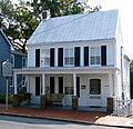
Stabler-Leadbeater Apothecary Shop Stabler-Leadbeater Apothecary Shop January 13, 2021 (#100006254 ) Alexandria 38°48′15″N 77°02′34″W / 38.8043°N 77.0428°W / 38.8043; -77.0428 (Stabler-Leadbeater Apothecary Shop ) Alexandria (independent city)
100
Stratford Hall Stratford Hall October 7, 1960 (#66000851 ) Lerty 38°08′59″N 76°50′23″W / 38.1498°N 76.8397°W / 38.1498; -76.8397 (Stratford Hall ) Westmoreland
Notable example of early Georgian architecture. Birthplace of Robert E Lee .
101
Thoroughgood House Thoroughgood House October 9, 1960 (#66000921 ) Virginia Beach 36°53′36″N 76°06′47″W / 36.8933°N 76.1131°W / 36.8933; -76.1131 (Thoroughgood House ) Virginia Beach (independent city)
One of the oldest brick houses in Virginia, built by Adam Thoroughgood's descendant .
102
Thunderbird Archeological District Thunderbird Archeological District May 5, 1977 (#77001495 ) Limeton Warren
Three archeological sites.
103
Tredegar Iron Works Tredegar Iron Works December 22, 1977 (#71001048 ) Richmond 37°32′08″N 77°26′43″W / 37.535556°N 77.445278°W / 37.535556; -77.445278 (Tredegar Iron Works ) Richmond (independent city)
One of the largest iron works from 1841 to 1865.
104
Tuckahoe Tuckahoe August 11, 1969 (#00000259 ) Manakin 37°34′14″N 77°39′11″W / 37.570472°N 77.653167°W / 37.570472; -77.653167 (Tuckahoe ) Goochland and Henrico
Tuckahoe, owned by the Randolph family , was the home of president Thomas Jefferson for 7 years during his boyhood.
105
John Tyler House John Tyler House July 4, 1961 (#66000922 ) Charles City 37°19′29″N 77°01′14″W / 37.324722°N 77.020556°W / 37.324722; -77.020556 (John Tyler House ) Charles City
Residence of President John Tyler .
106
University Of Virginia Historic District University Of Virginia Historic District November 11, 1971 (#70000865 ) Charlottesville 38°02′05″N 78°30′15″W / 38.034722°N 78.504167°W / 38.034722; -78.504167 (University Of Virginia Historic District ) Albemarle County
District includes Jefferson's original "academical village" and the Rotunda.
107
Variable Density Tunnel Variable Density Tunnel October 3, 1985 (#85002795 ) Hampton 37°04′37″N 76°20′39″W / 37.076826°N 76.344153°W / 37.076826; -76.344153 (Variable Density Tunnel ) Hampton (independent city)
Steel tank from a wind tunnel at Langley Research Center . (use source [1] )
108
Virginia Governor's Mansion Virginia Governor's Mansion June 7, 1988 (#69000360 ) Richmond 37°32′12″N 77°25′57″W / 37.536758°N 77.432498°W / 37.536758; -77.432498 (Virginia Governor's Mansion ) Richmond (independent city)
State Executive Mansion.
109
Virginia Military Institute Historic District Virginia Military Institute Historic District May 30, 1974 (#74002219 ) Lexington 37°47′25″N 79°26′09″W / 37.790278°N 79.435833°W / 37.790278; -79.435833 (Virginia Military Institute Historic District ) Lexington (independent city)
First state-supported military college.
110
Maggie Lena Walker House Maggie Lena Walker House May 15, 1975 (#75002100 ) Richmond 37°32′52″N 77°26′16″W / 37.547669°N 77.437699°W / 37.547669; -77.437699 (Maggie Lena Walker House ) Richmond (independent city)
Home of Maggie Lena Walker , first woman to establish an American bank; now a National Historic Site
111
Washington and Lee University Historic District Washington and Lee University Historic District November 11, 1971 (#71001047 ) Lexington 37°47′08″N 79°26′32″W / 37.785508°N 79.442113°W / 37.785508; -79.442113 (Washington and Lee University Historic District ) Lexington (independent city)
Neoclassical buildings that form one of the most dignified college campuses. Washington & Lee University
112
George Washington Boyhood Home Site George Washington Boyhood Home Site February 16, 2000 (#72001417 ) Fredericksburg 38°17′43″N 77°26′57″W / 38.295278°N 77.449167°W / 38.295278; -77.449167 (George Washington Boyhood Home Site ) Stafford
Known locally as Ferry Farm.
113
George Washington Masonic National Memorial George Washington Masonic National Memorial July 21, 2015 (#15000622 ) Alexandria 38°48′27″N 77°03′58″W / 38.80748°N 77.06598°W / 38.80748; -77.06598 (George Washington Masonic National Memorial ) Alexandria (independent city)
One of the largest private memorials to Washington, reflecting the Masonic involvement of many Founding Fathers
114
Waterford Historic District Waterford Historic District April 15, 1970 (#69000256 ) Waterford 39°11′12″N 77°36′36″W / 39.186667°N 77.61°W / 39.186667; -77.61 (Waterford Historic District ) Loudoun
Picturesque village, oldest settlement in Loudoun County
115
Westover Westover October 9, 1960 (#66000923 ) Charles City 37°19′58″N 77°10′23″W / 37.33278°N 77.17306°W / 37.33278; -77.17306 (Westover ) Charles City
Plantation that is ancestral seat of the Byrd family
116
White House of the Confederacy White House of the Confederacy December 19, 1960 (#66000924 ) Richmond 37°32′20″N 77°25′47″W / 37.538888°N 77.429738°W / 37.538888; -77.429738 (White House of the Confederacy ) Richmond (independent city)
Residence of Confederate President Jefferson Davis .
117
Wickham-Valentine House Wickham-Valentine House November 11, 1971 (#69000329 ) Richmond 37°32′30″N 77°25′52″W / 37.541695°N 77.431071°W / 37.541695; -77.431071 (Wickham-Valentine House ) Richmond (independent city)
One of Richmond's finest Federal residences.
118
Williamsburg Historic District Williamsburg Historic District October 9, 1960 (#66000925 ) Williamsburg 37°15′45″N 76°41′59″W / 37.2625°N 76.69972°W / 37.2625; -76.69972 (Williamsburg Historic District ) Williamsburg (independent city)
Capital of Virginia from 1699 to 1799.
119
Woodlawn Woodlawn August 6, 1998 (#70000792 ) Alexandria 38°43′00″N 77°08′10″W / 38.716667°N 77.136111°W / 38.716667; -77.136111 (Woodlawn ) Fairfax
Flagship property of the National Trust for Historic Preservation .
120
Woodrow Wilson Birthplace Woodrow Wilson Birthplace July 19, 1964 (#66000926 ) Staunton 38°08′55″N 79°04′09″W / 38.148473°N 79.069136°W / 38.148473; -79.069136 (Woodrow Wilson Birthplace ) Staunton (independent city)
Birthplace of President Thomas Woodrow Wilson , now his presidential library
121
Wren Building, College of William and Mary Wren Building, College of William and Mary October 9, 1960 (#66000929 ) Williamsburg 37°16′08″N 76°42′33″W / 37.268973°N 76.709126°W / 37.268973; -76.709126 (Wren Building, College of William and Mary ) Williamsburg (independent city)
Wren Building at the College of William and Mary .
122
Wythe House Wythe House April 15, 1970 (#70000866 ) Williamsburg 37°16′12″N 76°42′12″W / 37.269958°N 76.703284°W / 37.269958; -76.703284 (Wythe House ) Williamsburg (independent city)
One of Virginia's finest Georgian brick townhouse and home of George Wythe .
123
Yeocomico Church Yeocomico Church April 15, 1970 (#69000331 ) Tucker Hill 38°03′44″N 76°35′50″W / 38.062361°N 76.597139°W / 38.062361; -76.597139 (Yeocomico Church ) Westmoreland
Significant example of transitional Colonial architecture.


