Linosa
 Aerial view of Linosa | |
 | |
| Geography | |
|---|---|
| Location | Mediterranean Sea |
| Coordinates | 35°52′N 12°52′E / 35.867°N 12.867°E |
| Archipelago | Pelagie Islands |
| Area | 5.4 km2 (2.1 sq mi) |
| Administration | |
Italy | |
| Region | Sicily |
| Province | Agrigento |
| Comune | Lampedusa e Linosa |
| Demographics | |
| Population | 430 |
Linosa (Italian pronunciation: [liˈnoːza];[1] Sicilian: Linusa [lɪˈnuːsa]; Arabic: نموشة, Nammūša) is one of the Pelagie Islands in the Sicily Channel of the Mediterranean Sea.
The island is a part of the Italian comune of Lampedusa e Linosa, part of the province of Agrigento in Sicily, Italy. It has a population of 430.
Name
[edit]The island is cited first as Greek Aethusa (Αἰθοῦσσα) by ancient geographers Strabo and Ptolemy, and as Algusa (Ἀλγοῦσσα) by Roman essayist Pliny the Elder in his Naturalis Historia. Aethusa is Greek for "the sacrifices" (αἱ θυσίαί), probably referring to the twin volcanic peaks. The name "Lenusa" appeared first during the 16th century in the writing of Tommaso Fazello, while the modern one dates back to 1845.
Geography
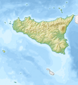
[edit]The island has an area of 5.45 square kilometres (2.10 sq mi) and is of volcanic origin. It is formed by a series of craters of which Monte Vulcano, 195 metres (640 feet) high, is the most important. The closest land to Linosa is the island of Lampedusa, which lies 43 km (27 mi) to the south. Linosa is situated 119 kilometres (74 miles) west of Gozo, Malta, 121 km (75 miles) southeast of Pantelleria, 163 km (101 mi) south of Sicily and 165 km (103 mi) east of Cape Mahida in Tunisia.
History
[edit]
During the Punic Wars it was used by the Romans as a base; the 150 water cisterns remaining are from this period. Roman domination was followed by Saracen, Norman, Angevin and Aragonese control. During the Napoleonic Wars, the British considered the possibility of taking over Linosa (together with Pantelleria and Lampedusa) so as to be able to supply Malta, but a Royal Commission stated in an 1812 report that there would be considerable difficulties in this venture.[2]
The island remained deserted until 1843 when Ferdinand II of the Two Sicilies ordered Knight Bernardo Maria Sanvinsente, captain of frigate, to colonize the island. The first thirty colonists (artisans from Ustica, Agrigento and Pantelleria) with the addition of a mayor, a priest and a doctor, landed on 25 April 1845.
During World War II, a small Italian garrison surrendered[3] to a British force from HMS Nubian on the morning of 13 June 1943.
Few were interested in the island during the Kingdom of Italy and only in the 1970s did the island begin to change, with technological innovations and the development of tourism. The first telephone exchange was installed in 1963, the first power station in 1967, and a new school with a nursery in 1968. In 1983 the building of a desalinization plant provided a constant supply of potable water.
Economy
[edit]
Linosa's population subsists on agriculture and tourism. As of 2018, there are no airports, hotels or banks on the island.[4]
See also
[edit]References
[edit]- ^ Luciano Canepari. "Linosa". DiPI Online (in Italian). Retrieved 15 January 2020.
- ^ Ganado, Albert (10 November 2013). "Lampedusa's strong and long-standing relationships with Malta". Times of Malta. Archived from the original on 21 September 2017.
- ^ "Battle of Pantelleria and Pelagie Islands". WW2DB. Retrieved 26 November 2024.
- ^ "On tiny Linosa, it's easy to adopt island's relaxed rhythms". Associated Press. 3 October 2018. Retrieved 3 May 2023.
External links
[edit]- "Linosa". Global Volcanism Program. Smithsonian Institution. Retrieved 25 June 2021.
- Island statistics


