Linghai
Linghai
凌海市 | |
|---|---|
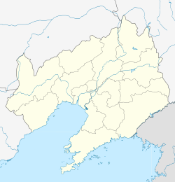
 Location of the city | |
| Coordinates: 41°10′N 121°21′E / 41.167°N 121.350°E | |
| Country | People's Republic of China |
| Province | Liaoning |
| Prefecture-level city | Jinzhou |
| City seat | Dalinghe Subdistrict |
| Area | |
| 2,585.5 km2 (998.3 sq mi) | |
| • Urban | 136.74 km2 (52.80 sq mi) |
| Elevation | 19 m (64 ft) |
| Population (2017)[1] | |
| 532,000 | |
| • Density | 210/km2 (530/sq mi) |
| • Urban | 137,300 |
| Time zone | UTC+8 (China Standard) |
| Postal code | 121200 |
Linghai (Chinese: 凌海; pinyin: Línghǎi) is a county-level city in the west of Liaoning province, Northeast China. It was called Jinxian or Jin County (Chinese: 锦县) until 1993, when it was reorganized into a county-level city and renamed Linghai. With its urban core lying on the west (right) bank of the Daling River, which flows into Liaodong Bay near the city, it is under the administration of the prefecture-level city of Jinzhou, the seat of which is 21 kilometres (13 mi) to the southwest.
Administrative divisions
[edit]There are three subdistricts, 11 towns, seven townships, and one ethnic township under the city's administration.[2]
Subdistricts:
- Dalinghe Subdistrict (大凌河街道), Jincheng Subdistrict (金城街道)
Towns:
- Shishan (石山镇), Yuji (余积镇), Shuangyang (双羊镇), Banjita (班吉塔镇), Shenjiatai (沈家台镇), Santaizi (三台子镇), Youwei Manchu Town (右卫满族镇), Yanjia (闫家镇), Xinzhuangzi (新庄子镇), Niangniangguan (娘娘宫镇), Cuiyan (翠岩镇)
Townships:
- Daye Township (大业乡), Xibaqian Township (西八千乡), Jianye Township (建业乡), Wendilou Manchu Ethnic Township (温滴楼满族乡), Baitaizi Township (白台子乡), Xietun Township (谢屯乡), Antun Township (安屯乡), Banshigou Township (板石沟乡)
Others:
- Dayou Farm (大有农场)
Climate
[edit]| Climate data for Linghai (1991–2020 normals) | |||||||||||||
|---|---|---|---|---|---|---|---|---|---|---|---|---|---|
| Month | Jan | Feb | Mar | Apr | May | Jun | Jul | Aug | Sep | Oct | Nov | Dec | Year |
| Mean daily maximum °C (°F) | −2.7 (27.1) |
1.3 (34.3) |
8.0 (46.4) |
16.2 (61.2) |
23.0 (73.4) |
26.3 (79.3) |
28.5 (83.3) |
28.4 (83.1) |
24.8 (76.6) |
17.1 (62.8) |
6.9 (44.4) |
−0.6 (30.9) |
14.8 (58.6) |
| Daily mean °C (°F) | −8.0 (17.6) |
−4.2 (24.4) |
2.3 (36.1) |
10.4 (50.7) |
17.3 (63.1) |
21.5 (70.7) |
24.5 (76.1) |
24.0 (75.2) |
19.1 (66.4) |
11.4 (52.5) |
1.8 (35.2) |
−5.6 (21.9) |
9.5 (49.2) |
| Mean daily minimum °C (°F) | −12.3 (9.9) |
−8.6 (16.5) |
−2.3 (27.9) |
5.4 (41.7) |
12.3 (54.1) |
17.4 (63.3) |
21.2 (70.2) |
20.3 (68.5) |
14.3 (57.7) |
6.5 (43.7) |
−2.6 (27.3) |
−9.8 (14.4) |
5.2 (41.3) |
| Average precipitation mm (inches) | 3.0 (0.12) |
3.9 (0.15) |
9.0 (0.35) |
26.3 (1.04) |
48.9 (1.93) |
90.7 (3.57) |
146 (5.7) |
151.5 (5.96) |
39.9 (1.57) |
33.5 (1.32) |
16.0 (0.63) |
3.9 (0.15) |
572.6 (22.49) |
| Average precipitation days (≥ 0.1 mm) | 1.9 | 2.2 | 2.8 | 4.9 | 7.4 | 11.2 | 10.7 | 9.2 | 6.0 | 5.1 | 3.7 | 1.9 | 67 |
| Average snowy days | 2.9 | 2.7 | 2.5 | 0.9 | 0 | 0 | 0 | 0 | 0 | 0.3 | 2.7 | 3.0 | 15 |
| Average relative humidity (%) | 50 | 50 | 48 | 50 | 56 | 71 | 81 | 80 | 68 | 59 | 54 | 52 | 60 |
| Mean monthly sunshine hours | 207.2 | 209.2 | 251.2 | 251.1 | 276.7 | 235.4 | 209.4 | 230.4 | 240.6 | 226.9 | 192.3 | 192.5 | 2,722.9 |
| Percent possible sunshine | 70 | 69 | 67 | 63 | 62 | 52 | 46 | 54 | 65 | 67 | 66 | 68 | 62 |
| Source: China Meteorological Administration[3][4] | |||||||||||||
Transportation
[edit]Railway
[edit]Linghai is served by Linghai South railway station, an infill station on the Qinhuangdao–Shenyang passenger railway and the southern terminus of the Chaoyang–Linghai high-speed railway.
Airport
[edit]Jinzhou Bay Airport is located here.
References
[edit]- ^ a b Ministry of Housing and Urban-Rural Development, ed. (2019). China Urban Construction Statistical Yearbook 2017. Beijing: China Statistics Press. p. 50. Retrieved 11 January 2020.
- ^ 锦州市
- ^ 中国气象数据网 – WeatherBk Data (in Simplified Chinese). China Meteorological Administration. Retrieved 5 October 2023.
- ^ 中国气象数据网 (in Simplified Chinese). China Meteorological Administration. Retrieved 5 October 2023.
External links
[edit]

