Kuakata
Kuakata
কুয়াকাটা | |
|---|---|
|
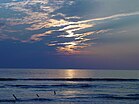
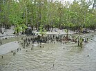
Bay of Bengal, Kuakata beach and Sundarbans Mangrove Forest | |
| Nickname: Daughter of Sea (সাগরকন্যা) | |
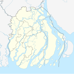
| Coordinates: 21°49′16″N 90°07′11″E / 21.82111°N 90.11972°E | |
| Country | Bangladesh |
| Division | Barisal Division |
| District | Patuakhali District |
| Upazila | Kalapara |
| Time zone | UTC+6 (BST) |
Kuakata (Bengali: কুয়াকাটা) is a town of Patuakhali located in southern Bangladesh known for its panoramic sea beach.[1][2] Kuakata beach is a sandy expanse 18 kilometres (11 mi) long and 3 kilometres (1.9 mi) wide.[3] From the beach one can have an unobstructed view of both sunrise and sunset over the Bay of Bengal.[1]
Etymology
[edit]The name Kuakata originated from the word 'kua' — the Bengali word for "well" which was dug on the seashore by the early Rakhine settlers (Burmese tribes) in quest of collecting drinking water.[4] They landed on the Kuakata coast in the 18th century after being expelled from Arakan (Myanmar) by the Burmese extremists.[5] Afterwards, it has become a tradition of digging wells in the neighbourhoods of Rakhaine tribes for water.
Geography
[edit]Kuakata is situated in Kalapara Upazila, Patuakhali District.[6] It is about 320 kilometres (200 mi) south of Dhaka, the capital, and about 70 kilometres (43 mi) from the district headquarters.[1]
Demographics
[edit]According to the 2011 Bangladesh census, Kuakata had 2,065 households and a population of 9,077.[7]
Culture
[edit]Kuakata is a place of pilgrimage for Hindu and Buddhist communities. Innumerable devotees arrive here at the festivals of 'Rush Purnima' and 'Maghi Purnima'. On these occasions the pilgrims take holy baths at the bay and participate in the traditional fairs.[1] One may visit a 100-year-old Buddhist temple where the statue of Goutama Buddha and two 200-year-old wells are located.
Tourism
[edit]The town Kuakata has sea beach named Kuakata Beach. Many tourists visit the place to see the beach although it hasn’t international recognition like Cox's Bazar Beach but it is popular in Bangladesh. There are many places tourist visit such as:
- Kuakata National Park
- Kuakata Ecopark
- Forest of Fatra: The protected mangrove forest on the western side of the beach is known as the 'second Sundarban'
- Well of Kuakata: At the beginning of Rakhine village Keranipara near Kuakata Beach is an ancient well near a Buddhist monastery.
- Shima Buddhist Monastery: In front of the ancient well is the ancient Seema Buddhist Vihara, which contains a meditating Buddha image made of Ashta dhatu weighing about thirty-seven maunds.
- Rakhaine settlement of Keranipara: Keranipara, the village of the Rakhine tribesmen, begins in front of Seema Buddhist Vihar;
- Alipur Port: About four kilometers north of Kuakata is Alipur Mohipur, one of the largest fishing centers in the southern region;
- Mishripara Buddhist Monastery: About eight kilometers east of Kuakata beach, Misripara, home to Rakhine tribes, has a Buddhist monastery that houses the largest Buddhist statue in the subcontinent.
- Forest of Gangamati: Gangamati or Ghazmati forest along the Gangamati canal east of Kuakata beach.
Gallery
[edit]-
Kuakata Beach
-
Beach
-
Mangrove forest
-
Kuakata at early morning
-
Kuakata Beach
-
Kuakata Sea Beach
-
A horseman roaming on Kuakata beach
-
Buddha statue of Srimangal Buddha Vihar in Kuakata
See also
[edit]- List of cities and towns in Bangladesh
- Cox's Bazar – a tourist beach town in southeastern Bangladesh
- Patenga – a tourist beach in the city of Chittagong
References
[edit]- ^ a b c d "Tourist Attractions in Bangladesh". Bangladesh Parjatan Corporation. Archived from the original on 19 July 2011.
- ^ "List of Bangladeshi Villages". Travel Tips. USA Today. Retrieved 4 April 2015.
- ^ Kabir, Ekramul (2012). "Kalapara Upazila". In Islam, Sirajul; Jamal, Ahmed A. (eds.). Banglapedia: National Encyclopedia of Bangladesh (Second ed.). Asiatic Society of Bangladesh.
- ^ Aouwal, Abdul (2016). "Kuakata National Park of Bangladesh". Ontaheen. Archived from the original on 12 August 2016. Retrieved 26 June 2016.
- ^ Majida, Mustapha (2005). The Rakhaines: Aborigines in Bangladesh. Dhaka: Mowla Brothers. ISBN 978-9844104662.
- ^ "NGA GeoName Database". National Geospatial-Intelligence Agency. Retrieved 9 January 2016.
- ^ "Population Census 2011: Patuakhali Table C-01" (PDF). Bangladesh Bureau of Statistics. Archived from the original (PDF) on 13 November 2014. Retrieved 11 July 2014.
External links
[edit]- কুয়াকাটা সমুদ্র সৈকত [Kuakata beach]. Kalapara Upazila (in Bengali). Archived from the original on 8 June 2016.
- Kuakata Travel Guide


