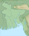
Kuakata National Park
Appearance
| Kuakata National Park | |
|---|---|
 | |
 | |
| Location | Patuakhali, Bangladesh |
| Coordinates | 21°51′14″N 90°05′27″E / 21.853960°N 90.090764°E |
| Area | 1613 hectares |
| Established | 24 October 2010 |
Kuakata National Park (Bengali: কুয়াকাটা জাতীয় উদ্যান) is IUCN Category II national park and nature reserve in Bangladesh.[1] The park is located at Kalapara Upazila under Patuakhali District.[1] It has been declared as one of the safe zones for vultures as per the Vulture Safe Zone-2 Schedule of the government of Bangladesh.[2]
The park was officially declared as a national park by the government of Bangladesh on 24 October 2010 for the purpose of conservation of flora, fauna, nature and development of tourism facilities.[1][3] It covers an area of 1613 hectares.[3]
References
[edit]- ^ a b c "National Parks". bforest.gov.bd. Retrieved 8 June 2020.
- ^ "Vulture Safe Zone". bforest.gov.bd. Retrieved 10 June 2020.
- ^ a b "Biodievsrity Flora_NCS" (PDF). bforest.portal.gov.bd. Retrieved 8 June 2020.
Wikimedia Commons has media related to Kuakata National Park.

