Klučov (Kolín District)
Klučov | |
|---|---|
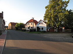
 Centre of Klučov | |
| Coordinates: 50°5′42″N 14°54′36″E / 50.09500°N 14.91000°E | |
| Country | |
| Region | Central Bohemian |
| District | Kolín |
| First mentioned | 1250 |
| Area | |
| • Total | 14.44 km2 (5.58 sq mi) |
| Elevation | 207 m (679 ft) |
| Population (2024-01-01)[1] | |
| • Total | 1,116 |
| • Density | 77/km2 (200/sq mi) |
| Time zone | UTC+1 (CET) |
| • Summer (DST) | UTC+2 (CEST) |
| Postal code | 282 01 |
| Website | www |
Klučov is a municipality and village in Kolín District in the Central Bohemian Region of the Czech Republic. It has about 1,100 inhabitants.
Administrative parts
[edit]The villages of Lstiboř, Skramníky and Žhery are administrative parts of Klučov.
Geography
[edit]Klučov is located about 21 kilometres (13 mi) northwest of Kolín and 27 km (17 mi) east of Prague. It lies in a flat agricultural landscape of the Central Elbe Table. The highest point is at 252 m (827 ft) above sea level. The Šembera River flows through the municipality.
History
[edit]The first written mention of Klučov is from 1250. Until 1418, the village was owned by a local noble family that called themselves Lords of Klučov. In the following decades, Klučov was property of various lower noblemen. Shortly after 1534, Klučov was annexed to the Kostelec estate.[2]
Demographics
[edit]
|
|
| ||||||||||||||||||||||||||||||||||||||||||||||||||||||
| Source: Censuses[3][4] | ||||||||||||||||||||||||||||||||||||||||||||||||||||||||
Transport
[edit]Klučov is located on the railway line Prague–Kolín.[5]
Sights
[edit]
The Church of the Assumption of the Virgin Mary is located in Lstiboř. It was originally a Gothic church from the mid-14th century. In 1747–1752, it was rebuilt in the Baroque style, but retained the Gothic core.[6]
The Church of the Beheading of Saint John the Baptist is located in Skramníky. It was also built in the Gothic style in the mid-14th century. Next to the church is a Baroque rectory.[7]
References
[edit]- ^ "Population of Municipalities – 1 January 2024". Czech Statistical Office. 2024-05-17.
- ^ "Historie Klučova" (in Czech). Obec Klučov. Retrieved 2024-05-28.
- ^ "Historický lexikon obcí České republiky 1869–2011" (in Czech). Czech Statistical Office. 2015-12-21.
- ^ "Population Census 2021: Population by sex". Public Database. Czech Statistical Office. 2021-03-27.
- ^ "Detail stanice Klučov" (in Czech). České dráhy. Retrieved 2024-05-28.
- ^ "Kostel Nanebevzetí Panny Marie s farou" (in Czech). National Heritage Institute. Retrieved 2024-05-28.
- ^ "Kostel Stětí sv. Jana Křtitele s farou" (in Czech). National Heritage Institute. Retrieved 2024-05-28.
External links
[edit]

