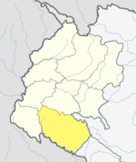
Khailad
Appearance
Khailad
खैलार | |
|---|---|
| Coordinates: 28°33′N 80°56′E / 28.55°N 80.94°E | |
| Country | |
| Zone | Seti Zone |
| District | Kailali District |
| Population (1991) | |
• Total | 5,734 |
| Time zone | UTC+5:45 (Nepal Time) |
Khailad is a village development committee in Kailali District But now it is combine with Bhajani Municipality in the Seti Zone of western Nepal. At the time of the 1991 Nepal census it had a population of 5734 living in 610 individual households.[1]
References
[edit]- ^ "Nepal Census 2001", Nepal's Village Development Committees, Digital Himalaya, archived from the original on 12 October 2008, retrieved 15 November 2009.
External links
[edit]


