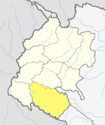
Janaki Rural Municipality (Kailali District)
Janaki Rural Municipality
जानकी गाउँपालिका | |
|---|---|
| Coordinates: 28°33′35″N 81°06′27″E / 28.559795°N 81.107626°E | |
| Country | |
| Province | Sudurpashchim |
| District | Kailali |
| No. of wards | 9 |
| Established | 10 March 2017 |
| Incorporated (VDC) | Janakinagar, Pathraiya, Durgauli, and Munuwa |
| Government | |
| • Chairperson | Ganesh Chaudhary (NUP) |
| • Vice-chairperson | Lalmati Devi Kathriya (NC) |
| Area | |
• Total | 107.27 km2 (41.42 sq mi) |
| Population (2011) | |
• Total | 48,540 |
| • Density | 450/km2 (1,200/sq mi) |
| Time zone | UTC+5:45 (Nepal Standard Time) |
| Headquarter | Durgauli |
| Website | Official Website |
Janaki is a rural municipality in Kailali District located in Sudurpashchim Province of Nepal.
The rural municipality was established In 2017 while the Nepalese government restructured 753 new local level units cancelling the old thousands of local level units. The rural municipality was created merging the then four following VDCs: Janakinagar, Pathraiya, Durgauli, and Munuwa.[1][2][3][4] Total area of this rural municipality is 107.27 square kilometres (41.42 sq mi) and it is divided into 9 wards. 48,540 individuals lived here according to the 2011 Nepal census.[2][5]
Demographics
[edit]At the time of the 2011 Nepal census, Janaki Rural Municipality had a population of 48,540. Of these, 60.1% spoke Tharu, 21.6% Nepali, 11.4% Achhami, 3.9% Doteli, 1.0% Dailekhi, 0.6% Urdu, 0.4% Magar, 0.4% Maithili, 0.2% Jumli, 0.1% Awadhi, 0.1% Bajureli, 0.1% Hindi and 0.1% other languages as their first language.[6]
In terms of ethnicity/caste, 60.4% were Tharu, 10.1% Hill Brahmin, 9.8% Chhetri, 8.4% Kami, 3.1% Thakuri, 1.8% Damai/Dholi, 1.7% Magar, 1.3% Lohar, 0.8% Sanyasi/Dasnami, 0.7% Musalman, 0.7% Sarki, 0.3% other Dalit, 0.2% Badi, 0.1% Bengali, 0.1% Gurung, 0.1% Kumal, 0.1% Newar, 0.1% Teli, 0.1% other Terai and 0.2% others.[7]
In terms of religion, 95.3% were Hindu, 2.5% Christian, 1.4% Buddhist, 0.7% Muslim and 0.1% others.[8]
In terms of literacy, 64.7% could read and write, 2.0% could only read and 33.2% could neither read nor write.[9]
References
[edit]- ^ "District Corrected Last for RAJAPATRA" (PDF). www.mofald.gov.np. Retrieved 17 July 2018.
- ^ a b "स्थानीय तहहरुको विवरण" [Details of the local level bodies]. www.mofald.gov.np/en (in Nepali). Ministry of Federal Affairs and Local Development. Retrieved 17 July 2018.
- ^ "New local level structure comes into effect from today". www.thehimalayantimes.com. The Himalayan Times. 10 March 2017. Retrieved 17 July 2018.
- ^ "New local level units come into existence". www.kathmandupost.ekantipur.com. 11 March 2017. Retrieved 18 July 2018.
- ^ "राष्ट्रिय जनगणना २०७८ प्रारम्भिक नतिजा". www.cbs.gov.np. Central Bureau of Statics, Nepal. 26 January 2022. Archived from the original on 26 January 2022. Retrieved 29 May 2022.
- ^ NepalMap Language [1]
- ^ NepalMap Caste [2]
- ^ NepalMap Religion [3]
- ^ NepalMap Literacy [4]


