Jardim, Mato Grosso do Sul
Appearance
Município de Jardim | |
|---|---|
| Nickname: A Capital do Sudoeste | |
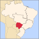
 Location in Brazil | |
| Country | |
| Region | Center-West |
| State | Mato Grosso do Sul |
| Founded | 1945 |
| Government | |
| • Mayor | Carlos Américo Grubert (PSDB) |
| Area | |
| 2,201.73 km2 (850.09 sq mi) | |
| Elevation | 259 m (850 ft) |
| Population (2020 [1]) | |
| 26,238 | |
| • Density | 10.58/km2 (27.4/sq mi) |
| • Urban | 87% |
| Time zone | UTC−4 (AMT) |
| HDI (2000) | 0.774 – medium |
| Website | Jardim, MS |
Jardim is a municipality located in the Brazilian state of Mato Grosso do Sul. Its population was 26,238 (2020) and its area is 2,202 km².
The municipality holds the Buraco das Araras Private Natural Heritage Reserve, whose main feature is the huge sinkhole named the Buraco das Araras.[2]
References
[edit]- ^ IBGE 2020
- ^ Buraco das Araras (in Portuguese), Buraco das Araras, archived from the original on 2016-05-06, retrieved 2016-05-09


