Jaraguari
Jaraguari | |
|---|---|
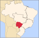
 Location in Mato Grosso do Sul state | |
| Coordinates: 20°08′31″S 54°23′56″W / 20.14194°S 54.39889°W | |
| Country | Brazil |
| Region | Central-West |
| State | Mato Grosso do Sul |
| Area | |
| • Total | 2,913 km2 (1,125 sq mi) |
| Population (2021[1]) | |
| • Total | 7,342 |
| • Density | 2.5/km2 (6.5/sq mi) |
| Time zone | UTC−4 (AMT) |
Jaraguari is a municipality located in the Brazilian state of Mato Grosso do Sul. Its population was 7,342 (2021) and its area is 2,913 km².
History
[edit]It was first settled by Brazilians in 1875 when Porfirio Alberto de Freitas, his wife, and his brother in-law settled into Jaraguari Velho (then called Fazenda Estiva). In January 1909, José Thomaz Barbosa would draw up the borders of the municipality. Later, de Freitas ordered the construction of a church. It was only completed in 1923. It had been named Senhor Divino Espírito Santo, and was destroyed in 1930. After that, Japanese settlers arrived and created a separate community. In 1953, Jaraguari was made a municipality. The name was derived from Araguari, the old hometown of de Freitas. A J was added because Jaragua means grass in Brazilian Portuguese.[2]
Deforestation
[edit]Jaraguari is largely covered by forests, but has suffered 1.5% forest lost in the past 20 years, with much of this picking up pace in the 2010s.[3]
References
[edit]- ^ IBGE 2021
- ^ "DADOS HISTÓRICOS DO MUNICÍPIO". Jaraguari Prefeiturea. Retrieved 17 October 2021.
- ^ "Jaraguari, Mato Grosso Do Sul, Brazil Deforestation Rates & Statistics". Global Forest Watch. Retrieved 17 October 2021.


