It Wytfean
Appearance
It Wytfean
Witveen | |
|---|---|
Hamlet | |
 | |
| Coordinates: 53°10′6″N 6°6′5″E / 53.16833°N 6.10139°E | |
| Country | |
| Province | |
| Municipality | |
| Postal code | 9261[1] |
| Dialing code | 0511[1] |
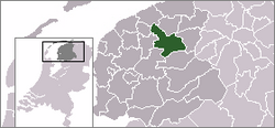
It Wytfean (Dutch: Witveen) is a hamlet in Tytsjerksteradiel in the province of Friesland, the Netherlands.[2] It Wytfean has a Mennonite Church, and was a separate parish up to 1838 when it merged with Rottevalle.[3]
It Wytfean is not a statistical entity,[4] and the postal authorities have placed it under Eastermar.[1] It Wytfean has place name signs.[5]
The hamlet was first mentioned in 1543 as opt Witte feenen, and means "white moorland". It started as a peat colony in 1620 by Swiss Mennonite refugees.[6] It Wytfean was home to 240 people in 1840. Nowadays, it consists of about 35 houses.[5]
References
[edit]- ^ a b c "Postcode 9261 in Eastermar". Postcode bij adres (in Dutch). Retrieved 4 April 2022.
- ^ "It Wytfean - (geografische naam)". Etymologiebank.nl (in Dutch). Retrieved 23 June 2020.
- ^ "Rottevalle-Witveen". Doopgezind Rottevalle (in Dutch). Retrieved 23 June 2020.
- ^ "Kerncijfers wijken en buurten 2021". Central Bureau of Statistics. Retrieved 4 April 2022.
not found
- ^ a b "It Wytfean". Plaatsengids (in Dutch). Retrieved 4 April 2022.
- ^ "It Wytfean - (geografische naam)". Etymologiebank (in Dutch). Retrieved 4 April 2022.
Wikimedia Commons has media related to It Wytfean.


