Hoseynabad-e Jonubi Rural District
Appearance
Hoseynabad-e Jonubi Rural District
Persian: دهستان حسين آباد جنوبي | |
|---|---|
| Coordinates: 35°33′26″N 47°06′20″E / 35.55722°N 47.10556°E[1] | |
| Country | Iran |
| Province | Kurdistan |
| County | Sanandaj |
| District | Hoseynabad |
| Capital | Hoseynabad |
| Population (2016)[2] | |
| • Total | 6,579 |
| Time zone | UTC+3:30 (IRST) |
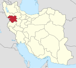
Hoseynabad-e Jonubi Rural District (Persian: دهستان حسين آباد جنوبي)[3] is in Hoseynabad District of Sanandaj County, Kurdistan province, Iran.[4] It is administered from the city of Hoseynabad.[5]
Demographics
[edit]Population
[edit]At the time of the 2006 National Census, the rural district's population (as a part of the Central District) was 7,467 in 1,763 households.[6] There were 6,787 inhabitants in 1,780 households at the following census of 2011.[7] The 2016 census measured the population of the rural district as 6,579 in 1,842 households, by which time the rural district had been separated from the district in the establishment of Hoseynabad District.[4] The most populous of its 27 villages was Hoseynabad (now a city),[8] with 1,594 people.[2]
See also
[edit]References
[edit]- ^ OpenStreetMap contributors (20 August 2023). "Hoseynabad-e Jonubi Rural District (Sanandaj County)" (Map). OpenStreetMap (in Persian). Retrieved 20 August 2023.
- ^ a b "Census of the Islamic Republic of Iran, 1395 (2016)". AMAR (in Persian). The Statistical Center of Iran. p. 12. Archived from the original (Excel) on 8 May 2022. Retrieved 19 December 2022.
- ^ Iranian National Committee for Standardization of Geographical Names website (in Persian)
- ^ a b "With some changes in the geography of four provinces: Three new cities were added to the map of the country's divisions". DOLAT (in Persian). Ministry of Interior, Political and Defense Commission. 6 October 2011. Archived from the original on 12 April 2018. Retrieved 15 November 2023.
- ^ "Creation and formation of 21 rural districts including villages, farms and places in Sanandaj County under Kurdistan province". Islamic Parliament Research Center (in Persian). Ministry of Interior, Council of Ministers. 18 May 1366. Archived from the original on 10 May 2015. Retrieved 23 January 2024.
- ^ "Census of the Islamic Republic of Iran, 1385 (2006)". AMAR (in Persian). The Statistical Center of Iran. p. 12. Archived from the original (Excel) on 20 September 2011. Retrieved 25 September 2022.
- ^ "Census of the Islamic Republic of Iran, 1390 (2011)". Syracuse University (in Persian). The Statistical Center of Iran. p. 12. Archived from the original (Excel) on 19 January 2023. Retrieved 19 December 2022.
- ^ Fazli, Abdolreza Rahmani (21 September 2017). "Notification of the resolution of the Ministry of Interior regarding the conversion of Hoseynabad village, the center of Hoseynabad District, Sanandaj County, to a city". DOTIC (in Persian). Ministry of Interior. Archived from the original on 19 August 2023. Retrieved 19 August 2023.


