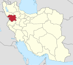
Hasanabad, Sanandaj
Hasanabad
Persian: كرجو | |
|---|---|
Neighborhood | |
| Coordinates: 35°15′27″N 46°58′06″E / 35.25750°N 46.96833°E[1] | |
| Country | Iran |
| Province | Kurdistan |
| County | Sanandaj |
| District | Central |
| City | Sanandaj |
| Population (2006)[2] | |
| • Total | 7,292 |
| Time zone | UTC+3:30 (IRST) |
Hasanabad (Persian: حسن آباد)[a] was a village in, and the former capital of, Abidar Rural District of the Central District of Sanandaj County, Kurdistan province, Iran.[4] The capital of the rural district has been transferred to the village of Kilaneh.[5]
The village of Hasanabad has been absorbed by the city of Sanandaj as a neighborhood referred to as District 3.[citation needed]
History
[edit]In 746 AH, "Amir Hasan Khan Ardalan" built a strong fort for the center of his government on the top of a mountain in the south of the village. At the beginning of the 10th century AH, Helu Khan Ardalan, the then governor of Kurdistan, made it the seat of government. Probably, before the establishment of the city of Sane Dej (Sanandaj), Abadii and Hassanabad Castle were the capital of Kurdistan Province, and from 1046 AH after the destruction of Hassanabad Castle, Sanandaj became the center of Kurdistan Province. The remains of Hassan Abad Castle facilities are still in place.
Hassanabad Castle is one of the difficult and strategic hills of the region, which has a relatively steep slope on the mountainside. This castle is a type of mountain castle that has high stone walls on the slope of the mountain and towers along the walls. The wall of the castle is about 1100 meters, which starts at a height of 200 meters and rises to a height of 400 meters. The main administrative and military buildings inside the castle are built on the highest point of the mountain at a height of 400 meters, which mainly have brick architecture. From the lowest part of the wall to the top of the mountain, platforms for the construction of the building of the castle residents have been created in the outer layer of the hill, and the castle also has a tower, a rampart, and a stone fence, the type of material of which is made of local stone and mud mortar.
According to archaeologists, this area was undoubtedly one of the biggest fortresses and fighting bases for Iranians during the wars between Iran and Rome. Also, later during the Safavid era, this region was the center of the ruling government of Kurdistan (Ardlan). There have been conflicts between Ardalan and the Safavid king, which has led to peace between both sides. Based on this peace, the Safavid king asked Ardalan to destroy parts of this castle.
Some time ago, a group cemetery was found in this area, which is estimated to be at least 3000 years old. Also, large jars filled with bronze and... were found.
Hasan Abad Castle has been registered in the list of national monuments under the number 11758 on March 24, 2003; And one of the best and most famous tourist attractions is Kurdistan, and many ancient artifacts have been discovered there, and some of the residents also found a treasure there.
Demographics
[edit]Ethnicity
[edit]The village was populated by Kurds.[6]
Population
[edit]At the time of the 2006 National Census, the village's population was 7,292 in 1,868 households.[2]
Geography
[edit]Hasanabad is located 5 km from Sanandaj city at the crossing point of at least 34 villages in the region. While the wave of marginalization has been created in the four informal settlements of Sanandaj, "Hasan Abad" is also located as one of the four separated urban areas of Sanandaj in the southwest side of this city.[citation needed]
See also
[edit]Notes
[edit]References
[edit]- ^ OpenStreetMap contributors (3 March 2024). "Hasanabad, Sanandaj County" (Map). OpenStreetMap (in Persian). Retrieved 3 March 2024.
- ^ a b "Census of the Islamic Republic of Iran, 1385 (2006)". AMAR (in Persian). The Statistical Center of Iran. p. 12. Archived from the original (Excel) on 20 September 2011. Retrieved 25 September 2022.
- ^ Hasanabad can be found at GEOnet Names Server, at this link, by opening the Advanced Search box, entering "-3066058" in the "Unique Feature Id" form, and clicking on "Search Database".
- ^ "Creation and formation of 21 rural districts including villages, farms and places in Sanandaj County under Kurdistan province". Islamic Parliament Research Center (in Persian). Ministry of Interior, Council of Ministers. 18 May 1366. Archived from the original on 10 May 2015. Retrieved 23 January 2024.
- ^ Jahangiri, Ishaq. "Approval letter regarding country divisions in the counties of Kurdistan province". Islamic Parliament Research Center of the Islamic Republic of Iran (in Persian). Ministry of Interior, Council of Ministers. Archived from the original on 13 March 2019. Retrieved 3 March 2024.
- ^ Mohammadirad, Masoud; Anonby, Erik; et al. "Language distribution in Kordestan Province, Iran". Atlas of the languages of Iran (ALI). Geomatics and Cartographic Research Centre, Carleton University. Archived from the original on 28 May 2023.


