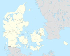
Herning railway station
Appearance
Herning Station Herning Banegård | ||||||||||||||||||||||||||
|---|---|---|---|---|---|---|---|---|---|---|---|---|---|---|---|---|---|---|---|---|---|---|---|---|---|---|
| railway junction | ||||||||||||||||||||||||||
 Herning Station in 2019 | ||||||||||||||||||||||||||
| General information | ||||||||||||||||||||||||||
| Location | Banegårdsparken 6C 7400 Herning[1][2] Herning Municipality Denmark | |||||||||||||||||||||||||
| Coordinates | 56°08′00″N 8°58′41″E / 56.13333°N 8.97806°E | |||||||||||||||||||||||||
| Elevation | 53.4 metres (175 ft)[3] | |||||||||||||||||||||||||
| Owned by | Banedanmark | |||||||||||||||||||||||||
| Operated by | DSB Arriva | |||||||||||||||||||||||||
| Line(s) | ||||||||||||||||||||||||||
| Platforms | 2 | |||||||||||||||||||||||||
| Tracks | 4 | |||||||||||||||||||||||||
| History | ||||||||||||||||||||||||||
| Opened | 28 August 1877[5] | |||||||||||||||||||||||||
| Rebuilt | 1906[5] 28 April 1979 | |||||||||||||||||||||||||
| Services | ||||||||||||||||||||||||||
| ||||||||||||||||||||||||||
| ||||||||||||||||||||||||||
Herning station (Danish: Herning Station or Herning Banegård) is the main railway station serving the city of Herning in Jutland, Denmark.[1][2]
Herning station is an important railway junction where the Vejle-Holstebro Line and the Skanderborg-Skjern Line cross each other. The station was opened in 1877 with the opening of the Silkeborg-Herning section of the Skanderborg-Skjern Line.[5] It offers direct InterCityLyn services to Copenhagen and Struer operated by DSB as well as regional train services to Aarhus, Fredericia, Esbjerg and Thisted operated by Arriva.[1][2]
See also
[edit]References
[edit]Citations
[edit]- ^ a b c "Herning Station" (in Danish). DSB. Retrieved 11 October 2021.
- ^ a b c "Herning Station" (in Danish). GoCollective. Retrieved 20 April 2024.
- ^ "Herning Banegård Center (Hr)". danskejernbaner.dk (in Danish). Retrieved 9 September 2024.
- ^ Jensen 1979, p. 46.
- ^ a b c Jensen 1979, p. 21.
Bibliography
[edit]- Jensen, Niels (1977). Vestjyske jernbaner (in Danish). Copenhagen: J.Fr. Clausens Forlag. ISBN 87-11-03821-7.
- Jensen, Niels (1979). Midtjyske jernbaner (in Danish). Copenhagen: J.Fr. Clausens Forlag. ISBN 87-11-03904-3.
External links
[edit]Wikimedia Commons has media related to Herning Station.
- (in Danish) Banedanmark – government agency responsible for maintenance and traffic control of most of the Danish railway network
- (in Danish) DSB – largest Danish train operating company
- (in Danish) GoCollective – private public transport company operating bus and train services in Denmark
- (in Danish) Danske Jernbaner – website with information on railway history in Denmark


