Gurara II Hydroelectric Power Station
| Gurara II Hydroelectric Power Station | |
|---|---|
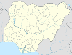
| Location | Kagarko, Kaduna State, Nigeria |
| Coordinates | 09°36′50″N 07°41′31″E / 9.61389°N 7.69194°E |
| Construction began | 2023 Expected |
| Opening date | 2026 Expected |
| Construction cost | US$1.24 billion |
| Owner(s) | Federal Government of Nigeria |
| Dam and spillways | |
| Type of dam | Gravity dam |
| Impounds | Gurara River |
| Power Station | |
| Turbines | 6 |
| Installed capacity | 360 MW (480,000 hp) |
| Annual generation | 1,130 GWh |
The Gurara II Power Station is a proposed 360 megawatts hydroelectric power station across the Gurara River in Nigeria. The power station is owned and is under development by the Federal Government of Nigeria. The Exim Bank of China has agreed to lend US$1 billion towards the construction of this renewable energy project. The Nigerian Federal Executive Council accepted that offer in May 2019.[1][2]
The power station is separate from the 30 MW Gurara I Hydroelectric Power Station that crosses the same river and was under development by a concessionaire, as of May 2021.[3]
Location
[edit]The power station would lie across the Gurara River, downstream of the 30 megawatts Gurara I Hydroelectric Power Station. This is near the settlement of Kagarko, in Kaduna State, located in North-West Nigeria.[4]
Kagarko is located approximately 148 kilometres (92 mi), by road, south of Kaduna metropolis of the state capital.[5] This is about 92 kilometres (57 mi) northeast of Abuja, the capital city of Nigeria.[6]
Overview
[edit]The design calls for generation capacity of 360 Mega Watts. A penstock pipe measuring 100 metres (328 ft) in length and 4.4 metres (14 ft) in diameter will direct water from the reservoir to the generation turbines inside the power house. The dam and power station will be built in one phase. When completed, the power station is expected to supply 1,130 Giga-Watts per hour of clean renewable energy to the Nigerian grid, annually.[2]
Ownership
[edit]As of December 2021, this power station was owned by the Nigerian Federal Ministry of Water Resources.[2]
Construction costs and funding
[edit]It has been reported that construction of this power station is expected to cost US$1.240 billion. The table below illustrates the expected sources of funding for the construction of the project.[1][2]
| Rank | Source | Dollar Amount (millions) | Percentage |
|---|---|---|---|
| 1 | Exim Bank of China | 1,000 |
80.6
|
| 2 | Government of Nigeria | 240 |
19.4
|
| Total | 1,240 |
100.0
|
Completion date
[edit]Groundbreaking is expected in 2023 and commercial commissioning is anticipated in 2026.[2]
See also
[edit]References
[edit]- ^ a b Jean Marie Takouleu (23 May 2019). "Nigeria: Exim Bank of China invests $1 billion in Gurara II hydroelectric project". Afrik21.africa. Paris, France. Retrieved 15 May 2022.
- ^ a b c d e Carmen (1 December 2021). "Gurara, Nigeria: Profile of Gurara II Hydroelectric Power Station". Power-Technology.com. New York City. Retrieved 15 May 2022.
- ^ Okechukwu Nnodim (23 May 2021). "FG signs contract to raise power generation by 360MW". The Punch. Lagos, Nigeria. Retrieved 15 May 2022.
- ^ North African Post (23 May 2019). "Nigeria approves $1bn Chinese loan for Hydropower project". The North Africa Post. Rabat, Morocco. Retrieved 15 May 2022.
- ^ "Road Distance Between Kaduna, Nigeria And Kagarko, Nigeria" (Map). Google Maps. Retrieved 15 May 2022.
- ^ "Road Distance Between Kagarko, Nigeria And Abuja, Nigeria" (Map). Google Maps. Retrieved 15 May 2022.


