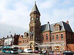
Gerards Bridge railway station
Appearance
Gerards Bridge | |
|---|---|
| General information | |
| Location | St Helens, St Helens England |
| Coordinates | 53°27′45″N 2°43′51″W / 53.462481°N 2.730809°W |
| Grid reference | SJ516965 |
| Platforms | Two |
| Other information | |
| Status | Disused |
| History | |
| Original company | St Helens Canal and Railway |
| Pre-grouping | London and North Western Railway |
| Key dates | |
| 1 February 1858 | Opened |
| 1 August 1905 | Closed |
Gerards Bridge railway station was on the St Helens to Rainford Junction[1] then Ormskirk line immediately north of Haresfinch Road in St Helens, England.[2] It opened on 3 February 1858 and closed on 1 August 1905. Remnants of the line through the station survive, leading to Pilkington's Cowley Hill site, though in September 2015 the tracks were out of use.
Services
[edit]The December 1895 timetable showed six "Down" trains to Rainford Junction and five "Up" to St Helens Monday-to-Friday, with an extra train in each direction on Saturdays.No trains called at Gerards Bridge on Sundays.[3]
| Preceding station | Disused railways | Following station | ||
|---|---|---|---|---|
| St Helens Central Line closed, station open |
London and North Western Railway St Helens Canal and Railway |
Moss Bank Line and station closed |
References
[edit]Sources
[edit]- Pixton, Bob (1996), The Archive Photographs Series Widnes and St Helens Railways, The Chalford Publishing Company, ISBN 0 7524 0751 1
External links
[edit]- A detailed history via Disused Stations UK
- The station on an 1888-1913 Overlay OS Map via National Library of Scotland


