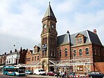
Formby Power Station railway station
Formby Power Station | |
|---|---|
 Derelict railway power station at Altcar, Formby | |
| General information | |
| Location | Formby, Metropolitan Borough of Sefton England |
| Coordinates | 53°32′33″N 3°03′58″W / 53.5424°N 3.0661°W |
| Grid reference | SD293056 |
| Other information | |
| Status | Disused |
| History | |
| Original company | Lancashire and Yorkshire Railway |
| Pre-grouping | Lancashire and Yorkshire Railway |
| Post-grouping | London, Midland and Scottish Railway |
| Key dates | |
| c.1917 | Opened |
| c.1943–1944 | Closed |
Formby Power Station railway station was a railway station on the Liverpool, Crosby and Southport Railway, situated south of Hogshill Lane and just north of the River Alt.
History
[edit]The railway station was opened circa 1917 by the Lancashire and Yorkshire Railway (L&YR) as a small halt adjacent to Formby power station. The station did not appear in the public timetables and was only open for use for employees of the power station.[1]
The station was located south of Hogshill Lane and just north of the River Alt.[2][3]
The power station was L&YR owned and operated, it had opened in 1904 and generated current for the L&YR local electrically powered lines, chiefly between Liverpool, Southport and Ormskirk.[1][4]
The halt was closed around 1943–1944 and the power station closed down in 1946.[1][5][2]
The line through the station remains open and is today used by trains on the Merseyrail Northern Line.[6]
The power station building was later used by Metal Closures Rosslite Limited as a factory producing expanded polystyrene packaging and insulation products, and then as a business centre. The site eventually became derelict but plans were later announced to convert it for residential use.[7]
The power station was demolished in 2016, the whole site was levelled and work started on a new housing development, leaving no trace of the original buildings. Development of the site was completed in August 2016, including a new access road connecting the site with Park Road. The roads on the new development were named after some of the pioneers in the field of electricity: Callan Crescent, Edison Close, Gilbert Close, Tesla Way, and Wheatstone Road.[citation needed]
In February 2017, a gate was installed on Hoggs Hill Lane to prevent vehicular access to the site via the original route.[citation needed]
| Preceding station | Historical railways | Following station | ||
|---|---|---|---|---|
| Altcar Rifle Range Until 1921 |
Lancashire and Yorkshire Railway Liverpool, Crosby and Southport Railway |
Formby | ||
| Hightown Since 1921 |
||||
References
[edit]- ^ a b c Quick 2023, p. 198.
- ^ a b Gell 1986.
- ^ Lancashire XC.8 (Map). 25 inch. Ordnance Survey. 1927.
- ^ Marshall 1970, pp. 154–157.
- ^ Marshall 1970, p. 169.
- ^ "Merseyrail Network Map". Merseyrail. Retrieved 14 July 2024.
- ^ "Formby's Power House building to be turned into apartments". Liverpool Echo. 1 July 2010.
Sources
[edit]- Gell, Rob (1986). An Illustrated Survey of Railway Stations Between Southport & Liverpool 1848-1986. Heyday Publishing Company. ISBN 0-947562-04-4.
- Marshall, John (1970). The Lancashire & Yorkshire Railway. Vol. 2. Newton Abbot: David & Charles. ISBN 978-0-7153-4906-9.
- Quick, Michael (2023) [2001]. Railway passenger stations in Great Britain: a chronology (PDF). version 5.05. Railway & Canal Historical Society.
Further reading
[edit]- Gahan, John W. (1985). Seaport to Seaside: Lines to Southport and Ormskirk - 13 decades of trains and travel. ISBN 978-0-907768-07-5.
{{cite book}}: CS1 maint: ignored ISBN errors (link)
External links
[edit]- "Formby Power Station". Formby Civic Society. Archived from the original on 30 September 2011.
- Science and Society Picture Library - Search for "Formby Power Station".


