Gaizhou
Appearance
(Redirected from Gai County)
Gaizhou
盖州市 | |
|---|---|
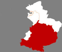
 Location in Yingkou | |
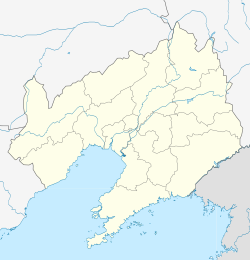
| Coordinates: 40°24′N 122°21′E / 40.400°N 122.350°E | |
| Country | People's Republic of China |
| Province | Liaoning |
| Prefecture-level city | Yingkou |
| Area | |
| 2,930.0 km2 (1,131.3 sq mi) | |
| • Urban | 150.00 km2 (57.92 sq mi) |
| Elevation | 9.1 m (30 ft) |
| Population (2017)[1] | |
| 704,000 | |
| • Density | 240/km2 (620/sq mi) |
| • Urban | 231,100 |
| Time zone | UTC+8 (China Standard) |
| Gaizhou | |||||||||
|---|---|---|---|---|---|---|---|---|---|
| Traditional Chinese | 蓋州 | ||||||||
| Simplified Chinese | 盖州 | ||||||||
| Postal | Kaichow Kaihsien (1965–1992) Kaiping (until 1965) | ||||||||
| |||||||||
| Gaixian | |||||||||
|---|---|---|---|---|---|---|---|---|---|
| Traditional Chinese | 蓋縣 | ||||||||
| Simplified Chinese | 盖县 | ||||||||
| Postal | Kaihsien | ||||||||
| |||||||||
| Gaiping | |||||||||
|---|---|---|---|---|---|---|---|---|---|
| Traditional Chinese | 蓋平 | ||||||||
| Simplified Chinese | 盖平 | ||||||||
| Postal | Kaiping | ||||||||
| |||||||||
Gaizhou (simplified Chinese: 盖州; traditional Chinese: 蓋州; pinyin: Gàizhōu), formerly Gaixian, Gaiping, and Kaiping, is a county-level city in Liaoning province, China. It is under the administration of Yingkou City, which lies 31 km (19 mi) to the north-northwest, and is located at the northwest end of the Liaodong Peninsula near the northeast coast of the Bohai Sea.
Administrative divisions
[edit]There are six subdistricts, 18 towns, and three townships under the city's administration.[2]
Subdistricts:
- Gulou Subdistrict (鼓楼街道), Xicheng Subdistrict (西城街道), Dongcheng Subdistrict (东城街道), Taiyangsheng Subdistrict (太阳升街道), Tuanshan Subdistrict (团山街道), Xihai Subdistrict (西海街道)
Towns:
- Gaotun (高屯镇), Shagang (沙岗镇), Jiulongdi (九垄地镇), Jiuzhai (九寨镇), Wanfu (万福镇), Wolongquan (卧龙泉镇), Qingshiling (青石岭镇), Nuanquan (暖泉镇), Guizhou (归州镇), Bangshibu (榜式堡镇), Tuandian (团甸镇), Shuangtai (双台镇), Yangyun (杨运镇), Xutun (徐屯镇), Shizijie (什字街镇), Kuangdonggou (矿洞沟镇), Chentun (陈屯镇), Liangtun (梁屯镇),
Townships:
- Xiaoshipeng Township (小石棚乡), Guoyuan Township (果园乡), Ertai Township (二台乡)
Climate
[edit]| Climate data for Gaizhou (1991–2020 normals, extremes 1981–2010) | |||||||||||||
|---|---|---|---|---|---|---|---|---|---|---|---|---|---|
| Month | Jan | Feb | Mar | Apr | May | Jun | Jul | Aug | Sep | Oct | Nov | Dec | Year |
| Record high °C (°F) | 9.9 (49.8) |
19.0 (66.2) |
22.7 (72.9) |
29.8 (85.6) |
34.7 (94.5) |
36.6 (97.9) |
36.8 (98.2) |
36.1 (97.0) |
33.3 (91.9) |
27.7 (81.9) |
21.5 (70.7) |
16.2 (61.2) |
36.8 (98.2) |
| Mean daily maximum °C (°F) | −2.5 (27.5) |
1.6 (34.9) |
8.5 (47.3) |
17.0 (62.6) |
23.5 (74.3) |
27.3 (81.1) |
29.6 (85.3) |
29.1 (84.4) |
24.9 (76.8) |
17.4 (63.3) |
7.9 (46.2) |
0.3 (32.5) |
15.4 (59.7) |
| Daily mean °C (°F) | −7.8 (18.0) |
−3.6 (25.5) |
3.3 (37.9) |
11.7 (53.1) |
18.3 (64.9) |
22.7 (72.9) |
25.5 (77.9) |
24.8 (76.6) |
19.5 (67.1) |
11.7 (53.1) |
2.7 (36.9) |
−4.9 (23.2) |
10.3 (50.6) |
| Mean daily minimum °C (°F) | −12.2 (10.0) |
−8.2 (17.2) |
−1.4 (29.5) |
6.5 (43.7) |
13.0 (55.4) |
18.1 (64.6) |
21.8 (71.2) |
20.8 (69.4) |
14.5 (58.1) |
6.7 (44.1) |
−1.9 (28.6) |
−9.2 (15.4) |
5.7 (42.3) |
| Record low °C (°F) | −28.2 (−18.8) |
−22.0 (−7.6) |
−13.3 (8.1) |
−7.1 (19.2) |
2.5 (36.5) |
8.1 (46.6) |
14.9 (58.8) |
9.5 (49.1) |
2.9 (37.2) |
−6.4 (20.5) |
−16.5 (2.3) |
−23.2 (−9.8) |
−28.2 (−18.8) |
| Average precipitation mm (inches) | 3.8 (0.15) |
7.3 (0.29) |
11.4 (0.45) |
33.3 (1.31) |
54.9 (2.16) |
72.3 (2.85) |
141.2 (5.56) |
165.2 (6.50) |
50.4 (1.98) |
35.5 (1.40) |
20.6 (0.81) |
8.9 (0.35) |
604.8 (23.81) |
| Average precipitation days (≥ 0.1 mm) | 2.6 | 2.8 | 3.7 | 6.0 | 7.5 | 9.0 | 11.1 | 10.0 | 6.4 | 6.3 | 4.9 | 3.5 | 73.8 |
| Average snowy days | 4.0 | 3.5 | 2.8 | 0.6 | 0 | 0 | 0 | 0 | 0 | 0.2 | 3.1 | 4.2 | 18.4 |
| Average relative humidity (%) | 57 | 53 | 50 | 49 | 54 | 65 | 75 | 77 | 69 | 63 | 60 | 59 | 61 |
| Mean monthly sunshine hours | 189.0 | 190.6 | 229.9 | 236.1 | 266.4 | 230.2 | 202.8 | 212.6 | 228.1 | 212.6 | 171.4 | 170.8 | 2,540.5 |
| Percent possible sunshine | 63 | 63 | 62 | 59 | 60 | 51 | 45 | 51 | 62 | 62 | 58 | 59 | 58 |
| Source: China Meteorological Administration[3][4] | |||||||||||||
References
[edit]- ^ a b Ministry of Housing and Urban-Rural Development, ed. (2019). China Urban Construction Statistical Yearbook 2017. Beijing: China Statistics Press. p. 50. Archived from the original on 18 June 2019. Retrieved 11 January 2020.
- ^ 营口市-行政区划网
- ^ 中国气象数据网 – WeatherBk Data (in Simplified Chinese). China Meteorological Administration. Retrieved 29 July 2023.
- ^ 中国气象数据网 (in Simplified Chinese). China Meteorological Administration. Retrieved 29 July 2023.
External links
[edit]40°24′N 122°21′E / 40.400°N 122.350°E

