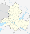
File:Outline Map of Rostov Oblast.svg
Appearance

Size of this PNG preview of this SVG file: 519 × 599 pixels. Other resolutions: 208 × 240 pixels | 416 × 480 pixels | 665 × 768 pixels | 887 × 1,024 pixels | 1,775 × 2,048 pixels | 1,000 × 1,154 pixels.
Original file (SVG file, nominally 1,000 × 1,154 pixels, file size: 107 KB)
File history
Click on a date/time to view the file as it appeared at that time.
| Date/Time | Thumbnail | Dimensions | User | Comment | |
|---|---|---|---|---|---|
| current | 13:27, 3 April 2010 |  | 1,000 × 1,154 (107 KB) | Виктор В | == {{int:filedesc}} == {{Information |Description={{ru|1=Позиционная карта Ростовской области<br>Равноугольная проекция, растяжение — 150 %. Координаты краёв: * север � |
File usage
The following 97 pages use this file:
- 1st Rossoshinskiy
- 2014 Winter Olympics torch relay
- 25 let Voenkonezavoda
- 2nd Rossoshinskiy
- Abramovka, Rostov Oblast
- Abrikosovy
- Aksay, Rostov Oblast
- Aksay Bridge
- Alexandrovka, Russia
- Alley of Immortality (Taganrog)
- Andreyevsky (rural locality)
- Avilova Cave
- Azov
- Bataysk
- Bataysk air base
- Belaya Kalitva
- Bogoroditsky (rural locality)
- Bokovskaya
- Bolshiye Saly
- Chaltyr
- Church of John the Baptist (Nesvetay)
- Donetsk, Rostov Oblast
- Dubovskoye, Rostov Oblast
- Egorlykskaya (air base)
- Freken Bock (Cafe)
- Gavala House
- Gigant, Rostov Oblast
- Gluboky, Kamensky District, Rostov Oblast
- Gorny, Krasnosulinsky District, Rostov Oblast
- Gremuchiy Spring
- Gukovo
- Kagalnitskaya
- Kamenolomni
- Kamensk-Shakhtinsky
- Kashary, Rostov Oblast
- Kazanskaya, Rostov Oblast
- Kirovsky City District, Rostov-on-Don
- Kondraty Bulavin house
- Konstantinovsk
- Kozinka
- Krasny Sulin
- Kuleshovka, Rostov Oblast
- Kuybyshevo, Rostov Oblast
- Main building of Warsaw University (Rostov-on-Don)
- Martyn Brothers House
- Millerovo, Millerovsky District, Rostov Oblast
- Millerovo air base
- Millerovo air base attack
- Morozovsk
- Morozovsk air base
- Nikanorovka, Rostov Oblast
- Novocherkassk
- Novoshakhtinsk
- Oblivskaya
- Orlovsky, Rostov Oblast
- Persianovka
- Peschanokopskoye
- Platov International Airport
- Pokrovskoye, Rostov Oblast
- Proletarsk, Rostov Oblast
- Razdolny, Russia
- Romanovskaya, Rostov Oblast
- Rostov-on-Don
- Rostov-on-Don Airport
- Rostov-on-Don North (air base)
- Salsk
- Samarskoye, Rostov Oblast
- Sarkel
- Semikarakorsk
- Semyonovka, Russia
- Shakhty
- Shelling of Donetsk, Rostov Oblast
- Sholokhovsky (urban-type settlement)
- Southern Federal District
- State Bank Building (Rostov-on-Don)
- Taganrog
- Taganrog-Central air base
- Taganrog Round House
- Tanais
- The Durov Museum
- The Long Canyon
- Tselina, Russia
- Tsimlyansk
- Uglerodovsky
- Ust-Donetsky (urban-type settlement)
- Vesyoly, Vesyolovsky District, Rostov Oblast
- Volgodonsk
- Vyoshenskaya
- Weather station "Taganrog"
- Yegorlykskaya
- Zavetnoye, Rostov Oblast
- Zernograd
- Zernograd air base
- Zimovniki
- Zverevo
- Module:Location map/data/Russia Rostov Oblast
- Module:Location map/data/Russia Rostov Oblast/doc
Global file usage
The following other wikis use this file:
- Usage on af.wikipedia.org
- Usage on ar.wikipedia.org
- Usage on azb.wikipedia.org
- Usage on az.wikipedia.org
- Usage on ba.wikipedia.org
- Дондағы Ростов
- Белая Калитва
- Аҡсай таможня заставаһы
- Аҡсай хәрби-тарих музейы
- Вёшенская станицаһы
- Аҙау
- А. А. Дуров музейы
- Ҡалып:ПозКарта Россия Ростовская область
- Дала Ҡурғаны
- Рогожкино (Аҙау районы)
- Гигант (Ростов өлкәһе)
- Урыҫ-әрмән дуҫлығы музейы
- Ериковский
- Ҡарғын
- Донецк (Рәсәй)
- Ҡырым ауылы музейы
- Кружилинский утары
- Ливенцовка ҡәлғәһе
- Старочеркасская станицаһы
- Алексеевск ҡапҡалары
- Кручёная Балка
- Крученая (станция)
- Дала Көсөгө (Ростов өлкәһе)
- Березовка (Ростов өлкәһе)
- Маяҡ (Ростов өлкәһе)
- Кривянская станицаһы
- Колузаево
- Головатовка (Ростов өлкәһе)
- Высочино (ауыл)
- Григорьевка (Азов районы)
- Бирючий (Ростов өлкәһе)
- Галагановка (Ростов өлкәһе)
- Казачий Ерик (Ростов өлкәһе)
- Еремеевка (Ростов өлкәһе)
- Круглое (Ростов өлкәһе)
- Маргаритово (Ростов өлкәһе)
- Мечетка (Ростов өлкәһе)
- Калиновка (Азов районы)
- Кульбакин (Азов районы)
- Задонский (Азов районы)
- Донской (Азов районы)
- Песчанокопское
View more global usage of this file.

