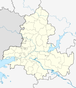
Romanovskaya, Rostov Oblast
Romanovskaya
Романовская | |
|---|---|
| Coordinates: 47°32′36″N 42°01′39″E / 47.54333°N 42.02750°E | |
| Country | Russia |
| Federal subject | Rostov Oblast[1] |
| Administrative district | Volgodonskoy District[1] |
| Founded | 1672 |
| Population | |
| • Total | 8,248 |
| Time zone | UTC+3 (MSK |
| Postal code(s)[3] | 347350 |
| OKTMO ID | 60612432101 |
Romanovskaya (Russian: Романовская) is a rural locality (a stanitsa) in Volgodonskoy District of Rostov Oblast, Russia. Population: 8,248 (2010 Census);[1] 6,896 (2002 Census).[4] It is also the administrative center of Volgodonskoy District.
History
[edit]Romanovskaya was first mentioned in official documents in 1613. It is believed that it was named after the first Tsar among Romanov House, Mikhail Feodorovich. Initially, the village was located on the right bank of the Don River. For almost two centuries, it had been moved several times from the right bank to the left, as the Don changed its flow and due to the raids of Tatars and Caucasian Highlanders.
Since 1840 it has been situated on the left bank. By the beginning of the 20th century there were 525 cossack and 151 peasant households, a church and two parochial schools.
During the period of general land surveying of Russia in 1888, the stanitsa of Romanovskaya was designated along with Tsimlyanskaya to the 1st Don district, with the district center in the stanitsa of Konstantinovskaya. In 1963, with the consolidation of rural areas and cities in the region, Romanovsky District, which had existed since 1937 and in 1957 was renamed Volgodonskoy, became part of Tsimlyansky District. Romanovskaya stanitsa became the administrative center of Volgodonskoy District, newly formed on May 10, 1983, at the expense of part of the territory of Tsimlyansky District.[5]
Landmarks
[edit]- Monument to Saints Peter and Fevronia.[6]
- Church of Michael the Archangel, built in 2010.[7]
References
[edit]- ^ a b c d e f Russian Federal State Statistics Service (2011). Всероссийская перепись населения 2010 года. Том 1 [2010 All-Russian Population Census, vol. 1]. Всероссийская перепись населения 2010 года [2010 All-Russia Population Census] (in Russian). Federal State Statistics Service.
- ^ "Об исчислении времени". Официальный интернет-портал правовой информации (in Russian). 3 June 2011. Retrieved 19 January 2019.
- ^ Почта России. Информационно-вычислительный центр ОАСУ РПО. (Russian Post). Поиск объектов почтовой связи (Postal Objects Search) (in Russian)
- ^ Federal State Statistics Service (21 May 2004). Численность населения России, субъектов Российской Федерации в составе федеральных округов, районов, городских поселений, сельских населённых пунктов – районных центров и сельских населённых пунктов с населением 3 тысячи и более человек [Population of Russia, Its Federal Districts, Federal Subjects, Districts, Urban Localities, Rural Localities—Administrative Centers, and Rural Localities with Population of Over 3,000] (XLS). Всероссийская перепись населения 2002 года [All-Russia Population Census of 2002] (in Russian).
- ^ "История". special.donland.ru. Retrieved 2017-10-08.
- ^ kerrangjke; rostov_don (2015-06-30). "Романовская". Ростовское городское сообщество. Retrieved 2017-10-08.
- ^ Архангела Михаила храм. / Волгодонской район, Романовская станица, Чибисова улица,1 . / Русские Церкви. russian-church.ru (in Russian). Retrieved 2017-10-08.


