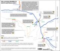
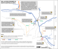
File:Map of rail access regimes in South Australia, 2021.tif
Appearance

Size of this JPG preview of this TIF file: 711 × 599 pixels. Other resolutions: 285 × 240 pixels | 570 × 480 pixels | 911 × 768 pixels | 1,215 × 1,024 pixels | 1,946 × 1,640 pixels.
Original file (1,946 × 1,640 pixels, file size: 9.14 MB, MIME type: image/tiff)
File history
Click on a date/time to view the file as it appeared at that time.
| Date/Time | Thumbnail | Dimensions | User | Comment | |
|---|---|---|---|---|---|
| current | 07:23, 30 November 2022 |  | 1,946 × 1,640 (9.14 MB) | SCHolar44 | Cropped to match previous version |
| 07:18, 30 November 2022 |  | 2,338 × 1,653 (14.75 MB) | SCHolar44 | Minor correction (Marree → Leigh Creek) by original uploader | |
| 07:48, 12 August 2022 |  | 1,943 × 1,641 (12.17 MB) | SCHolar44 | Upgraded Murraylands lines to standard gauge. | |
| 08:50, 1 August 2022 |  | 1,941 × 1,640 (12.15 MB) | SCHolar44 | Uploaded own work with UploadWizard |
File usage
The following page uses this file:
