Eliodoro Camacho Province
Eliodoro Camacho | |
|---|---|
Province | |
 Suches River in Umanata | |
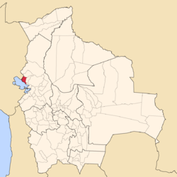
 Location of Eliodoro Camacho Province within Bolivia | |
 Provinces of the La Paz Department | |
| Coordinates: 15°30′0″S 69°5′0″W / 15.50000°S 69.08333°W | |
| Country | |
| Department | La Paz Department |
| Municipalities | 5 |
| Foundation | November 5, 1908 |
| Capital | Puerto Acosta |
| Area | |
• Total | 2,080 km2 (800 sq mi) |
| Population (2024 census)[1] | |
• Total | 63,266 |
| • Density | 30/km2 (79/sq mi) |
| • Ethnicities | Aymara |
| Time zone | UTC-4 (BOT) |
| Website | Official website |
Eliodoro Camacho is a province in the La Paz Department in Bolivia situated at Lake Titicaca. Its seat is Puerto Acosta.
Camacho Province is situated in the western region of the La Paz Department bordered to the north by the Muñecas Province, to the east by the Larecaja Province, to the south by the Omasuyos Province, to the west by Lake Titicaca and Moho Province located in the Puno Region of Peru.
Camacho Province was created during the presidency of General Ismael Montes on November 5, 1908,[2] named after the Bolivian politician and officer Eliodoro Camacho. Originally it was composed of the cantons Huaycho, Escoma, Carabuco, Italaque, Mocomoco and Ambaná. Huaycho became the capital of the province under the name "Puerto Acosta" (meaning: "Port Acosta") in honor of the writer Nicolás Acosta (1844 - 1893).[3]
Subdivision
[edit]The province is divided into five municipalities[4] which are further subdivided into cantons.
| Section | Municipality | Seat | Inhabitants (2001) [5] |
|---|---|---|---|
| 1st | Puerto Acosta Municipality | Puerto Acosta | 1,123 |
| 2nd | Mocomoco Municipality | Mocomoco | 444 |
| 3rd | Puerto Carabuco Municipality | Puerto Carabuco | 416 |
| 4th | Umanata Municipality (also Humanata Municipality) | Umanata (also Humanata) | 192 |
| 5th | Escoma Municipality | Escoma | 576 |
-
Transport in Eliodoro Camacho Province
See also
[edit]External links
[edit]References
[edit]- ^ "Bolivia: Administrative divisions". City Population. Retrieved 11 September 2024.
- ^ "www.lexivox.org". www.lexivox.org. Retrieved 2011-11-08.
- ^ Diccionario Cultural Boliviano (Spanish)
- ^ www.bolivia.com (Spanish)
- ^ www.ine.gov.bo Archived November 13, 2009, at the Wayback Machine (Spanish)
15°30′S 69°05′W / 15.500°S 69.083°W


