East Lamma Channel
This article needs additional citations for verification. (June 2023) |
| East Lamma Channel | |
|---|---|
| 東博寮海峽 (Chinese) | |
 East Lamma Channel near Lung Shan Pai | |
| Location | Hong Kong |
| Coordinates | 22°13′52″N 114°08′38″E / 22.231°N 114.144°E |
| Type | Channel |
| East Lamma Channel | |||||||||
|---|---|---|---|---|---|---|---|---|---|
| Traditional Chinese | 東博寮海峽 | ||||||||
| |||||||||
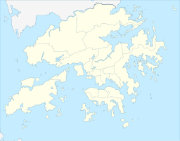
The East Lamma Channel (Chinese: 東博寮海峽) is a sea channel in Hong Kong.[1] It lies between the western shores of Hong Kong Island and Ap Lei Chau, and the east side of Lamma Island. To the north it leads into the Sulphur Channel and Victoria Harbour, to the south into the South China Sea.
The East Lamma Channel is one of the areas in the world with the heaviest traffic with more than 150 deep-water vessels of all kinds passing there every day. The eastern entrance to the channel is also the pilot point for ships going to the Kwai Tsing Container Terminals and for ships passing the Ma Wan water way up to the eastern Pearl River Delta ports in Shenzhen and Guangzhou. The East Lamma Channel is the deepest water entrance to the Hong Kong water area and part of the traffic controlled Ma Wan water way used by nearly all bigger ships coming from the east.
By Hong Kong maritime laws, ocean-going vessels entering Hong Kong via the East Lamma Straight need to slow down in order to pick up pilots at the Nganchau Pilot Boarding Station, then enter the west channel to the western seaports. When ocean-going vessels leave ports in Hong Kong, they also need to slow down and let the pilot disembark at the Nganchau Pilot Boarding Station. Therefore, the average speed of ships sailing in this strait is usually not higher than 15 knots.[2]
See also
[edit]References
[edit]- ^ "GeoNames.org". www.geonames.org. Retrieved 5 June 2023.
- ^ "立法會二十題:本港水域航速限制" [Legislative Council Question 20: Speed restrictions in Hong Kong waters]. www.info.gov.hk (in Chinese). Archived from the original on 2 September 2019. Retrieved 5 June 2023.

