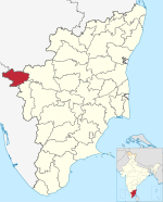
Devarshola
Devarsolai
Devarshola | |
|---|---|
Town Panchayat | |
 Devarshola Road | |
| Coordinates: 11°32′0″N 76°27′12″E / 11.53333°N 76.45333°E | |
| Country | |
| State | Tamil Nadu |
| District | The Nilgiris |
| Population (2001) | |
| • Total | 23,085 |
| Languages | |
| • Official | Tamil |
| Time zone | UTC+5:30 (IST) |
| Vehicle registration | TN 43 |
Devarshola is a panchayat town in The Nilgiris district in the state of Tamil Nadu, India.Devarshola comes under the administration of Gudalur revenue division and the taluk of Gudalur. It is one of the major tourist attractions in gudalur forest division and nearby to Mudumalai , Bandipur and Wayanad National parks. The state highway SH-98 Passing through the town which connects Gudalur and Sulthan Bathery (Connects TamilNadu and Kerala).
Demographics
[edit]As of 2001[update] India census,[1] Devarshola had a population of 23,085. Males constitute 50% of the population and females 50%. Devarshola has an average literacy rate of 68%, higher than the national average of 59.5%: male literacy is 75% and, female literacy is 62%. In Devarshola, 13% of the population is under 6 years of age.
Pincode : 643207.
References
[edit]- ^ "Census of India 2001: Data from the 2001 Census, including cities, villages and towns (Provisional)". Census Commission of India. Archived from the original on 16 June 2004. Retrieved 1 November 2008.


