Colville Lake/Tommy Kochon Aerodrome
Appearance
Colville Lake/Tommy Kochon Aerodrome | |||||||||||
|---|---|---|---|---|---|---|---|---|---|---|---|
 | |||||||||||
| Summary | |||||||||||
| Airport type | Public | ||||||||||
| Operator | Government of the Northwest Territories | ||||||||||
| Location | Colville Lake, Northwest Territories | ||||||||||
| Time zone | MST (UTC−07:00) | ||||||||||
| • Summer (DST) | MDT (UTC−06:00) | ||||||||||
| Elevation AMSL | 899 ft / 274 m | ||||||||||
| Coordinates | 67°01′16″N 126°07′43″W / 67.02111°N 126.12861°W | ||||||||||
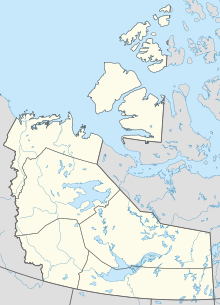
| Map | |||||||||||
 | |||||||||||
| Runways | |||||||||||
| |||||||||||
Colville Lake/Tommy Kochon Aerodrome (IATA: YCK, ICAO: CYVL) is a registered aerodrome located next to Colville Lake, Northwest Territories, Canada. A new terminal, with a small waiting room, washrooms and land line phone, and a longer runway were opened in October 2012 at a cost of CA$12.8 million.[3]
History
[edit]Prior to 2012 the airport was located within Colville Lake and had a single 2,743 ft (836 m) gravel runway (10/28). In 2009 the demand for a longer runway to handle larger aircraft resulted in the relocation.[4]
Airlines and destinations
[edit]| Airlines | Destinations |
|---|---|
| North-Wright Airways | Fort Good Hope, Norman Wells, Yellowknife |
Facilities
[edit]Besides an unmanned terminal there are no other facilities at the airstrip and no fuel is available.
See also
[edit]References
[edit]- ^ Canada Flight Supplement. Effective 0901Z 16 July 2020 to 0901Z 10 September 2020.
- ^ Synoptic/Metstat Station Information Archived December 1, 2011, at the Wayback Machine
- ^ "Colville Lake Celebrates Bigger and Better Airport". Infrastructure Canada. October 9, 2012. Retrieved June 28, 2016.
- ^ "Kathryn's Report: Colville Lake's $12 million airport a community effort. Aurora College taking advantage of construction training opportunities. Northwest Territories, Canada". Kathrynsreport.com. 2011-10-28. Retrieved 2022-03-13.
External links
[edit]- Page about this airport on COPA's Places to Fly airport directory

