Cholistan Wildlife Sanctuary
| Cholistan Wildlife Sanctuary | |
|---|---|
 | |
| Location | Cholistan Desert, Punjab, Pakistan |
| Nearest city | Bahawalpur |
| Coordinates | 28°56′24″N 72°07′55″E / 28.940°N 72.132°E |
| Area | 26,000 km2 (10,000 sq mi) |
Cholistan Wildlife Sanctuary is located in Punjab, Pakistan.[1] It comprises 2.6 million hectares.
Topography
[edit]This desert can be classified into two geomorphic zones based on its topography, the territory of the northern section, known as Lesser Cholistan, is around 7,770 km2, bordering canal-irrigated areas, while the area of the southern region, known as Greater Cholistan, is 18,130 km2. Low sandy ridges alternate with salty alluvial flats, known locally as dahars, to form the smaller Cholistan. Saline or saline-sodic soils are the two categories into which these soils fall, with pH values varying from 8.2 to 8.4 and from 8.8 to 9.6, respectively. The Greater Cholistan consists of river terraces, sizable sand dunes, and depressions. It is a wind-sorted sandy desert. The dunes are approximately 100 metres tall on average.[2]
The region experiences a wide range of temperatures, with summers potentially reaching over 50°C. The temperature difference between day and night is significant. The region experiences sporadic, erratic, and sparse rainfall, often between 100 and 250 mm, primarily during the monsoon season.[2]
Flora and fauna
[edit]Fauna
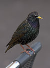
[edit]List of fauna found in the sanctuary.[3]
|
|
|
|
References
[edit]- ^ "Protected Areas".
- ^ a b "Pakistan Journal of Biological Sciences". Science Alert. Retrieved 13 November 2023.
- ^ "Natural Resource Diversity in Cholistan Desert (Pakistan) and Possible Conservational Measures". researchgate.net. Research Gate. Retrieved November 13, 2023.


