Chamber Hall Power Station
Appearance
| Chamber Hall Power Station | |
|---|---|
 | |
| Country | England |
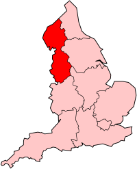
| Location | Bury, Greater Manchester |
| Coordinates | 53°35′50″N 2°17′55″W / 53.5973°N 2.2985°W |
| Commission date | 1912 |
| Decommission date | 1969 |
| Thermal power station | |
| Primary fuel | Coal |
| Power generation | |
| Nameplate capacity | 4,000 kW |
Chamber Hall Power Station was a coal-fired power station situated in Bury, Greater Manchester. It was opened in 1912 by the Bury Corporation Electricity Department.[1]
Generating plant
[edit]When commissioned in 1912, the station had two John Musgrave & Sons steam turbines of the Zoelly impulse type, each driving a Siemens Brothers 2,000 kW alternator, generating a three-phase output of 6,000 V at 50 Hz. The station's three Woodeson boilers were supplied by Clarke Chapman & Co.[1]
The station had its own railway siding connected to the adjacent Lancashire and Yorkshire Railway line.

