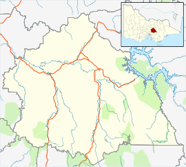
Castella, Victoria
Appearance
| Castella Victoria | |||||||||||||||
|---|---|---|---|---|---|---|---|---|---|---|---|---|---|---|---|
 Aerial view from north | |||||||||||||||
| Coordinates | 37°31′29″S 145°26′00″E / 37.52472°S 145.43333°E | ||||||||||||||
| Population | 257 (2021 census)[1] | ||||||||||||||
| Postcode(s) | 3777[2] | ||||||||||||||
| LGA(s) | Shire of Murrindindi | ||||||||||||||
| State electorate(s) | Eildon | ||||||||||||||
| Federal division(s) | Indi[2] | ||||||||||||||
| |||||||||||||||
Castella is a locality in Victoria, Australia. It lies to the east of Kinglake at the intersection of the Melba Highway and the Healesville Kinglake Road.[3]
The Castella Quarries produces sandstone and crushed rock.[4] One of the quarries was used to dump the drillings from a tunnel under the Toolangi State Forest.[5] This tunnel is part of the Sugarloaf Pipeline, carrying freshwater to Melbourne from the Goulburn River.
References
[edit]- ^ Australian Bureau of Statistics (28 June 2022). "Castella". 2021 Census QuickStats. Retrieved 16 July 2024.
- ^ a b http://apps.aec.gov.au/esearch/LocalitySearchResults.aspx?filter=3777&filterby=Postcode Archived 2009-10-26 at the Wayback Machine Australian Electoral Commission
- ^ "CASTELLA Postcode (VIC)".
- ^ "Archived copy" (PDF). Archived from the original (PDF) on 9 October 2009. Retrieved 24 November 2009.
{{cite web}}: CS1 maint: archived copy as title (link) - ^ "Tunnelling projects protect Australian water supplies — Trenchless International — the official magazine of the ISTT, covering no-dig trenchless technology". Archived from the original on 31 October 2009. Retrieved 24 November 2009.


