Cagayan de Sulu Airport
Appearance
(Redirected from CDY (airport))
Cagayan de Sulu Airport Landing sin Cagayan de Sulu | |||||||||||
|---|---|---|---|---|---|---|---|---|---|---|---|
| Summary | |||||||||||
| Airport type | Public | ||||||||||
| Operator | Civil Aviation Authority of the Philippines (airside and landside) Bangsamoro Airport Authority (landside[1]) | ||||||||||
| Serves | Mapun, Tawi-Tawi | ||||||||||
| Location | Mapun, Tawi-Tawi | ||||||||||
| Elevation AMSL | 98 ft / 30 m | ||||||||||
| Coordinates | 07°00′49″N 118°29′42″E / 7.01361°N 118.49500°E | ||||||||||
| Map | |||||||||||
 | |||||||||||
| Runways | |||||||||||
| |||||||||||
Statistics from the Development Plan for the Bangsamoro Final Report, August 2016[2] | |||||||||||
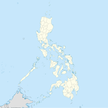
Cagayan de Sulu Airport (Tausug: Landing sin Cagayan de Sulu) (IATA: CDY, ICAO: RPMU) is an airport serving the island municipality of Mapun (formerly named Cagayan de Sulu), Tawi-Tawi, Philippines. The Civil Aviation Authority of the Philippines classifies this facility as a community airport.[3]
Though no airlines currently serve the airport, it sees some use by the military.[2]
References
[edit]- ^ Jannaral, Julmunir (26 December 2022). "BARMM to run six airports in 2023". The Manila Times. Retrieved 26 December 2022.
- ^ a b RECS International Inc.; Oriental Consultants Global Co., Ltd.; CTI Engineering International Co., Ltd.; IC Net Limited (April 2016). "Comprehensive Capacity Development Project for the Bangsamoro: Development Plan for the Bangsamoro, Final Report" (PDF). Retrieved 2 May 2017.[permanent dead link]
- ^ "CAAP Airport Directory". Civil Aviation Authority of the Philippines. August 2016. Archived from the original on 2017-05-14. Retrieved 2 May 2017.

