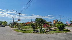
Blauwgrond
Appearance
Blauwgrond | |
|---|---|
 Leonsberg (2016) | |
 Map showing the resorts of Paramaribo District. Blauwgrond | |
| Coordinates: 5°51′57″N 55°07′36″W / 5.8659°N 55.1268°W | |
| Country | |
| District | Paramaribo District |
| Area | |
• Total | 43 km2 (17 sq mi) |
| Population (2012)[1] | |
• Total | 31,483 |
| • Density | 730/km2 (1,900/sq mi) |
| Time zone | UTC-3 (AST) |
Blauwgrond is a resort in Suriname, located in the Paramaribo District. Its population at the 2012 census was 31,483.[2] Blauwgrond started as a Javanese village to the north of Paramaribo. During the 1960s and 1970s, large scale building projects turned the village into a neighbourhood of Paramaribo,[3] and is mainly known as the Javanese culinary centre with many warungs and restaurants.[4] The resort was called Blauwgrond (English: Blue Ground), because the earth had a bluish colour.
Leonsberg is a former coffee plantation in the northern part of Blauwgrond. It was founded by A. Léon in 1819.[5] At Leonsberg there is a ferry to Nieuw-Amsterdam.
References
[edit]- ^ "Resorts in Suriname Census 2012" (PDF). Archived from the original (PDF) on 23 December 2021. Retrieved 28 May 2020.
- ^ Statoids.com
- ^ "Sranan. Cultuur in Suriname". Digital Library for Dutch Literature (in Dutch). 1992. Retrieved 28 May 2020.
- ^ "The Blauwgrond Experience". Werkgroup Caraïbische Letteres (in Dutch). Retrieved 28 May 2020.
- ^ "Plantage Leonsberg" (in Dutch). Retrieved 28 May 2020.

