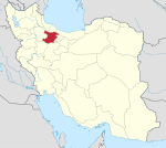
Basharyat District
Appearance
Basharyat District
Persian: بخش بشاریات | |
|---|---|
| Coordinates: 36°00′24″N 50°15′35″E / 36.00667°N 50.25972°E[1] | |
| Country | Iran |
| Province | Qazvin |
| County | Abyek |
| Capital | Khak-e Ali |
| Population (2016)[2] | |
• Total | 16,379 |
| Time zone | UTC+3:30 (IRST) |
Basharyat District (Persian: بخش بشاریات) is in Abyek County, Qazvin province, Iran. Its capital is the city of Khak-e Ali.[3]
Demographics
[edit]Population
[edit]At the time of the 2006 National Census, the district's population was 20,984 in 5,221 households.[4] The following census in 2011 counted 17,851 people in 5,272 households.[5] The 2016 census measured the population of the district as 16,379 inhabitants in 5,136 households.[2]
Administrative divisions
[edit]| Administrative Divisions | 2006[4] | 2011[5] | 2016[2] |
|---|---|---|---|
| Basharyat-e Gharbi RD[a] | 10,556 | 8,306 | 7,549 |
| Basharyat-e Sharqi RD | 7,282 | 6,193 | 5,682 |
| Khak-e Ali (city) | 3,146 | 3,352 | 3,148 |
| Total | 20,984 | 17,851 | 16,379 |
| RD = Rural District | |||
See also
[edit]Notes
[edit]- ^ Formerly Basharyat Rural District[3]
References
[edit]- ^ OpenStreetMap contributors (13 September 2024). "Basharyat District (Abyek County)" (Map). OpenStreetMap (in Persian). Retrieved 13 September 2024.
- ^ a b c Census of the Islamic Republic of Iran, 1395 (2016): Qazvin Province. amar.org.ir (Report) (in Persian). The Statistical Center of Iran. Archived from the original (Excel) on 30 November 2021. Retrieved 19 December 2022.
- ^ a b Habibi, Hassan (1 March 2015) [Approved 7 May 1380]. Approval letter regarding reforms and divisional changes in Qazvin province. rc.majlis.com (Report) (in Persian). Ministry of the Interior, Board of Ministers. Proposal 1.4.42.18069. Archived from the original on 19 February 2017. Retrieved 10 January 2024 – via Islamic Parliament Research Center of the Islamic Republic of Iran.
- ^ a b Census of the Islamic Republic of Iran, 1385 (2006): Qazvin Province. amar.org.ir (Report) (in Persian). The Statistical Center of Iran. Archived from the original (Excel) on 20 September 2011. Retrieved 25 September 2022.
- ^ a b Census of the Islamic Republic of Iran, 1390 (2011): Qazvin Province. irandataportal.syr.edu (Report) (in Persian). The Statistical Center of Iran. Archived from the original (Excel) on 19 January 2023. Retrieved 19 December 2022 – via Iran Data Portal, Syracuse University.


