Báta
Appearance
Báta | |
|---|---|
Village | |
 Aerial view of Báta | |
| Coordinates: 46°07′35″N 18°46′18″E / 46.12640°N 18.77167°E | |
| Country | Hungary |
| Region | Southern Transdanubia |
| County | Tolna |
| Subregion | Szekszárdi |
| Rank | Village |
| Government | |
| • Mayor | Sziebert György |
| Area | |
• Total | 66.17 km2 (25.55 sq mi) |
| Population (1 January 2008)[2] | |
• Total | 1,767 |
| • Density | 27/km2 (69/sq mi) |
| Time zone | UTC+1 (CET) |
| • Summer (DST) | UTC+2 (CEST) |
| Postal code | 7149 |
| Area code | +36 74 |
| KSH code | 11712[1] |
| Website | www.bata.hu |
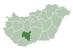
Báta is a village in Tolna County, Hungary.
References
[edit]- ^ a b Báta at the Hungarian Central Statistical Office (Hungarian).
- ^ Báta at the Hungarian Central Statistical Office (Hungarian). 1 January 2008
46°07′35″N 18°46′18″E / 46.12640°N 18.77167°E


