Alcántara Bridge
You can help expand this article with text translated from the corresponding article in Spanish. (June 2019) Click [show] for important translation instructions.
|
Alcántara Bridge | |
|---|---|
 | |
| Coordinates | 39°43′21″N 6°53′33″W / 39.7224°N 6.8924°W |
| Crosses | Tagus River |
| Locale | Alcántara, Spain |
| Heritage status | Listed as cultural heritage since 1921[1] |
| Characteristics | |
| Design | Roman arch bridge |
| Material | Stone |
| Total length | 181.7 m (596 ft)[2] |
| Width | 8.6 m (28 ft)[2] |
| Height | 45 m (148 ft)[3] |
| Longest span | 28.8 m (94 ft)[4] |
| No. of spans | 6 |
| Load limit | 52 t (57 short tons)[5] |
| History | |
| Designer | Caius Julius Lacer |
| Construction start | 104 AD |
| Construction end | 106 AD |
| Location | |
 | |
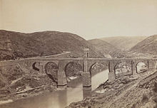
The Alcántara Bridge (also known as Trajan's Bridge at Alcantara) is a Roman bridge at Alcántara, in Extremadura, Spain. Alcántara is from the Arabic word al-Qantarah (القنطرة) meaning "the arch". The stone arch bridge was built over the Tagus River between 104 and 106 AD by an order of the Roman emperor Trajan in 98.[6]
History
[edit]

The Alcántara Bridge has suffered more damage from war than from the elements over the years. The Moors destroyed one of the smallest arches in 1214 although this was rebuilt centuries later, in 1543, with stone taken from the original quarries. The second arch on the northwest side was then later destroyed in 1760 by the Spanish to stop the Portuguese advancing and was repaired in 1762 by Charles III, only to be blown up again in 1809 by Wellington's forces attempting to stop the French. Temporary repairs were made in 1819, but much of the bridge was destroyed yet again in 1836 by the Carlists. The bridge was rebuilt in 1860 using mortared masonry.[6] And following completion of the José María de Oriol Dam, which allowed for the draining of the Tagus riverbed, the main pillars were completely repaired in 1969.
The bridge originally measured 190 m (620 ft) in length, which today is reduced to 181.7 m (596 ft).[2] The clear spans of the six arches from the right to the left riverside are 13.6 m (45 ft), 23.4 m (77 ft), 28.8 m (94 ft), 27.4 m (90 ft), 21.9 m (72 ft) and 13.8 m (45 ft).[4]
Construction
[edit]The bridge's construction occurred in the ancient Roman province of Lusitania. In Ancient Rome, the costs of building and repairing bridges, known as opus pontis ("bridge work"), were the responsibility of multiple local municipalities. Their shared costs prove Roman bridges belonged to the region overall, and not to any one town (or two, if on a border). The Alcántara Bridge was built at the expense of 12 local municipalities in Lusitania. The names were added on an inscription on the archway over the central pier.[7]
| Original | Latin in full | Translation |
|---|---|---|
| Municipia provinciae Lusitaniae stip conlata quae opus pontis perfecerunt. Imp. Caesari divi Nervae f. Nervae. Traiano Aug. Germ. Dacico Ponti f. Max. Trib. potes VIII. imp. V. cos V. PP. | Caesar Imperator, son of divine Nerva, Nerva Traianus Germanicus Dacicus, Maximus Pontifex, Tribunitia Potestas for the 8th time, Imperium for the 5th time, Pater of the Patria | The municipalities of the province of Lusitania contributed to the construction of the bridge. The Emperor Caesar, son of divine Nerva, the German, the Dacian, Trajan, who was made three times Highest Priest, given eight times the Tribune power, and given five times the government; Father of the country |
| Original | Translation |
|---|---|
Pontem perpetui mansurum |
The illustrious Lacer, with divine skill, made this bridge, which shall remain through the unending ages of the world [lit., through the ages of the unending world] |
Gallery
[edit]-
Looking south, in the background the small temple with Lacer's grave
-
The entrance of the temple with the crypt of the Roman engineer
See also
[edit]References
[edit]- ^ Patrimonio histórico: Bienes culturales protegidos. Consulta de bienes inmuebles. Bien: "Puente de Alcántara", retrieved 13-01-2010 (in Spanish)
- ^ a b c Galliazzo 1994, p. 354
- ^ From river bed to deck, excluding the triumphal arch (Galliazzo 1994, pp. 354f.). O'Connor 1993, p. 109 gives 48 m, 40–42 m for the height above the water level plus 14 m for the triumphal arch.
- ^ a b Galliazzo 1994, p. 356
- ^ Durán Fuentes 2004, p. 237
- ^ a b c Whitney, Charles S. (2003) [1929], Bridges of the World: Their Design and Construction, Mineola, New York: Dover Publications, pp. 75–79, ISBN 0-486-42995-4
- ^ Frothingham, A.I. (1915). "The Roman Territorial Arch". American Journal of Archaeology. 14 (19). Macmillan Company: 159, 172.
Further reading
[edit]- Brown, David J. (1993), Bridges, New York: Macmillan Publishing Company, p. 25, ISBN 0-02-517455-X
- Durán Fuentes, Manuel (2004), La Construcción de Puentes Romanos en Hispania, Santiago de Compostela: Xunta de Galicia, pp. 194–200, ISBN 978-84-453-3937-4
- Galliazzo, Vittorio (1994), I ponti romani. Catalogo generale, vol. 2, Treviso: Edizioni Canova, pp. 353–358 (No. 754), ISBN 88-85066-66-6
- Graf, Bernhard (2002), Bridges that Changed the World, Munich: Prestel, pp. 20–21, ISBN 3-7913-2701-1
- O'Connor, Colin (1993), Roman Bridges, Cambridge University Press, pp. 109–111 (SP21), ISBN 0-521-39326-4


