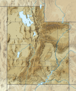
1901 Richfield earthquake
| UTC time | 1901-11-14 04:39:00 |
|---|---|
| USGS-ANSS | ComCat |
| Local date | 13 November 1901 |
| Local time | 09:39 p.m. MST |
| Magnitude | 7.0 Mw |
| Depth | 10.0 km (6.2 mi) |
| Epicenter | 38°46′N 112°05′W / 38.77°N 112.08°W |
| Areas affected | Utah |
| Max. intensity | MMI IX (Violent) |
| Landslides | multiple |
| Aftershocks | >35 |
| Casualties | none |
The 1901 Richfield earthquake was a magnitude Mw7.0 earthquake that occurred on 13 November 1901 at approximately 9:39 PM MST at Richfield, Utah, United States. If estimations are accurate, it is the largest earthquake ever recorded in Utah.[1]
Earthquake
[edit]The earthquake struck at approximately 9:39 PM MST approximately 1.2 miles (1.9 km) south of Richfield, Utah, United States.[2][3] Reports of the length of the quake varied from about one minute to three minutes.[4][5] There were three waves—increasing in power—to the initial quake, and "roaring" or "low rumbling" sounds accompanying the shock waves were reported in Fillmore, Cedar City, and Salt Lake City.[5]
The time of the quake is officially recorded by the Intermountain Seismic Belt Historical Earthquake Project (ISBHEP) as 9:39 PM MST.[2] The USGS report gives an official time as 9:32 PM MST.[3] News reports from the time give times ranging from 9:30 PM MST to 10:45 PM MST.[4][5]
Magnitude and intensity
[edit]The quake was recorded by the ISBHEP as a Mw6.5 and an intensity of IX (Violent).[2][6] The official USGS report in their historical earthquakes list stated no magnitude and an intensity of VIII (Severe).[3][7][8] An official report published in 1988 assigned a magnitude of Mw7 and an intensity of IX (Violent).[1]
The quake was felt in an area of 50,000 square miles (130,000 km2), including Cedar City (intensity VI), Oasis, and Fillmore.[3][1] Salt Lake City (with intensity of IV) is considered an "outlying point well outside the boundary of the main felt area."[1]
Destruction
[edit]Damage to chimneys, walls, roofs, windows was reported in Richfield, Beaver, Monroe, Joseph, Elsinore, and Marysvale, with minor damage reported in Parowan, Milford, Cedar City, St. George, and Kanab.[2][7][1]
Surface ruptures up to 300 feet (91 m) in length were reported in Richfield, with water and white sand being ejected from some of the cracks.[1] "Extensive rockslides" were reported between Beaver and Marysvale, especially in the canyons.[1]
Damage in Beaver included Beaver Woolen Mills, with an estimated US$4,000 in severe structural damage (approximately US$121,000 in 2020).[5][9] The roof of the Beaver County courthouse was crushed by chimneys collapsing onto it, and the walls of the building were cracked in over 25 places. Additional reports of lesser damage include a saloon, several merchant buildings, schools and related buildings, and a church building. Merchandise in several stores was also damaged.[5]
Minor damage was reported as far away as Salt Lake City, where several landslides were reported in Little Cottonwood, Big Cottonwood, and Bullion Canyon.[1] The landslides almost completely blocked the roads.[1] Surface ruptures and increased river flow were also reported.[1]
No people were killed in the quake.[5][7][10]
See also
[edit]References
[edit]- ^ a b c d e f g h i j Hopper, Margaret G. (4 April 1988). "Large Earthquakes in Sevier County, Utah, in 1901 and 1921" (PDF). United States Geological Survey. Open-File Report 88-404. Archived (PDF) from the original on 12 February 2017. Retrieved 4 May 2020.
- ^ a b c d Peterson, Sheryl (11 January 2020). "1901 – Southern Utah – M 6½ ±". University of Utah. Archived from the original on 20 April 2020. Retrieved 1 May 2020.
- ^ a b c d "M ? - Utah Overview". United States Geological Survey. Archived from the original on 21 August 2020. Retrieved 1 May 2020.
- ^ a b "Monroe: Severe Earthquake Shock Unnerves the People - Returned Missionary" (PDF). Deseret Evening News. 15 November 1901. p. 7. Archived (PDF) from the original on 21 August 2020. Retrieved 1 May 2020.
- ^ a b c d e f "Buildings were badly wrecked" (PDF). Deseret Evening News. 14 November 1901. p. 1. Archived (PDF) from the original on 21 August 2020. Retrieved 1 May 2020.
- ^ "Earthquake Summary" (PDF). University of Utah. Archived (PDF) from the original on 21 April 2020. Retrieved 1 May 2020.
For historical earthquake data where there was no instrumental recording of the shock, magnitude is estimated from the size of the felt area (see below). In such cases, the magnitudes are listed as a whole number followed by a ± or a fraction (e.g., 1/2) rather than a decimal (e.g., 0.5).
- ^ a b c "M ? - Utah Impact Summary". United States Geological Survey. Archived from the original on 21 August 2020. Retrieved 1 May 2020.
- ^ "M ? - Utah Technical Summary". United States Geological Survey. Archived from the original on 21 August 2020. Retrieved 1 May 2020.
- ^ "$4,000 in 1901 → $121,465.88 today". Official Data Foundation. Archived from the original on 1 May 2020. Retrieved 1 May 2020.
- ^ Dunn, Scott (9 October 2012). "5 biggest earthquakes ever to happen in Utah". KSL.com. Archived from the original on 18 March 2020. Retrieved 1 May 2020.

