Zemra Lake
Appearance
| Zemra Lake | |
|---|---|
 The lake within the alps. | |
| Location | Accursed Mountains Kosovo, Southern Europe |
| Coordinates | 42°31′49″N 20°7′14″E / 42.53028°N 20.12056°E |
| Max. length | 150 m (490 ft) |
| Max. width | 120 m (390 ft) |
 | |
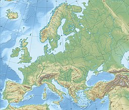
The Zemra Lake (Albanian: Liqeni i Zemrës) is a lake in the western edge of the Republic of Kosovo. Roughly in shape of a heart, the lake stretches inside the Accursed Mountains, some 400 m (1,312 ft) away from Albania. It is situated between 2,200 and 2,500 metres of elevation above sea level on the northern slopes of Maja e Gusanit, near Maja e Gjeravicës.[1]
See also
[edit]References
[edit]- ^ Max Bosse, Kathrin Steinweg (2006). Peaks of the Balkans. München: Bergverlag Rother. p. 126. ISBN 978-3-7633-4491-8.
External links
[edit] Media related to Zemra Lake at Wikimedia Commons


