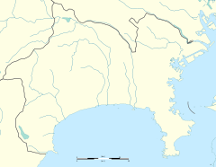
Zama Station
 East Exit of Zama Station | ||||||||||||||||||||
| General information | ||||||||||||||||||||
| Location | 5-1682 Iriya, Zama-shi, Kanagawa-ken 252-0029 Japan | |||||||||||||||||||
| Coordinates | 35°28′50.5″N 139°23′59.7″E / 35.480694°N 139.399917°E | |||||||||||||||||||
| Operated by | ||||||||||||||||||||
| Line(s) | ||||||||||||||||||||
| Distance | 39.2 km from Shinjuku | |||||||||||||||||||
| Platforms | 2 side platforms | |||||||||||||||||||
| Connections |
| |||||||||||||||||||
| Other information | ||||||||||||||||||||
| Station code | OH-31 | |||||||||||||||||||
| Website | Official website | |||||||||||||||||||
| History | ||||||||||||||||||||
| Opened | March 1, 1927 | |||||||||||||||||||
| Previous names | Shin-Zama (to 1937); Zama-Yūen (to 1941) | |||||||||||||||||||
| Passengers | ||||||||||||||||||||
| FY2019 | 20,833 daily | |||||||||||||||||||
| Services | ||||||||||||||||||||
| ||||||||||||||||||||
| ||||||||||||||||||||
Zama Station (座間駅, Zama-eki) is a passenger railway station located in the city of Zama, Kanagawa, Japan, and operated by the private railway operator Odakyu Electric Railway.
Lines
[edit]Zama Station is served by the Odakyu Odawara Line, and is located 39.2 km (24.4 mi) from the line's Tokyo terminal at Shinjuku Station.[1]
Station layout
[edit]The station consists of two side platforms serving two tracks, connected to the station building by footbridges. The station building is elevated, and is located above the tracks and platforms.
Platforms
[edit]
| 1 | ■ Odakyu Odawara Line | for Hon-Atsugi, Shin-Matsuda, and Odawara |
| 2 | ■ Odakyu Odawara Line | for Sagami-Ono, Shin-Yurigaoka, Yoyogi-Uehara, and Shinjuku |
History
[edit]The station opened on 1 March 1927, as Shin-Zama Station (新座間駅).[1] It was renamed Zama-Yūen Station (座間遊園駅) on 1 July 1937, and on 15 October 1941, it was renamed Zama Station.[1]
Station numbering was introduced in January 2014 with Zama being assigned station number OH31.[2][3]
Passenger statistics
[edit]In fiscal 2019, the station was used by an average of 20,833 passengers daily.[4]
The passenger figures for previous years are as shown below.
| Fiscal year | daily average |
|---|---|
| 2005 | 22,128[5] |
| 2010 | 21,983[6] |
| 2015 | 21,732[7] |
Surrounding area
[edit]West Entrance
[edit]- Hoshigaya Temple
- Nashi-no-ki ruins
- Suzukamyō Shrine
- Iriya Elementary School
- Zama High School
- Zama Special School
- JA Sagami Zama
- Uni Zama store (department store)
- Zama Police station
- Iriya Station (JR Sagami Line)
East Entrance
[edit]- Odakyu OX
- Yatoyama Park
- Zama Station Post office
Buses
[edit]West Entrance
[edit]Services are operated by Kanagawa Chuo Transportation and Zama Community Bus.
- <Iriya Route> City Office branch (ZCB)
- <Iriya Route> Main City Office (ZCB)
- <Ebina 10> Ebina Station East Entrance (Kanachu)
- <Ebina 10> Sobudai-mae Station (via Tatsunodai) (Kanachu)
East Entrance
[edit]Services are operated by Kanagawa Chuo Transportation.
- <Sobudaishita 02> Sobudai-shita Station
- <Sobudai 04> Zama-Yotsuya
- <Sobudai 04, Ebina 10> Sobudai-mae Station (via Tatsunodai)
- <Sobudaishita 02> Sagamino Station North Entrance (via Tatsunodai)[8]
See also
[edit]References
[edit]- ^ a b c Terada, Hirokazu (19 January 2013). データブック日本の私鉄 [Databook: Japan's Private Railways]. Japan: Neko Publishing. p. 236. ISBN 978-4-7770-1336-4.
- ^ "2014年1月から駅ナンバリングを順次導入します!" [From January 2014, station numbering will be introduced sequentially!] (PDF). odakyu.jp (in Japanese). 24 December 2013. Archived from the original (PDF) on 26 October 2022. Retrieved 9 January 2023.
- ^ Kusamichi, Yoshikazu (28 December 2013). "小田急グループ、鉄道から海賊船まで通しの駅番号…2014年1月から順次導入" [Odakyu Group, station numbers from railways to pirate ships, Introduced sequentially from January 2014]. Response Automotive Media (in Japanese). Archived from the original on 22 June 2020. Retrieved 10 January 2023.
- ^ 鉄道部門:1日平均駅別乗降人員 [Station passenger figures (Fiscal 2019)] (in Japanese). Japan: Odakyu Electric Railway. 2020. Retrieved 6 March 2020.
- ^ 神奈川県県勢要覧(平成18年度) [Kanagawa Prefecture official statistics (fiscal 2005)] (PDF) (in Japanese). Japan: Tokyo Metropolitan Government. Retrieved 26 March 2021.
- ^ 神奈川県県勢要覧(平成23年度) [Kanagawa Prefecture official statistics (fiscal 2010)] (PDF) (in Japanese). Japan: Kanagawa Prefecture. Retrieved 26 March 2021.
- ^ 神奈川県県勢要覧(平成28年度 [Kanagawa Prefecture official statistics (fiscal 2010)] (PDF) (in Japanese). Japan: Kanagawa Prefecture. Retrieved 26 March 2021.
- ^ Route for Kanachu buses
External links
[edit]![]() Media related to Zama Station at Wikimedia Commons
Media related to Zama Station at Wikimedia Commons
- Odakyu station information (in Japanese)


